
Perhaps Raymond Skiles should be relieved. A few months ago, the Trump administration was laying the groundwork to take part of his 550-acre ranch near tiny Langtry to build a border wall—part of a wildly unpopular plan to wall off much of West Texas, including Big Bend National Park. But then, in March, the government backed off the proposal without explanation. Skiles, a 71-year-old retired Big Bend National Park wildlife biologist, was pleased that a thirty-foot wall wouldn’t split his place. But he didn’t exactly rejoice.
In June, U.S. Customs and Border Protection, the parent agency of Border Patrol, awarded a staggering $2.6 billion contract—the largest upfront award for physical border infrastructure ever—to build a four- to six-foot-tall steel “vehicle barrier” and pave new patrol roads for a 156-mile stretch from Sanderson to Lake Amistad. Fisher Sand & Gravel Co., a North Dakota–based contractor with ties to the Trump administration, won the bid.
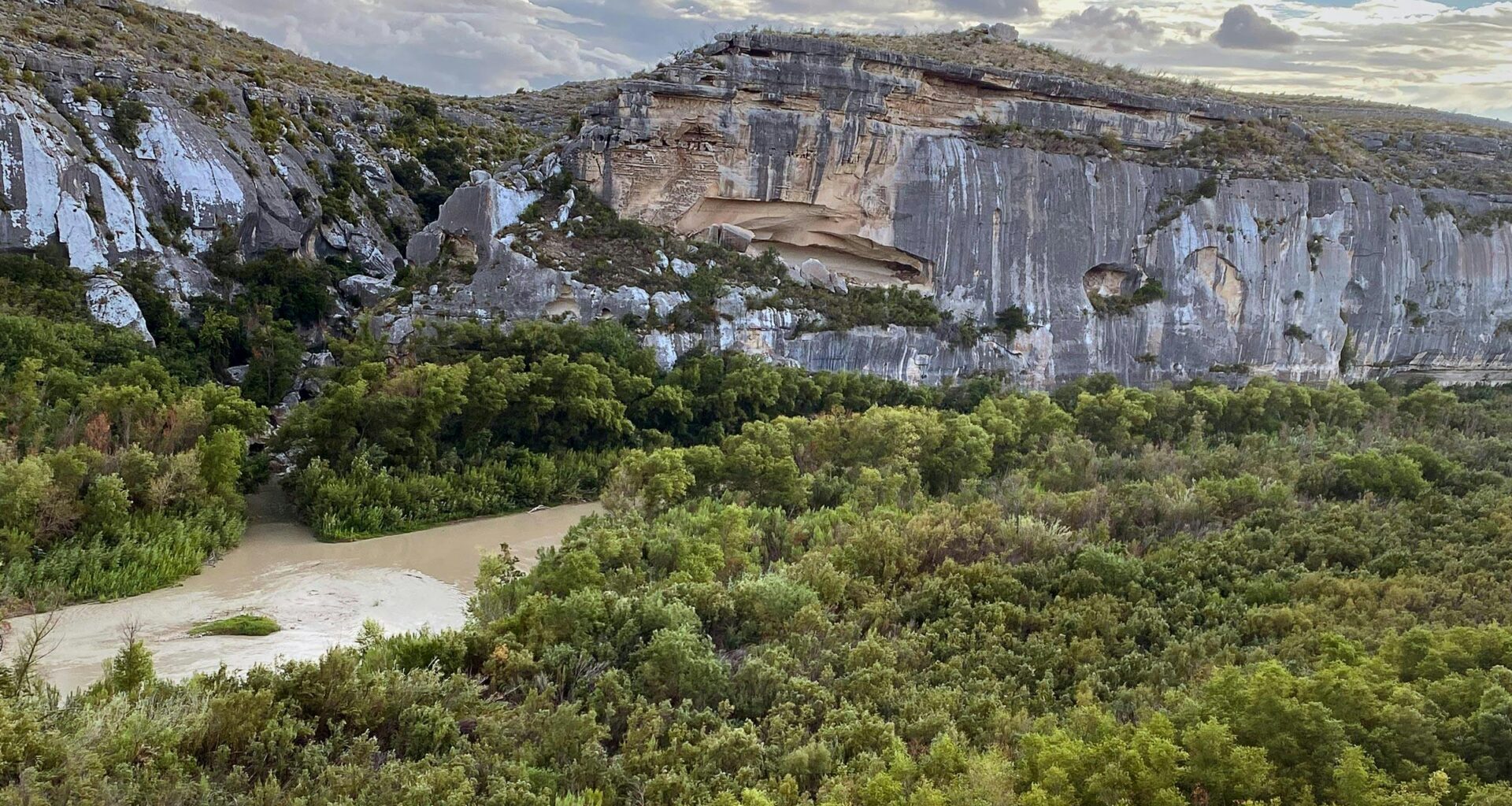
The new proposal will still tear up Skiles’s land, destroying important archaeological sites and polluting what is one of the last wild places in Texas. And if anything, the latest plans may constitute an even more pointless waste of taxpayer money than a thirty-foot wall. Skiles Ranch, like almost the entirety of the Lower Canyons stretch of the Rio Grande below the national park, is characterized by a deep river gorge, with natural canyon walls typically soaring from one hundred to three hundred feet. It’s remote, harsh, and seldom trafficked by migrants.
A border wall might, in theory, keep some of the small number who do cross there from entering Texas. But a vehicle barrier makes no sense for the simple reason that vehicles do not and cannot cross an impassable river gorge. As of now, smugglers have not figured out how to drive cars or trucks down vertical cliffs, across a river (or giant Lake Amistad), up vertical cliffs, and subsequently onto private property that’s surveilled and patrolled by Border Patrol, enclosed within fences, and watched over by heavily armed private landowners. Why would they? There are far easier and better places to traffic drugs and people.
“It’s impossible” to get a vehicle across the Rio Grande in the Langtry area, said Skiles. “There hasn’t been a vehicle, since the mule-and-wagon days, come down on the Mexican side.” Even if a “coyote” (a smuggler) could get a car down to the river, he would then encounter fifteen to fifty feet of mud in the Langtry area—the result of the muddy Rio Grande hitting the still waters of Lake Amistad, which has since receded. “So the idea of even driving across the canyon, even if you could get to the bank, is ludicrous,” Skiles said.
To understand this, you have to know something—really, anything—about the region’s topography. And clearly whoever drew up the maps in Washington, D.C., does not. “I know damn well nobody’s even been out there to look around,” Skiles told me. The whole thing has become “shockingly absurd.”
The Skiles Ranch, sixty miles west of Del Rio, is a piece of stunning, rugged desert perched over the Rio Grande’s deep chasm. Skiles is the third generation of his family to own it, after his grandparents bought the land in the 1940s. A major side canyon of the Rio Grande called Eagle Nest Canyon splits the property. This limestone enclosure holds several significant Native American pictographs, some of which are thousands of years old, as well as Bonfire Shelter, the most southerly “buffalo jump” site in North America.
Few migrants cross into Texas on foot through the ranches in the “wild and scenic” Lower Canyons because of the remote canyon lands—and it’s unlikely any wall would stop those who do. (Once, on a friend’s ranch just east of Langtry, near Skiles’s place, we found makeshift ladders used to scale the steep cliff: willow branches lashed together with plastic bags. The border jumpers evidently used these ladders to gain access to the first major ledge, about fifty feet high, then pulled themselves hand over hand on ratty ski rope they had somehow tied around protrusions in the rock.) A vehicle barrier is even harder to justify from a border-security perspective. Anyone on foot can hop right over it.
And what’s the rationale for the proposed new patrol roads? Border Patrol already uses a gravel road that parallels U.S. 90 as close as a quarter mile from the Rio Grande. The agency regularly smooths the road by dragging tires behind their trucks with a chain, making a soft powdery surface that’s easier for trained agents to “cut for sign,” i.e. look for footprints and other marks left behind by undocumented immigrants. Anyone crossing the river has to cross this patrol road to get to the highway. Fisher, the contractor, has told landowners that it plans to build roads down into the river canyon. In other words, the federal government would pay to remove a natural wall—a huge cliff—and replace it with a paved path.
Asked this week by Cohl Brazil, a landowner near Langtry, whether that might create a convenient ramp for migrants out of the river, Felipe Tenorio, a landowner liaison who works for Fisher, seemed unsure. “That I don’t know,” Tenorio said, according to audio verified by Texas Monthly. “But by building this road and building the vehicle barrier, Border Patrol is going to be able to access that whole portion and monitor it better to avoid any of these people that walk through or do whatever happens down there.”
Neither Fisher nor CBP responded to requests for comment.
Skiles is also concerned that roads down to the river would necessitate destroying the canyon itself, in an area that holds one of the greatest concentrations of ancient rock art in North America. Tenorio has conceded as much to landowners. “There will be areas that we will have to cut down . . . to be able to build the access road and the vehicle barrier,” Tenorio told Brazil. He said they would work with the federal government to steer around sensitive areas. “If there’s a historical marker or something out there, of course we’re going to take that into consideration,” Tenorio said. “I mean, the intent is not to destroy anything at all like what you’re talking about.” (The Department of Homeland Security has waived dozens of laws protecting the environment, wildlife, and cultural resources in order to expedite border-wall construction.)
Both CBP and Fischer have shared very little with the public about their plans. Landowners and local officials, including Trump-friendly Republicans, have had trouble getting information out of the Trump administration. CBP’s Smart Wall map has been one of the few sources of concrete information about the Trump administration’s plans for the border. Yet it has also been a catalyst for confusion and fury, due to frequent unannounced and unexplained changes. Early versions of the map indicated a physical barrier throughout much of West Texas, including in Big Bend National Park, Big Bend Ranch State Park, and along the “wild and scenic” stretch below the national park. In early March, amid widespread outrage across the political spectrum, including from MAGA-friendly border sheriffs, CBP changed the map without notice. In this iteration, the CBP would rely on “detection technology” in place of a wall from Big Bend Ranch State Park down to Lake Amistad.
Now the map shows a nearly contiguous border wall from south of El Paso down to Big Bend Ranch State Park, several sections of vehicle barrier in the national park as well as extensive new patrol roads. At Skiles’s place, the map shows the barrier-and-road system cutting across the mouth of Eagle Nest Canyon in the river’s floodplain before running up a one-hundred-foot cliff back toward U.S. 90.
But few locals trust the information on the site. Skiles recently received a packet from CBP threatening eminent domain proceedings if he didn’t agree to work with the agency. The packet included a proposed route that doesn’t correspond with the Smart Wall map.
The Trump administration, because it has waived dozens of federal laws, has tremendous latitude. “The plans they show on their Smart Wall map website are nonbinding,” said Laiken Jordahl, the national public lands advocate at the Center for Biological Diversity, a nonprofit that has sued DHS over the border-wall waivers. “They could show up tomorrow and start building thirty-foot walls throughout the entirety of the Big Bend sector, and they don’t have to notify the public. They don’t have to update any of these maps.”
Though it’s uncertain when construction will start—Tenorio told landowners it could begin in just sixty days—in recent weeks, CBP and Fisher have been quietly trying to soothe landowners. Christian Soenen, whose family owns a 725-acre property in Comstock, near Langtry, said agency officials recently told him that they were open to putting the barrier and patrol road alongside U.S. 90 rather than closer to the river. That’s good news for landowners like Soenen. Under that scenario, their property wouldn’t be split in two and sensitive areas would be avoided. The family’s ranch boasts a cave that has evidence of human habitation dating back six thousand to 12,000 years, as well as historically significant remnants of the transcontinental railroad that ran from New Orleans to San Francisco and was constructed in 1883. But moving the new patrol road next to the highway, with its existing adjacent patrol road, raises questions about why Border Patrol would need two patrol roads.
It also raises questions about spending. Are border-security imperatives driving the $2.6 billion Fisher contract—that’s about $16.7 million per mile—or is the money dictating decisions about the project? Notably, the contract was awarded after CBP backed off its plans for an extensive border wall in Big Bend. In his conversations with landowners, Tenorio seems eager to talk about the company’s ability to raze whole cliffs and build through flash flood–prone drainages—expensive engineering. But if the vehicle barrier and roads no longer cross the rugged riverside terrain and instead hug the relatively flat U.S. 90, construction costs would presumably be much less.
“There’s just no conceivable world where $2.6 billion is going to be spent on actual construction,” said Jordahl. “They scaled it back to not build wall, just vehicle barriers and roads. I feel like any competent construction firm could do that for a few hundred million dollars.”
Skiles said the opaque process, threatening legal letters from D.C., and constantly shifting plans has soured his opinion of Border Patrol. “I’ve long now abandoned seeking logic or just any intelligence that has to do with the local conditions,” Skiles said. His family, which has lived in the Langtry area for four generations, has always had “a cooperative and friendly relationship” with the field agents. Illegal activity has never been a major problem at Skiles Ranch, but he appreciated having “extra eyes” on his property. Now he plans to tell the local Border Patrol office that they’re no longer welcome to conduct routine patrols on his ranch. And he’s already changed the locks on the gate.
Read Next