
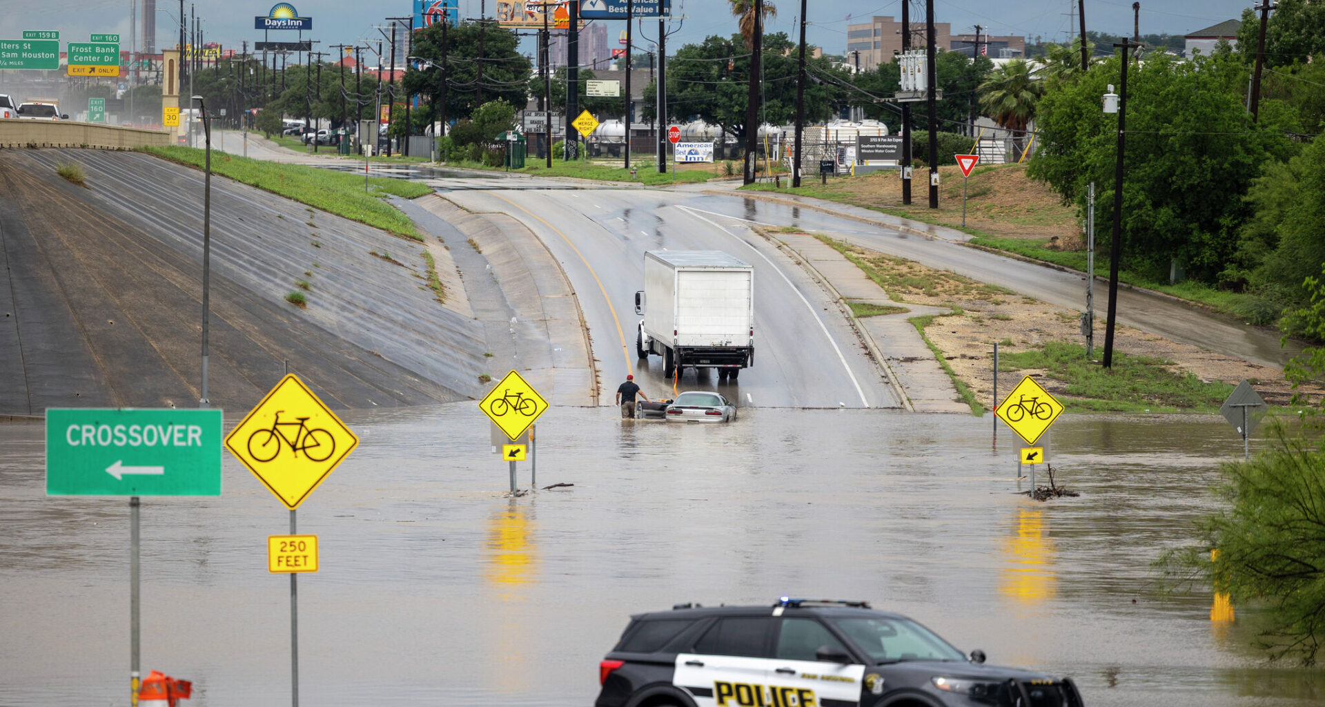
North Interstate 35 and Seguin Road was closed due to flooding after heavy rainfall in May 2026 in San Antonio. Similar scenes are possible this week as thunderstorms aim for South Texas.
Andrew J. Whitaker/San Antonio Express-News
The weather pattern is about to become much more active across South-Central Texas, as high levels of Gulf moisture will stream into the area over the next few days. Daily chances of showers and thunderstorms are expected, especially from late Monday through Wednesday this week.

San Antonio will also encounter a rising flash flood threat through the first half of the week, as isolated rainfall totals could reach higher than four inches in a few spots. Here’s a breakdown of what to expect in and around San Antonio.
Article continues below this ad
Sunday’s forecast
Before rain chances ramp up later in the week, Sunday’s weather is likely to be relatively quiet. San Antonio will start with mild temperatures in the upper 70s through 9 a.m. under mostly cloudy skies. Temperatures will rise steadily thereafter, reaching the upper 80s by noon.
Afternoon high temperatures are expected to top out near 92 degrees by 4 to 5 p.m., which is 3 degrees below average for mid-July. Humidity levels will still be very high, though, sending maximum “feels-like” temperatures between 100 and 102 degrees.
A few scattered showers and thunderstorms may also develop across the region during the afternoon, especially between 2 and 7 p.m. However, storm coverage will be rather low, and San Antonio’s overall rain chances will only be around 20%.
Article continues below this ad
A humid, but relatively pleasant Sunday evening is expected across the region, as temperatures will fall back into the 80s after 7 p.m. Rain chances will also fall back under 20%.
Flood threat rises
Much of the day on Monday is also expected to be relatively quiet, as afternoon high temperatures will rise once again into the low 90s with heat index values near 100 degrees. An isolated shower or storm is possible, but rain chances will stay near 20% through 7 p.m.
Article continues below this ad
By Monday night, storm chances will rise higher as high atmospheric pressure shifts farther away from South-Central Texas. San Antonio will have about a 50% chance of storms after 9 p.m., with additional rounds of thunderstorms continuing into the overnight hours and into Tuesday.
Much of South-Central Texas has been placed under a level 1 of 4 risk of flash flooding from late Monday through early Wednesday.
NOAA
The active weather will result in cooler temperatures on Tuesday, with highs expected to top out in the mid- to upper 80s. Weather models also indicate that widely scattered thunderstorms will continue Tuesday night and into the first half of the day on Wednesday.
Much of South and Central Texas, including the Hill Country and Interstate 35 corridor, is under a level 1 of 4 risk of excessive rainfall from Monday evening through Wednesday. That means flash flooding will be possible for some locations.
Article continues below this ad
How much rain? Weather models have been trending higher with expected rainfall totals. Through Wednesday, San Antonio is likely to see between 1 and 2 inches of rain, with isolated higher totals greater than 3 inches possible.
Shown are the potential rainfall totals across South Texas through Wednesday. Isolated higher amounts are possible.
Pivotal Weather
Rainfall totals will likely be even higher to the west, with 2 to 4 inches of rain likely this week in areas such as Uvalde, Eagle Pass3e and Del Rio. Isolated higher totals of 6 inches or more may also be possible in this region, due to very slow-moving storms.
Article continues below this ad
Rain chances will decrease significantly after Wednesday, but a lingering chance of a shower or storm may be possible on Thursday and Friday. Be sure to stay with expressnews.com/weather throughout the week for continued updates.