
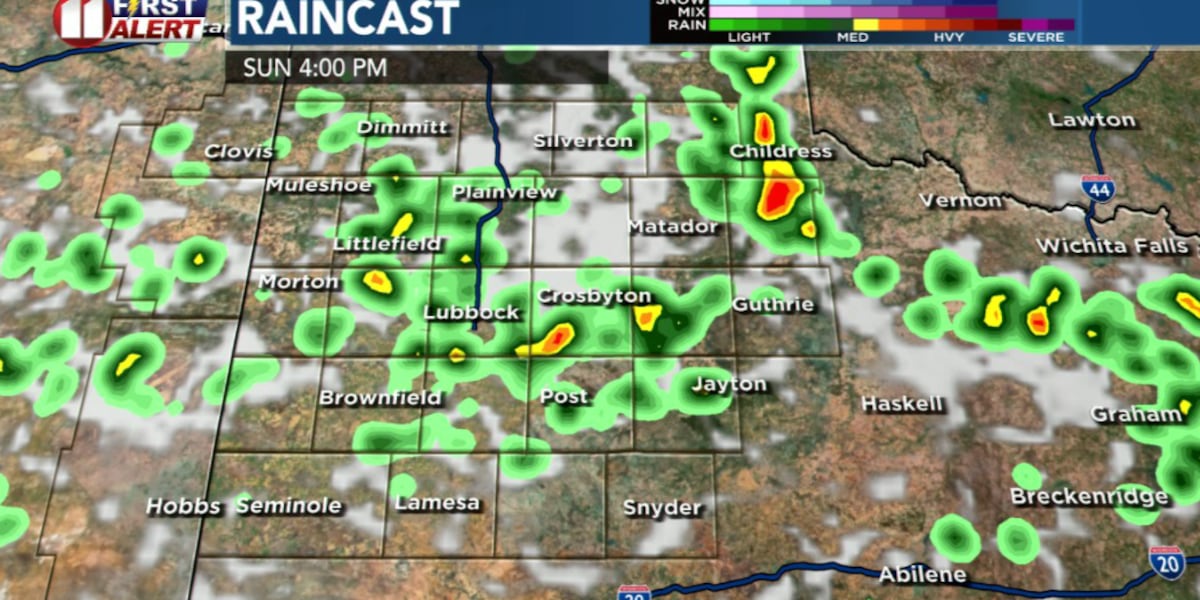
LUBBOCK, Texas (KCBD) – After several hot and mostly dry days, the weather pattern is becoming much more active across the South Plains.
Sunday should start off fairly quiet with warm temperatures for much of the South Plains, although a few early morning showers or storms can’t be ruled out.
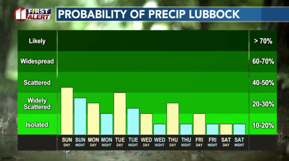 Hit and miss rain chances this week(KCBD)
Storm chances will increase this afternoon as leftover outflow boundaries push into the area. Even after the original storms weaken, their rain-cooled air spreads outward moving hundreds of miles, like mini cold fronts, triggering new thunderstorms when it collides with the warm, humid air.
And our atmosphere will have plenty of moisture to work with. Dew points today are expected to climb into the upper 50s and 60s, with moisture levels well above what’s typical for July.
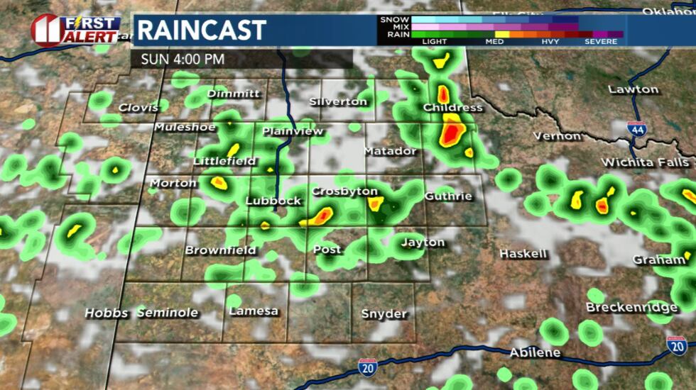 Scattered storm chances this afternoon and evening(KCBD)
Any storm that develops will be capable of producing brief heavy rainfall and lightning.
The overall severe weather threat remains low. However, a few stronger storms could produce wind gusts up to 60 mph.
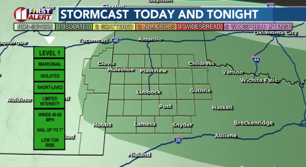 Severe threat is low for storms on Sunday(KCBD)
Highs temperatures Sunday will stay a little cooler than the past few days, with most communities reaching the lower to middle 90s. Areas that see more clouds or rain may stay even cooler.
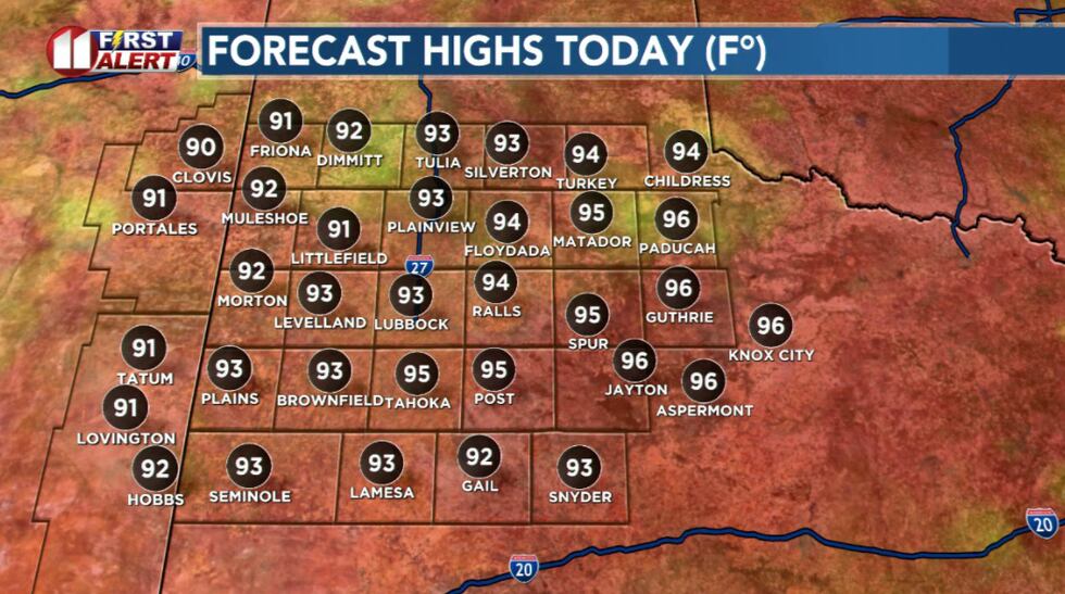 Lower temperatures today(KCBD)
Looking ahead, the weather pattern continues to favor daily thunderstorm chances through much of next week with temperatures below average for mid-July.
As is often the case with summertime storms on the South Plains, not everyone will receive rain each day. But nearly every afternoon and evening will carry at least a chance for scattered showers and thunderstorms as this more active pattern settles in.
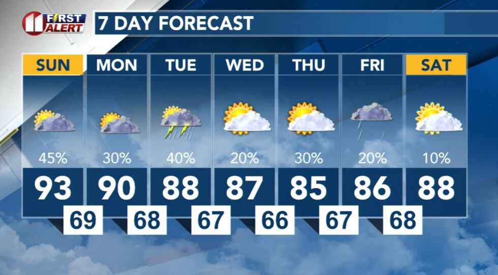 7 Day Forecast this week opens up to a more active pattern(KCBD)
Copyright 2026 KCBD. All rights reserved.