
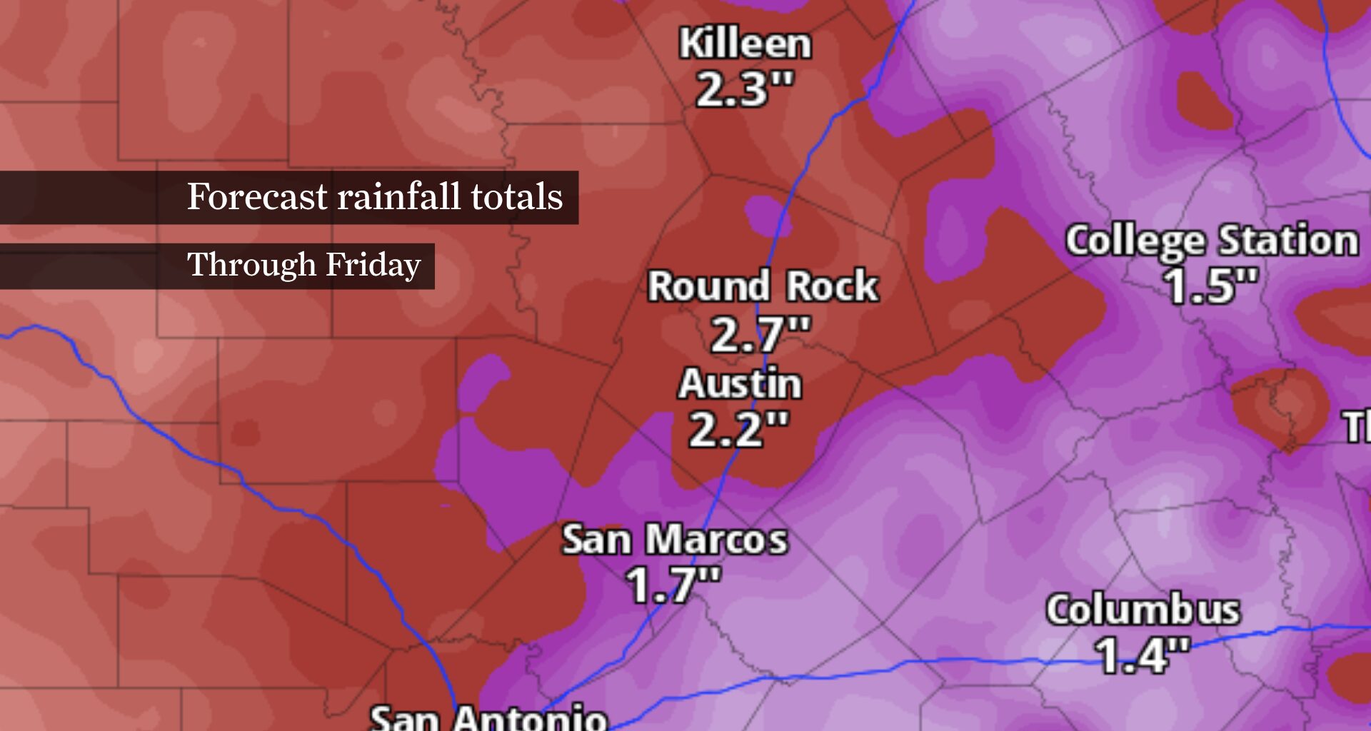
Daily chances for showers and thunderstorms will become the new normal as tropical moisture spreads across Central Texas. The wetter pattern will trim a few degrees off afternoon temperatures, but it also brings the potential for locally heavy rainfall and flash flooding through the middle of the week.
Monday kicks off a stretch of daily chances for showers and thunderstorms as tropical moisture continues to build across Central Texas.
Don’t expect rain all day. Instead, anticipate long stretches of dry weather interrupted by slow-moving afternoon and evening thunderstorms. Many neighborhoods may stay dry, but any storm that develops could quickly produce torrential downpours, frequent lightning and brief gusty winds.
That pattern is expected to continue through at least Wednesday as the atmosphere becomes increasingly moisture-rich. You’ll have a much better chance of seeing a shower or thunderstorm each day than in recent weeks, and any storms that develop could quickly drop heavy rainfall over a small area.
Atmospheric moisture is forecast to increase significantly, providing ample fuel for slow-moving thunderstorms capable of producing torrential downpours. As a result, all of Central Texas is under a level 2 of 4 risk of flooding Monday and Tuesday.
By Wednesday, the risk eases to a level 1 of 4, with the greatest flood threat shifting south and west of Austin by Thursday. Any thunderstorms that repeatedly move over the same locations could trigger flash flooding, especially in flood-prone areas, low-water crossings and along creeks and streams.
Exactly where the heaviest rain will fall remains impossible to pinpoint several days in advance. However, confidence continues to grow that at least some communities will see multiple rounds of heavy rain through midweek, increasing the potential for localized flooding before drier weather gradually returns later this week.
The added clouds and rainfall will knock temperatures back closer to typical levels for mid-July.
Highs Monday should reach the upper 80s to lower 90s, with some locations struggling to reach 90 degrees Tuesday through Thursday if rain becomes widespread. Temperatures are expected to remain below average through much of the upcoming week.
Don’t mistake the lower temperatures for a break from summer. Humidity will remain high, so despite the slightly cooler afternoons, it will still feel muggy between rounds of rain.