
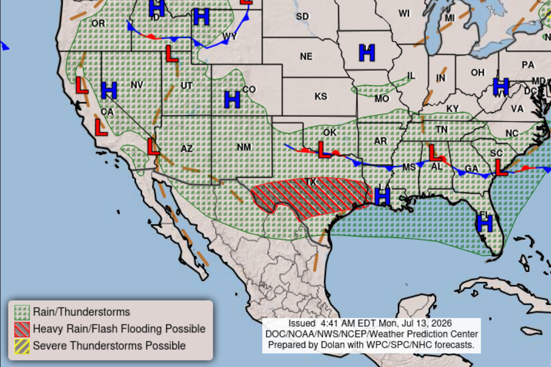
Houston is starting the work week with some clouds and potentially some heavy rainfall in some spots across Southeast Texas. Here’s the latest storm timeline, based on recent National Weather Service forecasts.
The combination of a stalled front to our north and deep volumes of tropical moisture from the Gulf of Mexico is expected to trigger scattered to widespread showers on Monday and Tuesday before a drying trend emerges in the second half of the week, the weather service said.
Morning: The weather service’s Weather Prediction Center has placed much of Southeast Texas under a level 2 of 4 risk, or at least a 15% chance, of flooding rainfall. The first round of showers are likely to persist throughout the morning.
Afternoon: Another wave of showers and possibly a thunderstorm is possible between 2 p.m. and 4 p.m. Rain chances will be as high as 80%. Forecasters anticipate new rainfall amounts of a quarter-inch to a half-inch, with isolated spots seeing higher totals.
Night: Rain will persist after 4 p.m. but likely wrapping up before 10 p.m., under otherwise mostly cloudy skies. Rain chances stay high but ease a bit to 60% with new rainfall amounts expected to be between a quarter-inch and a half-inch.
“Greatest coverage of (thunderstorm) activity is expected during late morning through early evening hours,” the weather service said in a forecast bulletin Monday. “A lull in activity is anticipated for Monday night with another round of activity set for Tuesday.”
Morning: More showers and thunderstorms will be possible Tuesday, starting as early as 5 a.m. Forecasters said the “greatest chances of locally heavy rainfall will be in the Brazos Valley, but isolated downpours will be possible across all of Southeast Texas.
Like on Monday, a sizable portion of Southeast Texas on Tuesday will be under a level 2 of 4 risk, or at least a 15% chance, of flooding rainfall.
Afternoon: While showers lingers into the early afternoon, Houston temperatures will be limited by the rain-cooled air. Expect daytime temps to peak at only 84, which is about 10 degrees cooler than normal for July 14 in Houston.
With rain chances as high as 80%, forecasters anticipate new rainfall amounts of a half-inch to almost a full inch.
Night: Rain chances begin to subside, with only a slight 20% chance after 1 a.m. Wednesday.
“(Cumulative) forecast rainfall totals continue to fall into the 1- to 3-inch range,” the weather service said. “Given the saturated profile being observed with soundings and light steering winds, storms with heavier downpours could result in localized totals of up to 5 inches (especially if storms train over the same areas).”
Wednesday: The rest of the work week will be marked by a gradual rise in temperatures and drier weather. Houston has 40% chance of rain, while afternoon temperatures are expected to rebound to 90 degrees.
Thursday: Houston will see the return of sunshine under albeit partly sunny skies. Afternoon temperatures will return to a seasonable average high of 94 degrees.
Friday: Expect mostly sunny skies in Houston on Friday, with temperatures peaking at 95 degrees.