
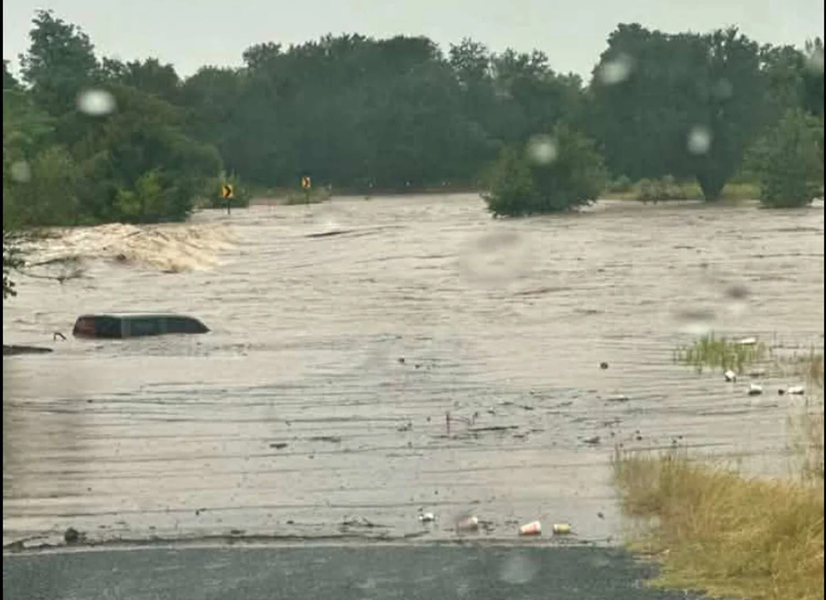
This rare July cold front continues to push a slow-moving storm system over Texas. Now, another round of clouds is set to douse South Central Texas with several more inches of rain on already soaked soil, and forecasters are warning of life-threatening, potentially catastrophic flooding. A shocking, record-setting 20 inches of rain could fall west of the Alamo City, sending river levels skyrocketing in a matter of hours.
From the Medina-Bexar county line and west along Highway 90, the National Weather Service has, in a rare move, issued the highest risk level for excessive rainfall. It estimates that as much as 20 inches of rain could fall in isolated pockets over the region in less than 12 hours, but 10 inches is possible across towns and cities.
This could send river and stream levels rising quickly, sometimes within a moment’s notice –– something NWS officials in South Central Texas were quick to note, as families are visiting the area during the summer.
“As far as the main stem rivers, there’s potential for significant main stream river flooding –– that’s moderate to major flood categories –– across the Pecos River Basin, portions of the Rio Grande Basin,” a meteorologist with the National Weather Service San Antonio-Austin office warned in a briefing Tuesday afternoon.
He said the Oasis, Frio, Medina and San Antonio rivers were all of the “highest concern” for the local weather team. With the region’s grounds soaked from heavy rains Monday night into Tuesday morning, these additional bouts of heavy rain could cause rapid runoff that can overload streams and tributaries.
The threat of more than a foot of rain looms over Uvalde and Medina counties, as well as several counties out west toward the Mexico border. But some models are showing those higher rain totals further east, creeping into Bexar County and San Antonio.
“For the remainder of the area, we don’t want to let our guard down. There’s still a level 2 to 3 out of 4 risk for flash flooding elsewhere. Anywhere else outside that high-risk area could easily pick up a quick 2 to 4 [or] 2 to 6 inches of rainfall,” the official said during the Tuesday update.
Nueces River could rise 6 feet in 12 hours
The Nueces River could rise by a whopping 6 feet in just 12 hours, from 1 a.m. to 6 p.m. on Wednesday, along the stretch from the City of Laguna to Uvalde. The river is projected to reach minor flood stages, which could trigger alerts and action from the NWS or local agencies.
It’s a concerning projection that Uvalde will be flanked to the east and west by rising river levels in the Nueces and Frio as up to 20 inches of rain pours down.

Flood waters continue to rise in Uvalde as inches of rain expected to fall. (Courtesy of City of Uvalde/SSgt. Willie de Leon Civic Center)
Frio River expected to flood near Uvalde
Uvalde, southwest of San Antonio, is undoubtedly among the hardest-hit areas in the region due to continued downpours. After inches upon inches of rain on Tuesday morning triggered evacuations and left drivers stuck on highways, the town fell under the highest risk level for excessive rainfall overnight and into Wednesday morning.
Because of this, the Frio River near Uvalde was projected to reach moderate flood stages by Tuesday evening, with officials warning of possible flooding of nearby structures and roads. As of Tuesday afternoon, that same river point was expected to remain between action and moderate flood stages through Wednesday night.
However, rain totals at the higher end of forecast estimates could easily keep these dangerous levels in place.
Rivers in San Antonio could rise rapidly
Saldo Creek and Leon Creek –– both notorious for dangerous flooding in San Antonio –– are expected to reach the “action” stage by late Wednesday. This stage is triggered when river levels require action by the NWS or a local agency to prepare for “significant hydraulic activity,” according to the National Water Prediction Service.
Other rivers, such as the Medina as it passes through San Antonio and the San Antonio River near Elmendorf, are expected to reach minor flood stages and approach moderate levels by Thursday. Based on current predictions, these rivers could rise to levels that pose a public threat. If they rise much higher, structures and roads near the streams may be inundated with water.
This article originally published at Up to 20 inches of rain overnight could send river levels skyrocketing.