
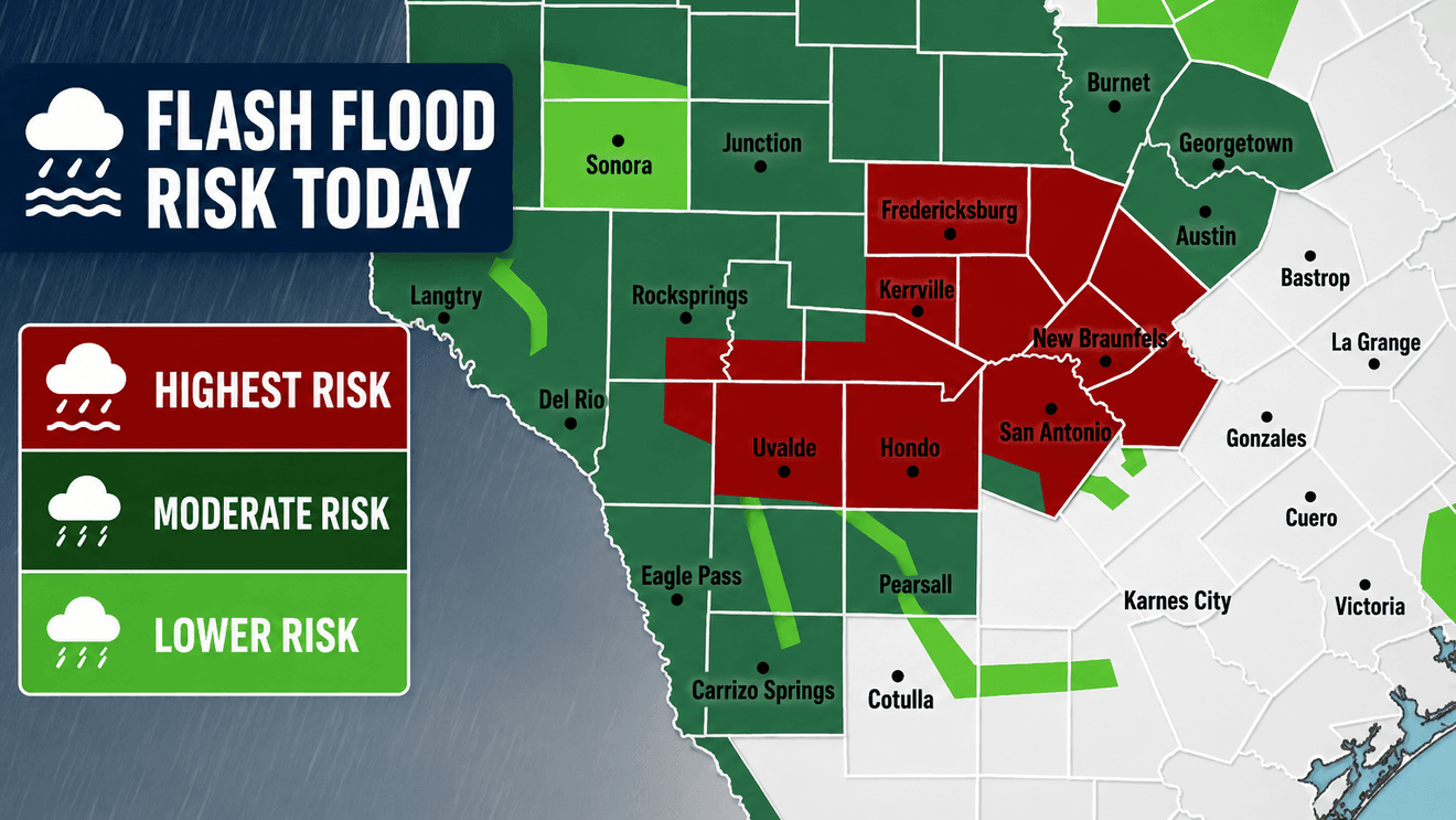
SAN ANTONIO – Significant flash flooding continues to impact parts of South Texas, with Boerne and Kendall County among the hardest-hit areas after several rounds of heavy rainfall.
Widespread rainfall totals of 3 to 10 inches have fallen across Kendall County, with isolated areas just west of Boerne receiving up to 16 inches of rain since the first round of storms moved through.
Check out the latest weather forecast here…
Flooding remains a concern on Wednesday as scattered showers and thunderstorms continue across the region, including parts of Bexar County. Forecasters warn that while rain coverage and intensity are expected to decrease into the evening, the threat of heavy downpours and flash flooding has not ended.
Check out our interactive radar here…
Another round of storms is expected to develop later Wednesday night into Thursday morning. The heaviest rain is expected to shift toward the western half of the region, especially near Del Rio, with Bexar County expected to remain on the eastern edge of the system or avoid the worst of the rainfall.
Send us your weather photos and videos…
The additional rainfall could create new flash flooding concerns, particularly in areas such as Uvalde, which have already received significant rainfall over the past day.
A fourth and final round of rain is expected Friday, though it is forecast to be the weakest. That activity should remain well west of San Antonio, primarily affecting areas from Del Rio to Sanderson, as drier conditions begin moving into the region.
Looking ahead, the weather pattern is expected to improve significantly. Forecasters say the weekend and much of next week should be dry, with temperatures climbing and humid conditions returning across South Texas.