
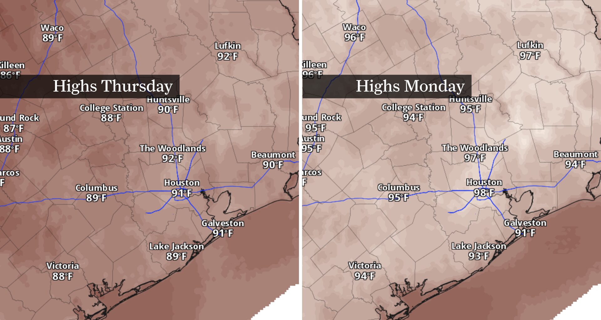
The same weather pattern that brought several days of locally heavy rainfall and street flooding is beginning to lose its grip on Southeast Texas. One more day of scattered showers and thunderstorms is expected Thursday before high atmospheric pressure takes control, bringing fewer storms, more sunshine and steadily rising temperatures into the weekend and early next week.
Thursday marks the transition between this week’s wetter weather pattern and a more typical mid-July setup.
While scattered showers and thunderstorms are expected to develop during the day, rain coverage will be noticeably lower than earlier this week. The best chance for rain will be west of Houston, where lingering tropical moisture will be deepest. Most neighborhoods should remain dry for much of the day, but any storm that develops could produce brief heavy rainfall, frequent lightning and gusty winds.
Temperatures will also begin creeping higher. Afternoon temps should reach the lower 90s across much of Southeast Texas, with humidity pushing heat index values into the upper 90s and lower 100s wherever sunshine breaks through for several hours.
Rain chances continue shrinking Friday as high air pressure strengthens over Texas, limiting the development of afternoon thunderstorms and allowing sunshine to become more common.
Only isolated showers and thunderstorms are expected through the weekend, meaning most communities will stay dry. Afternoon temperatures will climb into the mid-90s Saturday and Sunday, which is near normal for the second half of July.
Temperatures will continue climbing into early next week, with highs reaching the upper 90s across many inland locations by Monday and Tuesday. A few of the traditionally warmer spots could flirt with the 100-degree mark.
The return to summertime heat comes just days after Bush Intercontinental Airport reached only 79 degrees — the first sub-80-degree high since May 27 and Houston’s 23rd-coolest July day on record, going back to 1889.
Even where air temperatures remain in the upper 90s, humidity from moisture-rich tropical air out of the Gulf of Mexico will make it feel hotter. Afternoon heat index values are expected to climb well into the triple digits, making heat safety increasingly important for anyone spending extended time outdoors.
The overall pattern looks much more familiar for late July, with long stretches of dry weather interrupted only by isolated afternoon thunderstorms. After a stretch of heavy downpours, Houston’s weather is shifting back to the sticky heat that typically defines this time of year.