
LUBBOCK, Texas (KCBD) – The air over the South Plains is unusually humid for July, with more moisture than we see on about 95% of July days. Here is a look at dew point temperatures from earlier.
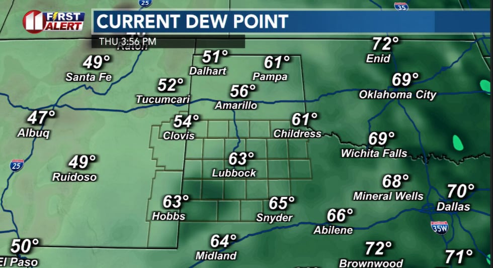 Dew points at 3:56 PM(KCBD)
Think of the dew point as a measure of how much moisture is already in the air. The higher the number, the muggier it feels outside. Normally in July our dew points are in the 50s. Today they’re in the 60s. That extra moisture means any storm that develops can produce heavy rainfall in short amounts of time.
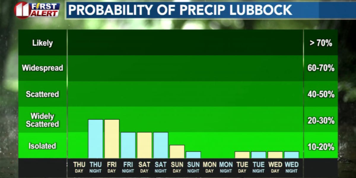
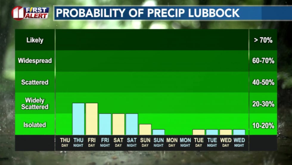 Rain chances will continue into Friday and Saturday before tapering off.(KCBD)
Scattered showers and storms will continue through Friday, with the best chances south and east of Lubbock. A few showers could still make it into the Hub City this afternoon and again Friday. While severe weather isn’t expected, localized flooding is possible where heavier storms develop.
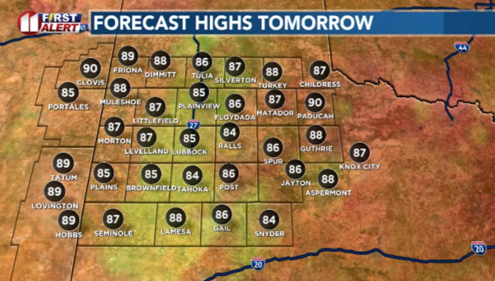 Highs tomorrow(KCBD)
Even if you don’t see rain, you’ll notice a big difference outside. Cloudy skies, humid air, and highs only in the mid to low 80s. That’s about 10-15 degrees below normal for mid-July.
The cooler, unsettled weather is being driven by a slow-moving storm system just south of the region. As it pulls away this weekend, rain chances will fade and temperatures will begin climbing.
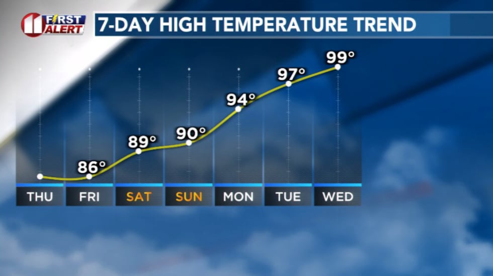 Temperatures will increase next week.(KCBD)
By next week, summer returns in full force with mostly sunny skies, dry conditions, and highs back in the upper 90s and low 100s.
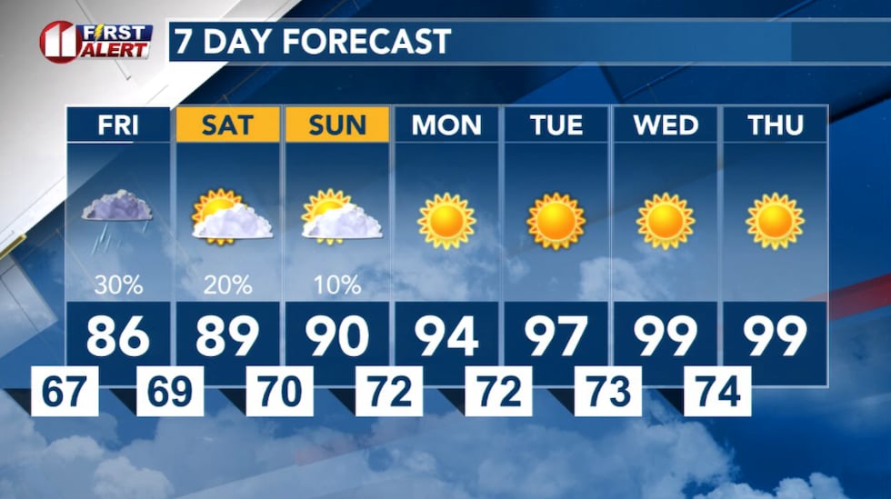 7 Day Forecast(KCBD)
Copyright 2026 KCBD. All rights reserved.