
The rain is finally beginning to wind down across Central Texas as the upper-level atmospheric disturbance responsible for the wet weather shifts west and northwest. In its place, a ridge of high air pressure will build over the region, bringing back sunshine and a return to more typical summertime weather through the weekend.
Be mindful that swift-moving water is passing through Lake Marble Falls and eventually into the reservoir of Lake Travis. If you’re planning to head out to the lake this weekend, take extra caution and be aware of changing water conditions.
A few lingering showers will be possible west of the Interstate 35 corridor on Friday, where the National Weather Service has a flood watch in effect through midday. However, the overall trend will slowly shift toward drier weather. Rain will gradually pull away from the western Hill Country, and we’ll begin to see a warming pattern across the region.
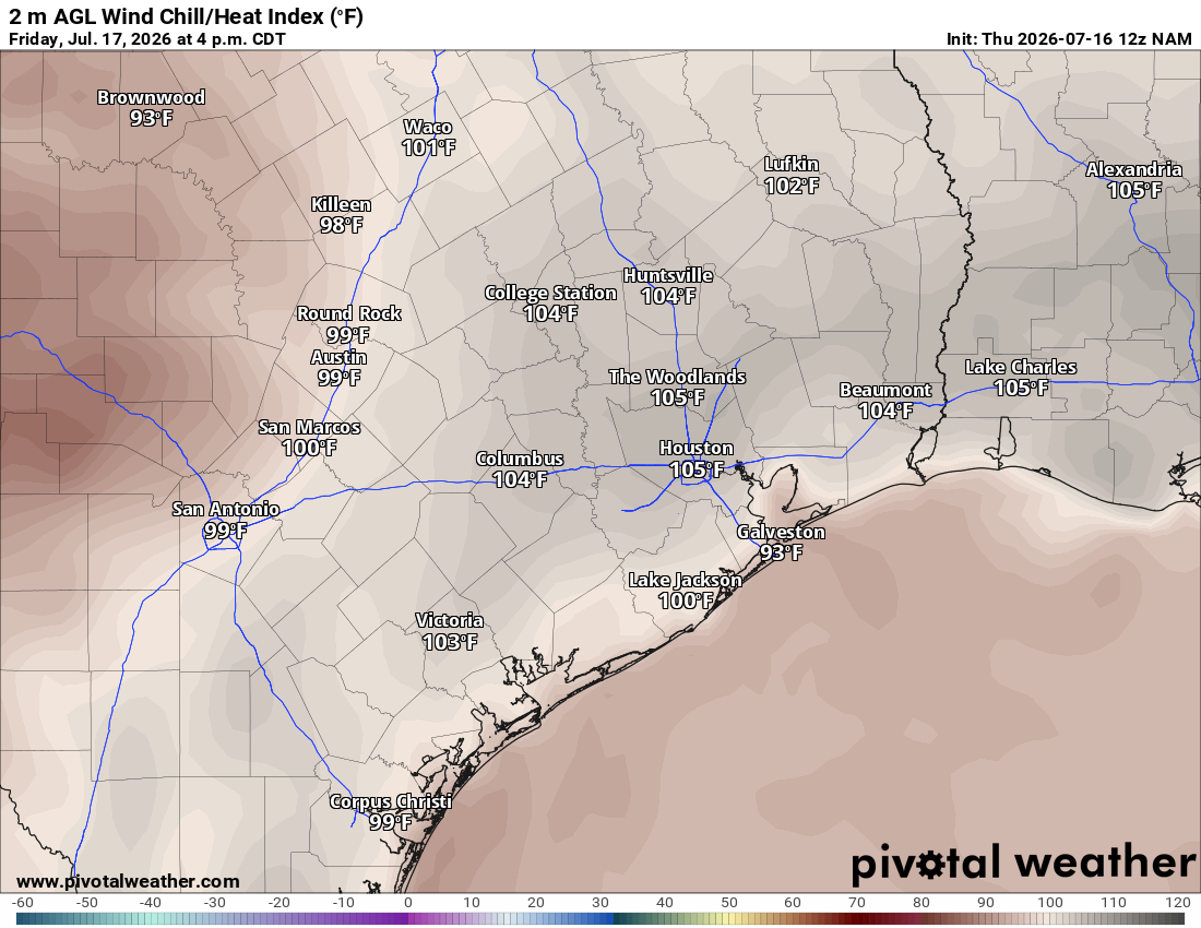
Austin will wake up Friday under an overcast sky with light south winds and sticky, humid air as morning temperatures only cool into the mid- to upper 70s. By the afternoon, sunshine will begin to break through the clouds as south winds pick up, with a few gusts of about 20 mph. Temperatures will climb into the upper 80s to near 90 degrees, but with the humidity, they will feel more like triple-digit temps.
The flood threat isn’t completely over, especially for our neighbors west of the Hill Country. The weather service’s Weather Prediction Center continues to assign a level 1 to 2 out of 4 risk, or at least a 5% to 15% chance, for excessive rainfall in an area from near San Angelo to Del Rio.
Just like we saw Thursday morning, the axis of heaviest rainfall could shift slightly east or west. We’ll continue to monitor the potential for new rounds of morning rain through midday Friday, especially across the Hill Country, where atmospheric instability will be the highest.
The weather pattern will begin to shift back towards a more typical summertime setup as high atmospheric pressure gradually builds across the Lone Star State beginning this weekend. After the active and very wet weather pattern this week, a few days of drying out will be a welcome change across Central Texas — and that’s something rarely said during July.
The forecast will become more predictable, with morning clouds giving way to partly sunny skies in the afternoon. Temperatures will also return closer to seasonable levels, with mornings in the upper 70s and afternoons in the lower to mid-90s.
The only hiccup will be the humidity-driven heat index values, or “feels like” temps, through the weekend, which could reach between 100 and 102 degrees as the ground saturated by rainfall dries out, resulting in air saturated with water vapor.
For the past several days, the Hill Country, Edwards Plateau, and Rio Grande Plains have been at the center of the flooding concerns, with some locations like Ingram, Leakey, and Knippa receiving nearly 2 feet of rain. More than a dozen spots have also received more than a foot of rainfall, including Kerrville, Concan, Utopia, Boerne and Fredericksburg.
While the highest totals were well west and south of Austin, we still picked up a significant amount of rainfall across the metro area.