
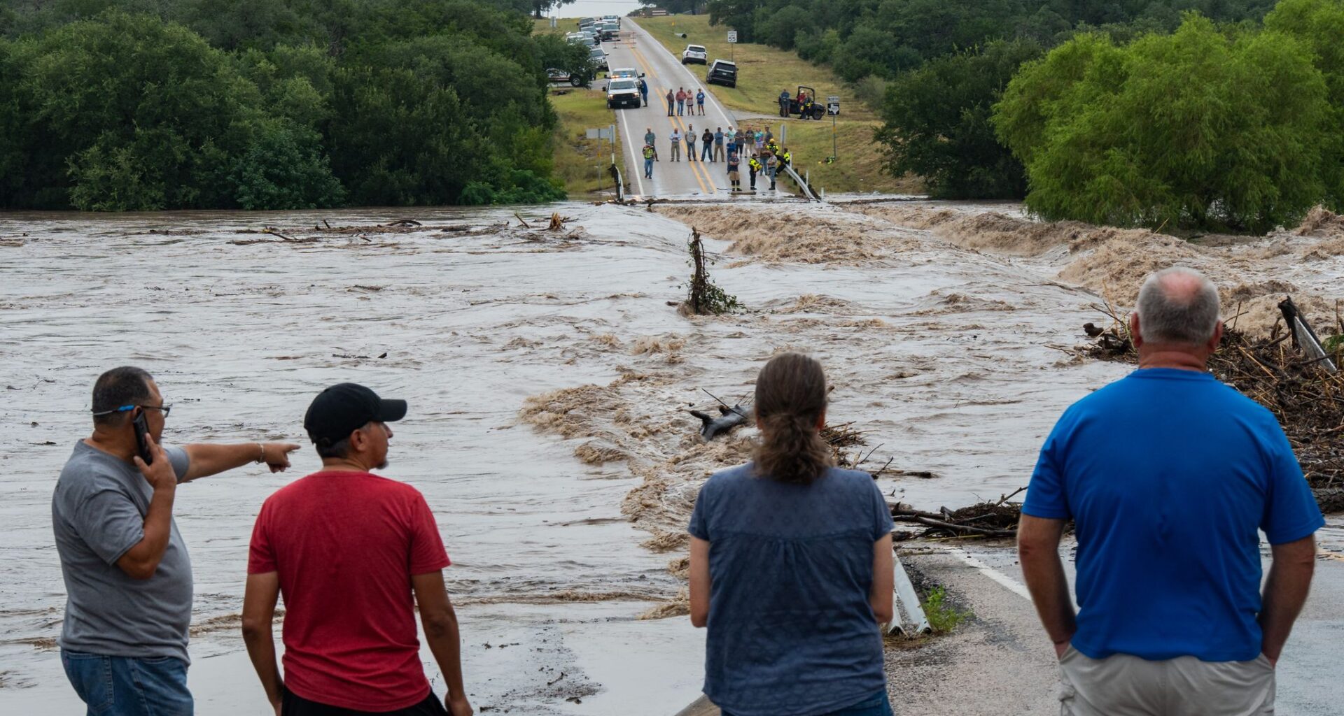
People gather Thursday to watch as the Pedernales River floods Ranch Road 1623 in Gillespie County near Stonewall.
Mikala Compton/Austin American-Statesman
Although Austin was spared the worst of the flooding that occurred this past week in South Texas and parts of the Hill Country, the city instead will likely benefit from floodwaters replenishing local waterways. But that is not always the case.

Drought-buster in the making?
The heavy rainfall in the past seven days has already significantly improved the status of freshwater sources and drought levels. Some data points, as of Friday, include:
Article continues below this ad
Lake Travis is considered 97% full, according to the Lower Colorado River Authority. The lake level, or surface elevation at Mansfield Dam, is 679.02 feet above mean sea level — that’s about 8 feet higher than last week. That’s also more than 12 feet above the historical average in July and it’s forecast to reach full capacity and into the flood pool of 682 to 684 feet above msl within the next 24 hours.
The J-17 San Antonio index well for the Edwards Aquifer is at 649.2 feet, which is 20.4 feet higher than it was six months ago on Jan.17. However, the index well remains 10 feet below its historical average for this time of year.
Texas data from the U.S. Drought Monitor released Thursday shows a statewide expansion of drought-free areas, from 52% of the Texas last week to about 59% this week. Severe drought remains along the Travis-Bastrop county line and western Bastrop County.
Texas drought data released Thursday showed that about 59% of the state was drought-free in the middle of July.
U.S. Drought Monitor/National Drought Mitigation Center
Life in flash flood alley
Austin sits in “flash flood alley,” a corridor that follows the curve of the Balcones Escarpment, from Dallas to Austin and then to the southwest of San Antonio. The escarpment is not only the eastern edge of the Edwards Plateau and the Hill Country, it’s also the natural boundary between the semi-arid higher elevations that stretch into West Texas and the humid Coastal Plains leading to the Gulf of Mexico.
Article continues below this ad
Because Texas has a unique natural combination of volatile weather patterns and a varied landscape, the state is susceptible to rapid-onset floods. Flash flooding is the state’s leading cause of weather-related deaths, according to the National Weather Service.
Managing floodwaters on the Colorado River
Austin also sits on the banks of the Colorado River, which is fed by significant tributaries in the Hill Country like the Pedernales and the Llano rivers. So, even if flooding rainfall occurs 100 miles away from Austin, rivers that feed the Colorado can bring any excess water to the city’s doorstep.
Article continues below this ad
Historically, that has meant that the Texas capital was vulnerable to nature’s whims during the rainy seasons. In the 1930s, the Texas Legislature established the Lower Colorado River Authority and the Highland Lakes, a chain of lakes created by a series of dams on the river, to not only tame the river during floods but also generate electricity from it.
For instance, Lake Travis and Mansfield Dam, which created it, were engineered to capture and store floodwaters from upstream, according to the LCRA. Austin was finally protected but it wouldn’t stop flooding along creeks and streams that are tributaries to the Colorado River — nor would it stop flooding from urban tributaries downstream from Lake Travis, such as Barton Creek, Bull Creek or Onion Creek.
People arrive Friday at a flooded low water crossing on the Old Kerr Highway, separating them from Texas 16 after catastrophic flooding swelled rivers across Central Texas and the Hill Country.
Sara Diggins/Austin American-Statesman
Llano River floods and Austin
The Hill Country flooding this past week has caused both the Pedernales and the Llano rivers to surge. As of 8 a.m. Friday, the National Weather Service was expecting the Llano River to crest again, around 19.5 feet by 2 a.m. Saturday. Flood stage is 10 feet, forecasters said, and the river is not likely to fall below that level until around 5 p.m. Saturday.
Article continues below this ad
In October 2018, about 13 inches of rainfall soaked the Hill Country west of Austin, creating a series of water crises that began with the flooding of the Llano River, which surged 30 feet above flood stage. A woman was killed when her car was swept away by floodwaters.
The surge found its way into Lake Travis, pushing lake levels above capacity. Finally, Austin’s water treatment plants struggled to filter the city’s drinking water because of excess silt churned by the floodwaters in the Highland Lakes. Authorities issued an unprecedented boil-water notice, warning residents not to drink straight from the tap for a week.
Safety after the floods
With more river flooding possible Friday on top of the catastrophic flooding that has already occurred over the past two days, it’s critical to stay out of floodwaters.
Article continues below this ad
After flood safety tips from the National Weather Service.
National Weather Service
Floodwater is far more dangerous than it appears. Even shallow, slow-moving water can hide serious hazards, including downed power lines, displaced wildlife, sharp debris, raw sewage, harmful bacteria, and toxic chemicals. As water flows over the landscape, it also can pick up pollutants like lawn chemicals, motor oil, pet waste and litter before making its way into local creeks, lakes, and rivers.
CENTRAL TEXAS FLOODING: What to know about floodwater dangers and cleanup
Article continues below this ad
Austin Watershed Protection recommends avoiding contact with floodwater and stay out of natural waterways for at least three days after the rain ends to reduce exposure to these contaminants.