
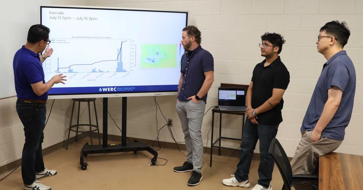

Nick Fang, UTA Water Engineering Research Center director, and his team go over flooding data on July 17 at Nedderman Hall. Fang and his colleagues received $4 million in funding from the Governor’s office for their flood research.
At 3:30 a.m. Thursday, many counties in the Texas Hill Country woke to a flash flood emergency announcement. There have been two confirmed deaths.
The waters rose 29 feet by 8 a.m. and left widespread destruction in its wake. As the flooding moves across the Guadalupe River, counties are still being hit. Last year, the counties experienced similar flooding.
The night of July 3, 2025, a National Weather Service Flood Watch came into effect in the Texas Hill Country.
By 1:14 a.m., it was upgraded to a Flash Flood Warning in Kerr County. They experienced unusually heavy rainfall in the early hours of July 4, resulting in severe flooding, which took the lives of more than 130 people, according to a UTA press release.
“This flood was by far, in a way, one of the most damaging and impactful floods that I’ve ever seen,” said Rice University Severe Storm Prediction, Education, & Evacuation from Disasters director Philip Bedient.
These events are the reason why professors like Bedient are working on a flash flood warning system.
Following the 2025 Hill County Flash Flood, the Texas Legislature conducted hearings, enacted emergency reform legislation and created general investigating committees, authorized by Government Code Section 301.017 to conduct inquiries and hearings, according to a Texas House of Representatives and Texas Senate general investigating committees report.
In November, Nick Fang, UTA Water Engineering Research Center director, and Bedient attended a hearing in Kerrville where they presented information on flood warning systems they had created together in the past.
Because of their previous experience, the team was awarded $4 million by the governor’s office in accordance with Senate Bill 5 to provide Hill Country with a more accurate flash flood warning system for the Guadalupe River through Kerrville, Bedient said.

Photo courtesy of Nick Fang
“We wanted to provide a functioning and actionable real-time flood warning system that uses a real-time radar and communication system to provide the best information to the community and the emergency personnel,” Fang said.
Bedient and Fang have been collaborating for decades, advancing storm-surge and flood modeling in Houston and along the Gulf Coast, according to a UTA press release. The duo, along with their teams, are developing the computer modeling system and comprehensive floodplain map library for the operational warning platform.
With UTA leading the project and Rice participating as a subawardee, the new system will be a weather-monitoring and modeling network designed to deliver fast and precise flood warnings for Texas Hill Country, according to a Rice press release.
Fang said the system works in three major components: data collection, a real-time flood warning module and then communication. Using radar rainfall information, the data is put into a real-time flood warning module that uses a physics-based hydrologic model and a data-driven model.
Once the data is processed through these models, the result will show when the peak of the flood will be, and how high it will be, he said.
Finally, the information will be translated for communication and given to final users, like emergency responders.
“We are working closely with the Texas Tech folks and they actually collect a lot of the best weather data,” Fang said. “They are installing more weather stations and radars in Hill Country and that dense network will provide better data for us.”
With the information gathered from the new system they will be able to develop a better flood warning system that represents the local conditions, he said.

Photo courtesy of Philip Bedient
The team is currently in the process of building a floodplain map library system, Bedient said.
The library system will include potentially 100 maps with different amounts of rainfall falling upstream and downstream in the watersheds, he said. These maps will then provide warning information to first responders and others responding to the flood.
“We’ve done this extensively in Houston and Dallas, and we’re following pretty much the same approach that we’ve used there,” Bedient said.
The approach will be built on more than two decades of experience protecting high-risk areas such as the Texas Medical Center in Houston, where Rice’s radar-based flood information and response system provides real-time flood mapping, according to a UTA press release.
Fang said with funding lasting until September 2027, they plan to deliver a system to be able to test in the fall of this year, gradually conducting more tests to make sure the system is working and will continue to work once installed.
“I think that this system is so vitally important to get it in place quickly, accurately and make sure that the coverage is complete upstream to downstream,” Bedient said.
He said modern technology that can be translated into easy-to-use directions is the purpose of the system they are building.
“It was the worst of all possible situations, but given the system we’re talking about here, there would be gauges, there would be sirens, there would be warning, there would be radar,” Bedient said.
“The hope would be we would never repeat what happened a year ago.”
@atclements03