
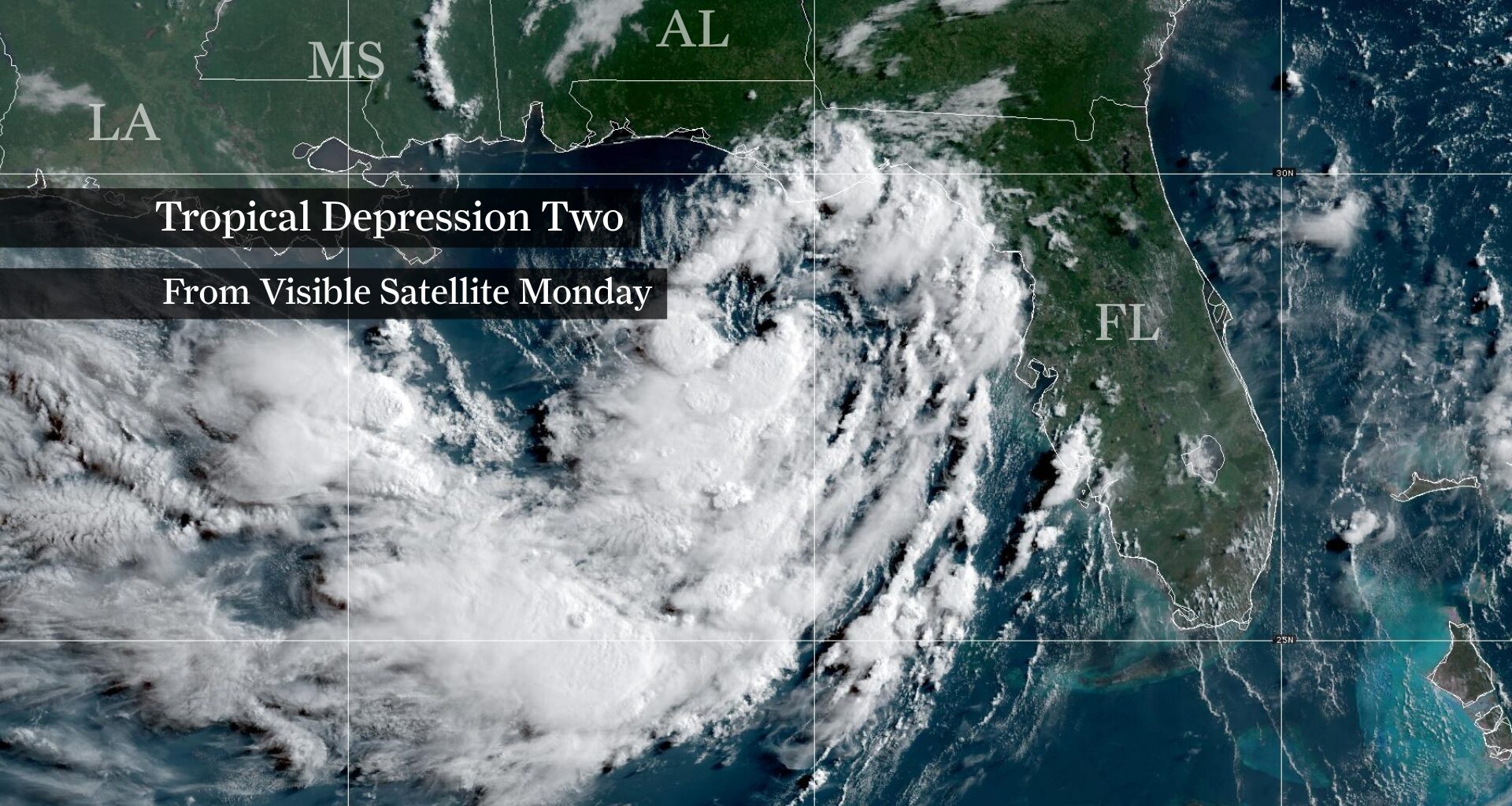
This visible-light weather satellite image, captured Monday morning, shows Tropical Depression Two as it churns off the Florida Panhandle. While the system is still disorganized, it’s expected to become Tropical Storm Bertha Monday.
National Oceanic and Atmospheric Administration
The forecast for Tropical Depression Two, which was churning Monday off the coast of the Florida Panhandle near Alabama, isn’t about whether it will strengthen. It’s about where it ultimately goes.
The depression is expected to become Tropical Storm Bertha later Monday while tracking westward along the northern Gulf Coast. Although the current forecast keeps the strongest weather hazards east of Texas, uncertainty will increase as the system approaches our corner of the northwestern Gulf of Mexico.
Article continues below this ad
With Texas still a few days away from any potential threats, relatively small changes in Bertha’s track could produce very different outcomes for Southeast Texas.
Worst-case scenario for Texas
A Louisiana track would bring Houston the greatest threats
For Houston, the worst-case scenario would be a track that carries the center of the system westward near the Louisiana coast before approaching the upper Texas coast later this week.
That path would keep Southeast Texas closer to the storm’s core for a longer period, increasing the potential for heavy rainfall, gusty winds, rough surf and minor coastal flooding.
Article continues below this ad
Regardless of the exact track, Texans along the Gulf Coast should still expect increasing surf, dangerous rip currents and at least some coastal water level rise later this week. The biggest uncertainty is how much of the heavier rain and stronger winds reach the Houston area.
A Texas landfall wouldn’t automatically be worse
A track toward the middle Texas coast, such as near Corpus Christi, would likely shift the heaviest rainfall and strongest winds southwest of Houston, leaving the metro to face comparatively lighter hazards.
SEASON OUTLOOK: Strong El Niño reshapes hurricane season outlook for Texas and Gulf Coast. Here’s how.
Article continues below this ad
In other words, where Bertha makes landfall along the Gulf Coast matters far more for Houston than whether it makes landfall in Texas.
Best-case scenario for Texas
The most favorable outcome for Texas would be for Bertha to move inland over Louisiana or Mississippi before continuing westward as a weakening tropical system.
Increasing wind shear is expected to develop by the middle of the week, while interaction with land should further disrupt the storm’s circulation. Several forecast models show Bertha weakening — or even dissipating — after it moves inland, limiting how much of the circulation ultimately reaches Texas.
For Southeast Texas, that would likely mean higher surf, dangerous rip currents and periods of elevated water levels along the coast later this week. Depending on Bertha’s exact track, Houston could see little or no rainfall, though a few passing tropical showers would still be possible.
Article continues below this ad
Most likely scenario for Texas
The current forecast falls between the best-case and worst-case scenarios, though recent trends have nudged it closer to the better end of the spectrum.
Since Tropical Depression Two formed Sunday morning, forecast guidance has shifted slightly north, bringing Bertha inland sooner than earlier forecasts indicated. Combined with increasing wind shear later this week, those trends generally favor a weakening tropical storm approaching Texas rather than one maintaining its strength deep into the western Gulf.
This map shows forecast rainfall totals across Texas through the upcoming weekend, according to NOAA’s Weather Prediction Center. Tropical Depression Two, which is expected to become Tropical Storm Bertha later Monday, could bring tropical downpours to portions of the Texas Gulf Coast later this week.
NOAA’s Weather Prediction Center / Pivotal Weather
That doesn’t mean Southeast Texas is in the clear.
Article continues below this ad
Forecast errors of 50 to 100 miles are common several days in advance, and a shift of that magnitude could be the difference between Houston seeing just rough surf and breezy weather or periods of heavy tropical rainfall and localized flooding.
The forecast won’t remain this uncertain for long. As Bertha begins its westward turn over the next 24 to 48 hours, the forecast should come into much sharper focus, helping narrow where the greatest hazards are most likely to occur.