
AUSTIN, Texas — As floodwaters continue to move through Central Texas waterways, state and local officials are closely watching a tropical system moving toward the U.S. Gulf Coast.
The National Hurricane Center expects a tropical depression in the Gulf to develop into Tropical Storm Bertha on Monday evening, a storm that could potentially bring more rain to an already soaked Texas.
Texas Division of Emergency Management (TDEM) Chief Nim Kidd said state leaders are monitoring the activity.
“We are all watching the tropics right now. We are getting into the heart of hurricane season, and so we want to keep our eyes out on the tropics and out on the Gulf and make sure all agencies and assets and resources are available,” Kidd said.
ALSO| Gov. Abbott brings CBS Austin along for Hill Country flood damage survey in Black Hawk
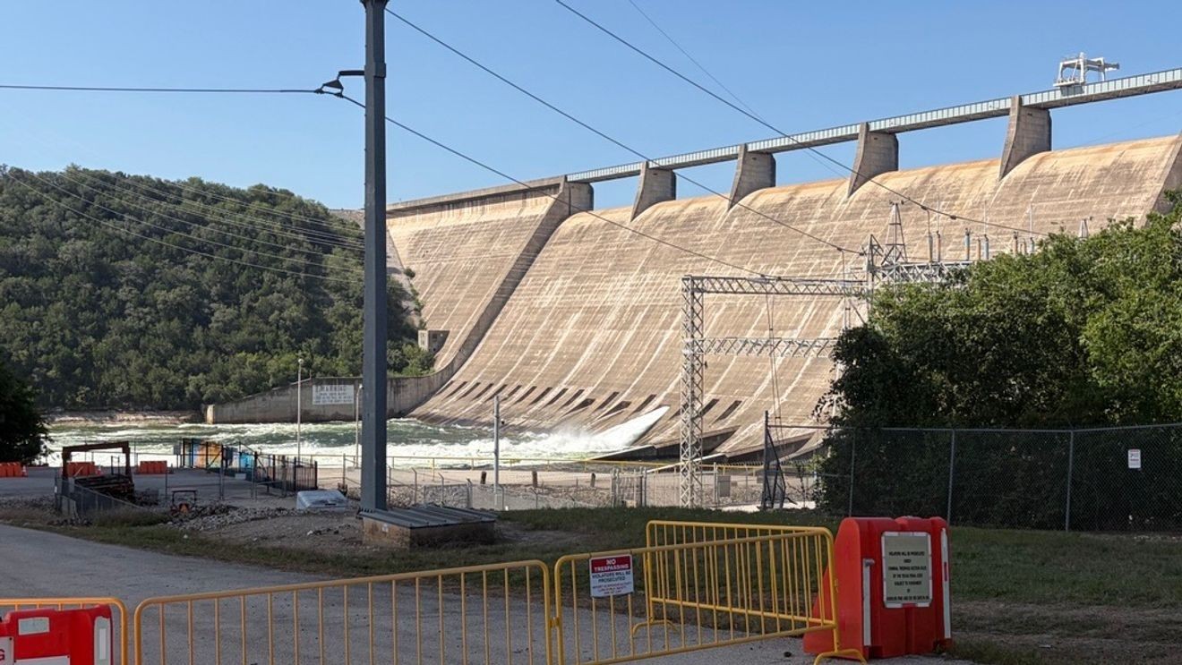
On Monday, floodgate operations continued at Mansfield Dam and Tom Miller Dam to flush excess water downstream from Lake Travis. The lake level moved beyond the lake’s capacity and into a floodplain and is now on track to return to 100% capacity.
“I would say that things are getting better,” Travis County spokesperson Hector Nieto said of flood conditions in the area.
Nieto said county officials, including Travis County Judge Andy Brown, are aware of the threat of more rain from tropical activity.
“We are definitely staying aware, and if we need to do any activities with our office of emergency management, we’ll be ready for it,” he said.
Austin Emergency Management said it is also monitoring conditions in the Gulf. Austin Watershed Protection shared a statement with CBS Austin Monday, revealing it will make decisions about next steps as the system moves closer to the Texas coast:
It is still too early to know what steps we may need to take for Tropical Depression 2, but Austin Watershed Protection monitors the weather on a daily basis. If our Flood Early Warning Team sees signs of potential for flooding, we will put crews on call to be ready to barricade roadways. We’ll also start checking culverts and low water crossings for any debris that can be removed ahead of time.
Recreational activity on Lake Travis between mile markers 27 and 27, Lake Austin and Lady Bird Lake remains prohibited as floodwater moves through the system.
As of Monday evening, the U.S. Army Corps of Engineers reports Lake Travis has an elevation of 683.8 feet, still above its full capacity of 681 feet.