
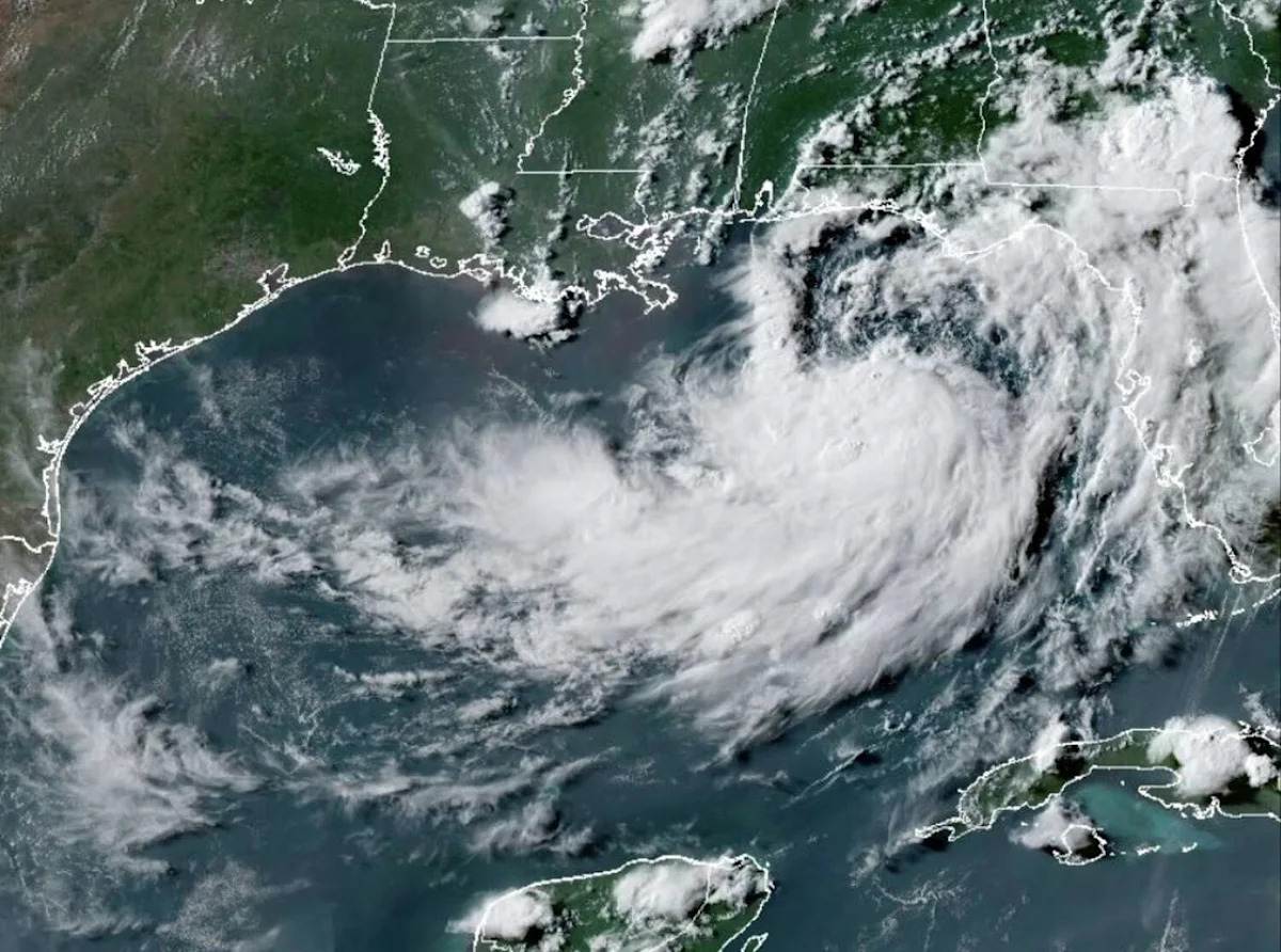
Tropical Storm Bertha has formed in the northeastern Gulf of Mexico, the National Hurricane Center announced Monday evening. Bertha is the second named storm of the 2026 Atlantic hurricane season, following Tropical Storm Arthur in mid-June.
Originally designated as a tropical depression early Sunday morning, the system gradually became better organized on Monday, developing a well-defined center of circulation. Bertha has sustained wind speeds of 40 mph – the minimum threshold for a named tropical storm.
As of 8 p.m. Monday, Bertha’s center is located about 110 miles south of Panama City, Florida. Over the next 36 to 48 hours, the storm is expected to drift slowly west-northwest at around 5 mph, likely remaining over the north-central Gulf through much of Wednesday.
Slight strengthening is possible as well. However, Bertha is expected to encounter dry air and moderate wind shear, which should prevent it from reaching hurricane strength.

Bertha is expected to make landfall in southeast Louisiana late Wednesday or early Thursday before then moving closer to the Texas coast. (National Hurricane Center)
By late Wednesday or early Thursday, Bertha is likely to make landfall in Southeast Louisiana, south of New Orleans. A tropical storm watch is in place for parts of the Florida Panhandle, Alabama, Mississippi, and Louisiana.
Will Bertha hit Texas?
According to the National Hurricane Center’s forecast cone, Bertha is expected to accelerate westward Thursday and Friday, potentially approaching or moving onshore along the Texas coast by Friday afternoon.
If this occurs, scattered showers and thunderstorms will become possible across portions of the Texas Gulf Coast, particularly near Port Arthur, Beaumont, Houston, Galveston, Victoria and Corpus Christi.
As Bertha approaches Texas, persistent dry air should continue to limit its strength, keeping impacts on the lower side. Wind shear is also likely to cause the tropical system to be lopsided, with the heaviest rainfall staying the southern side of the storm over the Gulf. Even so, locally heavy rain and tropical-storm force winds are possible for some, mainly in coastal cities.

Shown are the Atlantic tropical cyclone names for 2026. (NOAA)
Bertha may also bring a risk of high waves and rough surf, as well as a rising threat of rip currents.
However, there remains a high level of uncertainty in Bertha’s forecast track. If the storm incurs a lot of land interaction over Louisiana, it would likely weaken considerably and could dissipate before even reaching Texas. But if the storm stays over the warm Gulf waters, it could maintain its strength for a longer period.
For the San Antonio area, dry weather is expected to persist through most of the week. By Thursday and Friday, Bertha could bring a slight increase in moisture, resulting in just a 10% to 20% chance of isolated showers and thunderstorms. At this time, widespread impacts are not anticipated.
Subscribe
There’s more to San Antonio with the Express-News. Subscribe today for just 25¢.
This article originally published at Tropical Storm Bertha has developed over the Gulf. Will it hit Texas?.