
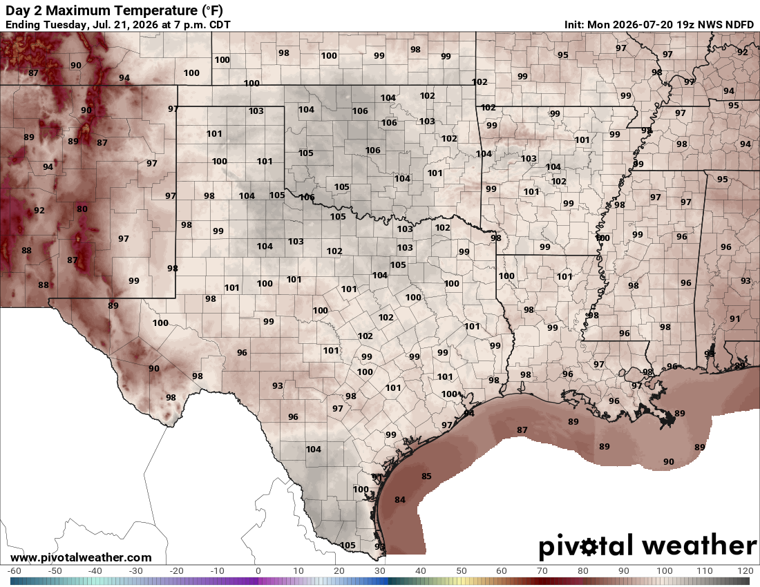
For Tuesday and Wednesday, the main story will be dry, sunny, and seasonably hot weather as an upper-level ridge of high atmospheric pressure continues to strengthen across the southwestern United States while high air pressure over Mexico continues to influence Texas.
Morning temperatures will be mild, ranging from the lower to mid-70s under mostly clear skies and light winds. By the afternoon, temperatures will climb to near the 100-degree mark, between 98 and 102 degrees, with heat index values — the humidity-driven “feels like” temps — ranging from 101 to 104 degrees.
Temperatures are expected to remain just below the National Weather Service’s criteria for a heat advisory to be issued Tuesday. While our neighbors to the north and east will be under heat alerts because of the health dangers linked to excessive humidity and extreme heat, Central Texas should stay just shy of those thresholds — for now. However, heat advisories could become necessary later this week as temperatures continue to climb.
Even without a heat advisory, it’s important to practice heat safety. Limit or avoid strenuous outdoor activities during the hottest part of the day, between noon and 6 p.m. Stay hydrated by drinking plenty of water and replenishing electrolytes, wear sunscreen, a hat, and lightweight, light-colored clothing, and take frequent breaks in air-conditioned or shaded areas.
Never leave children or pets in a parked vehicle, even for a few minutes. Check on older adults, neighbors, and anyone without reliable air conditioning. If you experience dizziness, confusion, nausea, or heavy sweating, move to a cooler place immediately and seek medical attention if symptoms worsen.
Temperatures will build a bit more on Wednesday with most locations reaching triple-digit temperatures.
“Factor in our dew points and Wednesday is looking like it could be a day for some heat headlines for at least portions of the area,” meteorologists at the National Weather Service said in their daily forecast. “Regardless, Wednesday and Thursday will be hot across the region and precaution should be used if you are spending an extended period of time outdoors.”
The second half of the week becomes a bit more challenging to forecast as our weather will depend on the track and strength of the system expected to become Tropical Storm Bertha. While hot and humid weather will continue locally, we are closely monitoring this tropical cyclone that has developed in the northeastern Gulf.
The current forecast has the system slowly moving west over the warm waters of the northern Gulf of Mexico, where it could strengthen before making landfall. The latest track brings the system toward the upper or middle Texas coast on Thursday, with the potential for it to move inland on Friday.
“There is much uncertainty with the track and intensity of this system and the impact that it will have on our region.,” the weather service said. “Being that we are not far removed from recent flooding across the area, we will continue to monitor this situation closely.”