
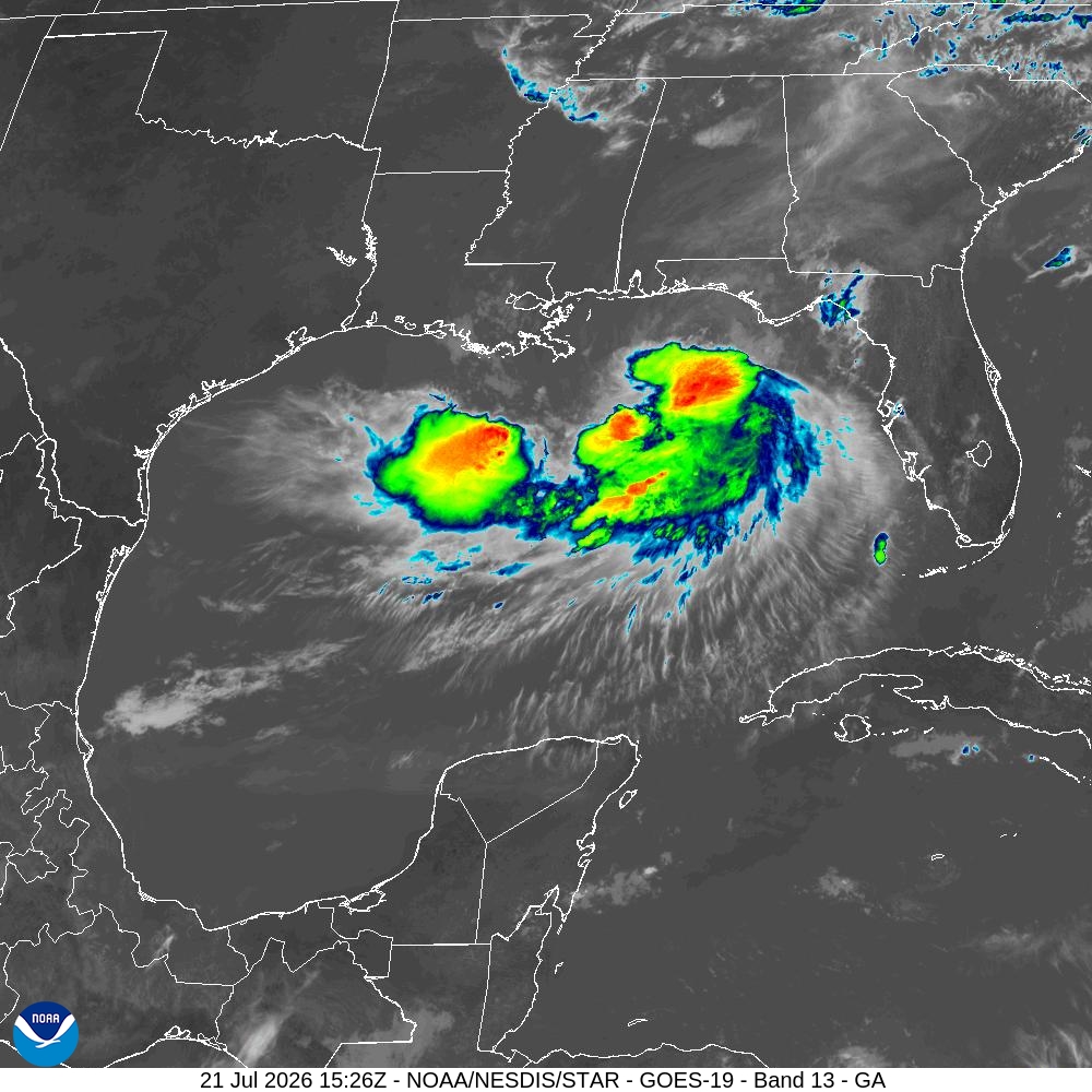
Say hello to Tropical Storm Bertha, the second named storm of the 2026 Atlantic hurricane season. Hurricane reconnaissance aircraft confirmed the system had strengthened into a tropical storm Monday evening, and it has continued to organize since then.
As of 10 a.m. Tuesday, Bertha has maximum sustained winds of 60 mph and is located about 70 miles south-southwest of Panama City in the Florida Panhandle, and 145 miles southeast of Mobile, Ala. The storm is drifting north-northwest at a slow 3 mph, but the National Hurricane Center expects it to turn more westward by Tuesday evening and continue that track through midweek.
Tropical storm-force winds extend outward up to 90 miles from the center, and a NOAA buoy near Pensacola, Fla., recently reported sustained winds of 49 mph with a gust to 54 mph.
“Tropical Storm Bertha has strengthened, but the system is expected to encounter a hostile environment by midweek due to increasing wind shear and interaction with the Louisiana coastline,” meteorologists with the National Weather Service said. “These factors should disrupt additional strengthening as the storm moves across the northwestern Gulf later this week.”
As for Texas, we are expecting the storm to approach the Texas coast as a tropical depression sometime Thursday night and into Friday with little impacts.
As this tropical activity ramps up, it’s a great time to refresh your understanding of three important hurricane terms: storm surge, hurricane watches vs. warnings, and the forecast cone. Knowing what these terms mean can help you make informed decisions and prepare for tropical weather threats, whether you live along the coast or farther inland.
Hurricane watch vs. hurricane warning: These alerts indicate how soon hurricane conditions may occur and when you should take action.
The forecast cone: Also known as the cone of uncertainty, this forecast graphic shows the most likely track of the storm’s center. Because hurricanes can change direction or speed, the forecast cone is updated with each new forecast as additional data becomes available.
It’s also important to remember that the cone does not represent the full extent of a storm’s impacts. Dangerous conditions, including damaging winds, storm surge, heavy rainfall, flooding, and tornadoes, can occur well outside the cone. Always pay attention to forecasts and local alerts, even if you are outside the projected path.