
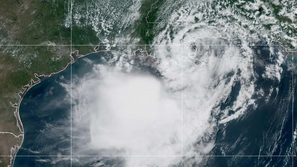
Tropical Storm Bertha made landfall along Louisiana’s southeastern coast Wednesday afternoon, becoming the second named storm in the Gulf of Mexico to affect the United States during the 2026 Atlantic hurricane season.
The storm came ashore near the Biloxi Wildlife Management Area in St. Bernard Parish, with maximum sustained winds of 45 mph. It is expected to continue tracking west along or near the Louisiana and upper Texas coasts through Thursday before making a second landfall in Texas on Friday.
TRACK BERTHA:
Follow the path of the second named storm of the 2026 Atlantic hurricane season.
Although Bertha has steadily weakened throughout Wednesday as dry air and increasing wind shear disrupted its circulation, it is expected to remain a tropical storm through late Thursday. Tropical storm conditions continued spreading westward along the northern Gulf Coast as the storm moved toward Texas.
Texas is next in Bertha’s path
Bertha’s Louisiana landfall is not expected to be its last. The storm is forecast to make a second landfall along the Texas coast Friday.

Texas is next in line to get tropical-storm-force winds and tropical downpours, as shown by the forecast track of Bertha into Southeast Texas by Thursday. (NOAA’s National Hurricane Center)
While Bertha’s center is expected to stay south of much of Southeast Texas until late Thursday, tropical weather will begin spreading into the region well before then.
Bertha prompts tropical alerts along Upper Texas Coast
A tropical storm watch remains in effect for portions of the upper Texas coast as Bertha continues moving west.
The watch extends from west of Morgan City in south-central Louisiana, to Sargent in Texas near Matagorda Bay, including portions of the upper Texas coast, where tropical storm conditions remain possible Thursday into Thursday night.
The strongest winds, heaviest rain and greatest storm surge are expected to remain east of Houston. Even so, Bertha will spread tropical moisture into Southeast Texas beginning Thursday, bringing scattered downpours, gusty winds and periods of heavy rain through Friday.

Bertha is expected to bring tropical downpours Thursday to portions of Southeast Texas, but the highest rainfall totals will mainly be found south of Houston. Localized rainfall amounts of 2 to 4 inches are possible, mainly towards Matagorda Bay. (NOAA’s Weather Prediction Center / Pivotal Weather)
Rainfall totals will vary sharply across Southeast Texas. The heaviest rainfall is expected near Matagorda Bay, where widespread totals of 1 to 4 inches are forecast. Much of the Houston area is expected to receive a half-inch to an inch, while many communities north of Interstate 10 may receive little, if any, rainfall. Isolated heavier totals remain possible where rain bands repeatedly move over the same locations, creating a localized flash flood risk.
Coastal flooding possible Thursday
Bertha’s circulation will also push elevated water levels and rough surf toward parts of the Upper Texas Coast.
MYTH BUSTING: Separating fact from fiction about El Niño, the climate phenomenon influencing the Atlantic hurricane season.
Storm surge of a foot to 3 feet above normally dry ground remains possible along portions of the northern Gulf Coast, depending on the timing of high tide. While the greatest surge is expected east of Texas, elevated water levels are still possible along parts of the Upper Texas Coast Thursday.
Dangerous surf and life-threatening rip currents are expected to continue spreading westward through the end of the week, creating hazardous beach conditions even well away from Bertha’s center.
Subscribe
There’s more to Houston with the Chronicle. Subscribe today for just 25¢.
This article originally published at Tropical Storm Bertha makes Louisiana landfall as it turns toward Texas.