
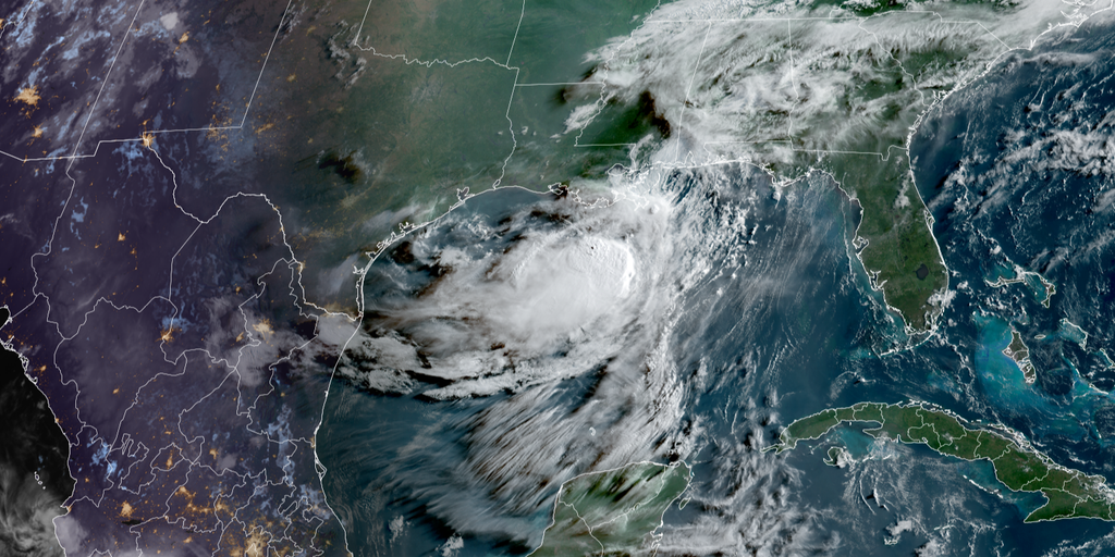
NEW ADVISORY 🌀: Tropical Storm Bertha continues its westward trek across Louisiana, and the latest National Hurricane Center forecast keeps the system on track for a potential second landfall along the Gulf Coast. FOX Weather Hurricane Specialist Bryan Norcross breaks down the 5 p.m. advisory, including the expanded Tropical Storm Warning and what to expect across the Gulf Coast in the days ahead.
NEW ORLEANS — Tropical Storm Bertha officially made landfall in southeastern Louisiana on Wednesday afternoon, and it continues to lash the northern Gulf Coast with tropical-storm-force winds and coastal flooding from parts of the Florida panhandle to Louisiana.
Bertha has since moved back offshore where it is expected to reorganize and intensify over a short period of time before lashing Texas on Thursday.
HURRICANE SEASON 2026: THESE ARE THE STORM NAMES YOU’LL SEE THIS SEASON
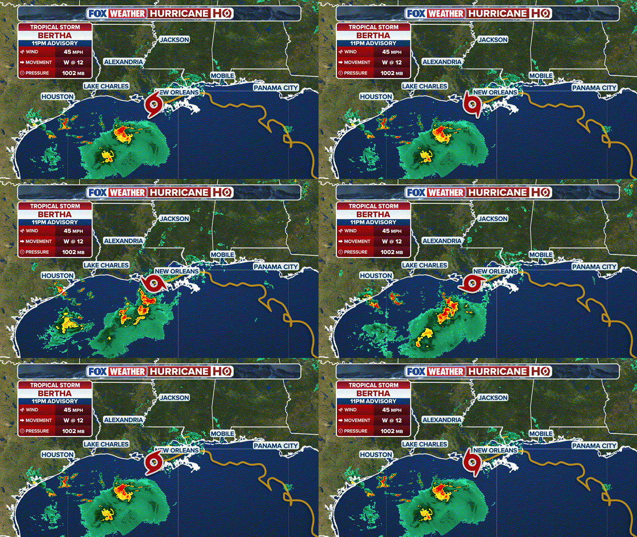 What to know about Tropical Storm Bertha.
(FOX Weather)
As Bertha reforms, it is tracking farther south and will bring tropical downpours to the Corpus Christi, Texas, region with wind and rain as far north as Houston and Galveston. Tropical storm conditions are expected to continue through Thursday afternoon.
The FOX Forecast Center said Bertha has a short period of time to strengthen over the open water before impacting the Texas coastline.
Bertha formed Monday in the northeastern Gulf, becoming the second named storm of the Atlantic hurricane season.
Tropical storm conditions are spreading across the northern Gulf Coast, according to the National Hurricane Center (NHC).
Tropical Storm Bertha is moving along the Gulf Coast, with the outer bands lashing cities along the coast. FOX Weather Senior Correspondent Robert Ray captured the strong winds and roaring waves along the beaches of Dauphin Island, Alabama as Bertha continues along its path.
As of Wednesday night, Bertha was about 75 miles southwest of New Orleans, with maximum sustained winds of 45 mph, and is moving west-northwest at 12 mph.
TRACK BERTHA: LIVE RADAR, FLOOD THREAT, WIND SPEED AND RADAR
FOX Weather Senior Correspondent Robert Ray experienced rough surf and 40 mph wind gusts on Dauphin Island, Alabama, early Wednesday.
Bertha moved over the uninhabited Chandeleur Islands, a set of barrier islands that mark the easternmost point of Louisiana, on Wednesday morning.
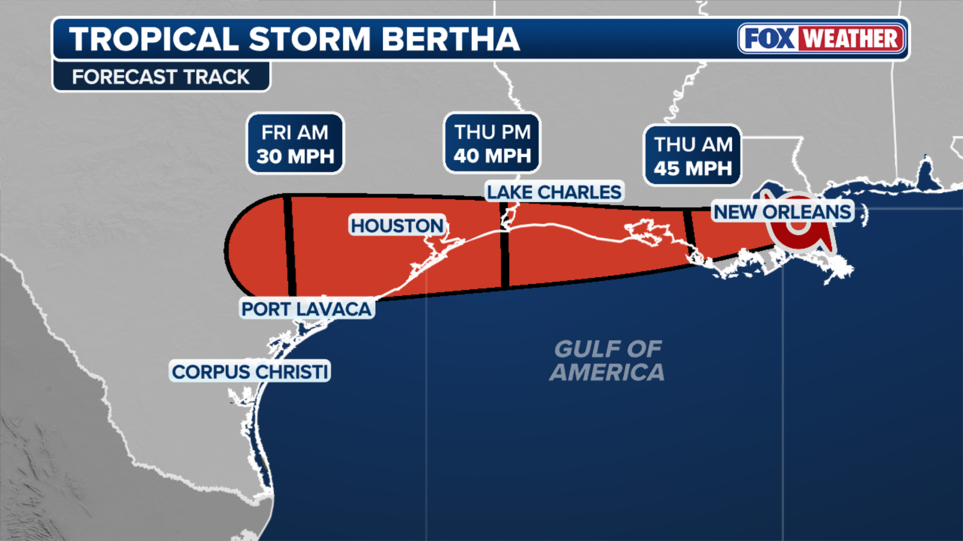 Here is how Tropical Storm Bertha is expected to form along the Southeast.
(FOX Weather)
Tropical Storm Warnings are in effect from the Alabama/Florida border to Morgan City, Louisiana, indicating that these areas could experience tropical storm conditions through Thursday. This warning includes New Orleans and Lake Pontchartrain.
WHAT HURRICANE AND TROPICAL STORM WATCHES AND WARNINGS MEAN
Meanwhile, Tropical Storm Watches were extended westward and now cover the area west of Morgan City to Sargent, Texas.
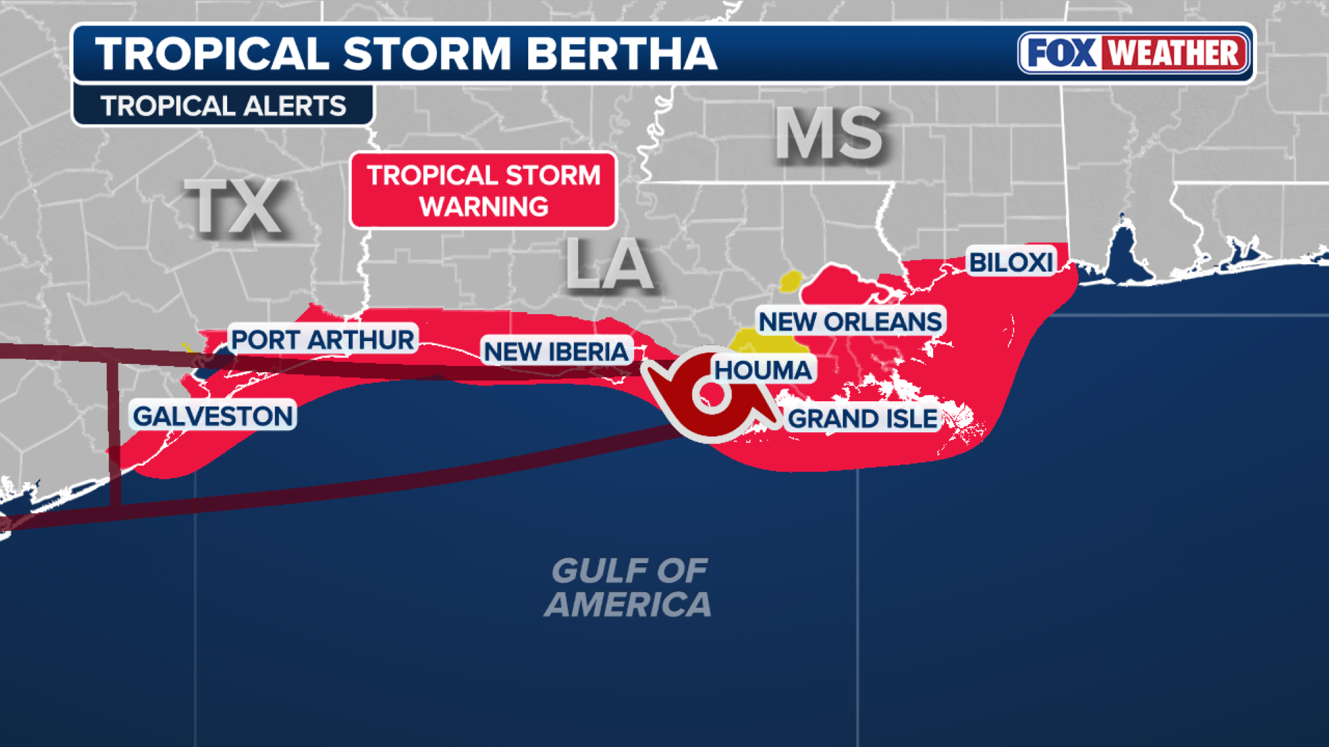 Tropical Alerts for Tropical Storm Bertha.
(FOX Weather)
A Coastal Flood Warning is in effect for southeastern Louisiana and the Mississippi coast, with 1 to 3 feet of water expected in low-lying coastal areas.
Bertha is also bringing life-threatening rip currents along the northern Gulf Coast, as well as parts of the Florida Gulf Coast.
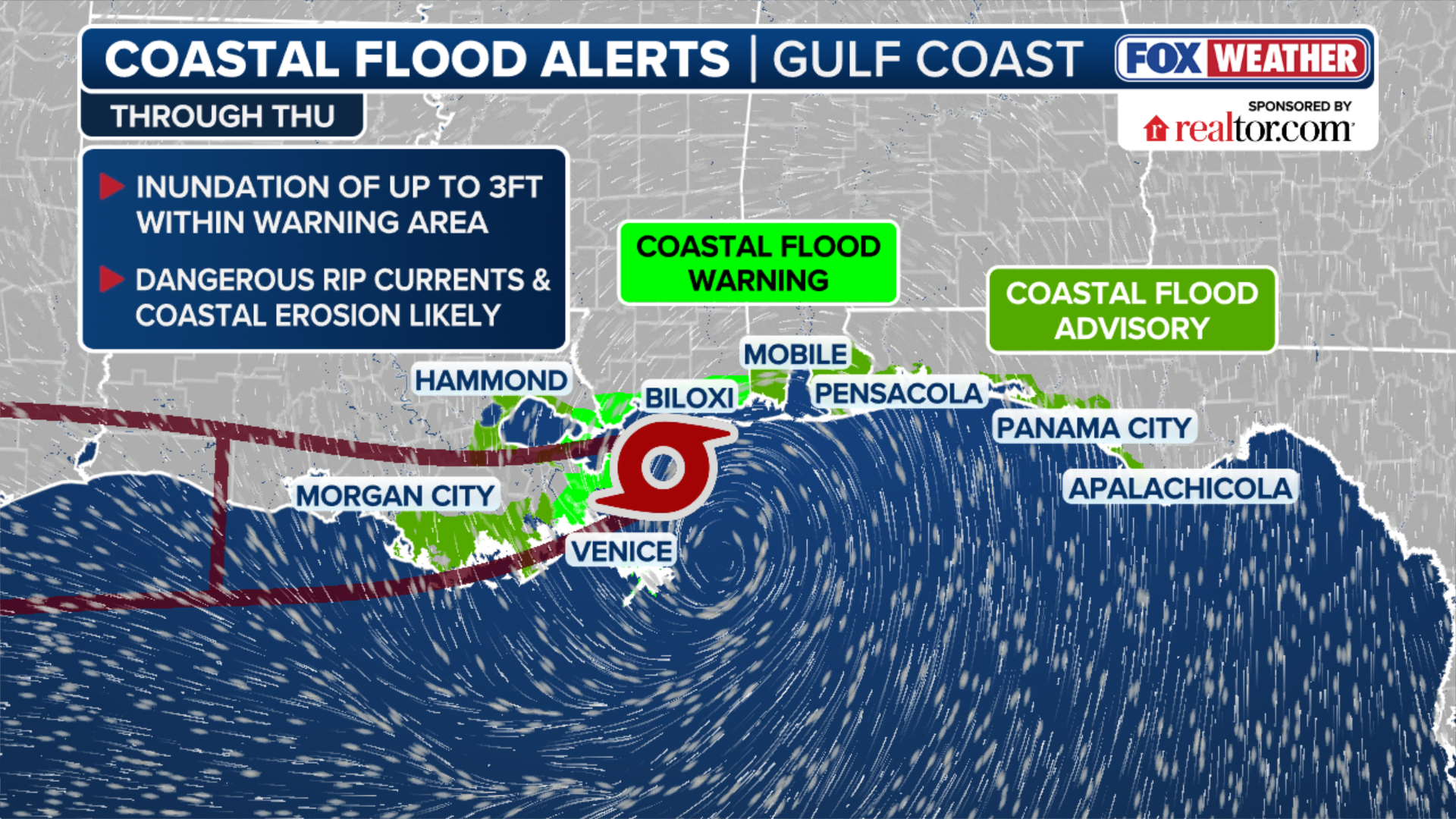 Coastal Flood Alerts for Tropical Storm Bertha.
(FOX Weather)
TIMELINE: WHEN YOU WILL SEE THE FIRST IMPACTS OF TROPICAL STORM BERTHA IN THE SOUTHEAST
The FOX Forecast Center said Bertha reached peak intensity Tuesday as a moderate tropical storm, with the heaviest rain offshore.
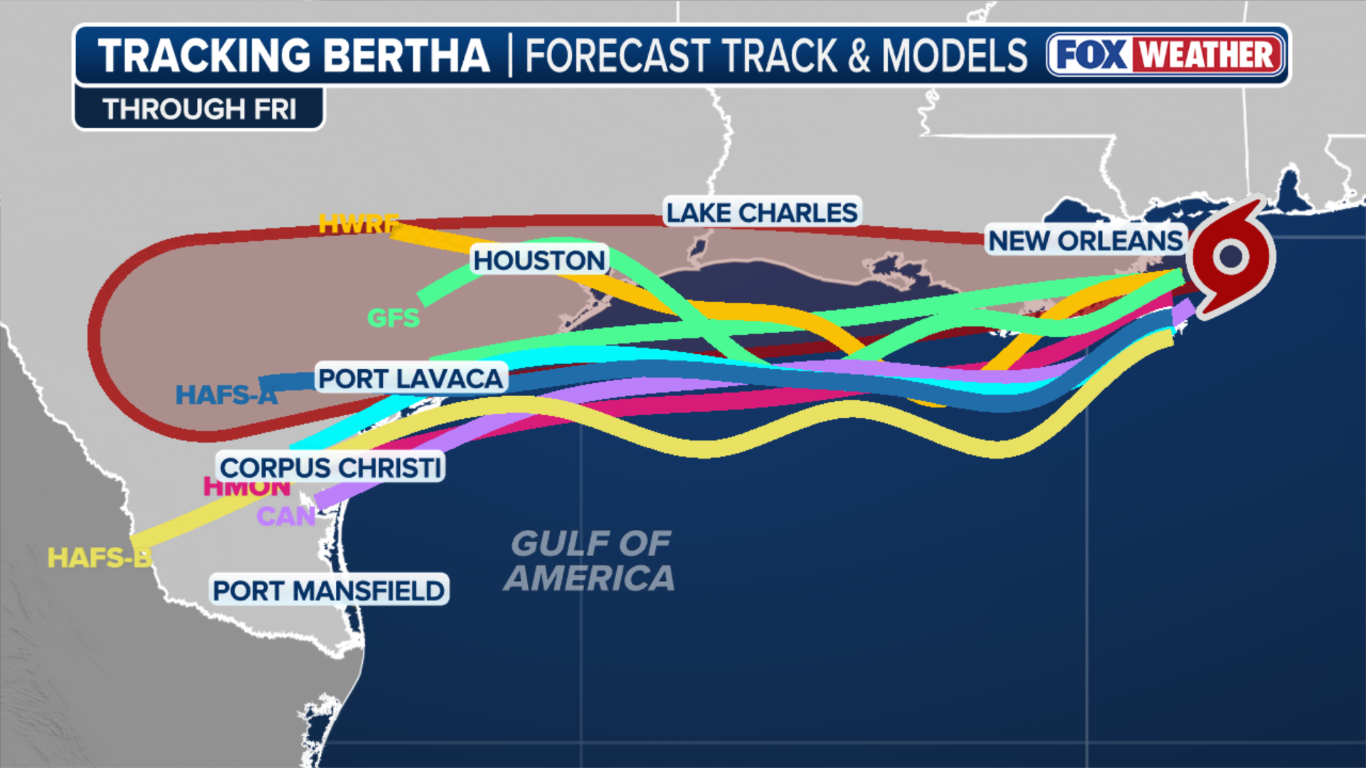 Computer forecast model tracks for Tropical Storm Bertha.
(FOX Weather)
“Its lopsided nature means most of the rain will fall on the southern side of the system — well off the coast,” the FOX Forecast Center said.
HOW ARE HURRICANES RATED? THE SAFFIR-SIMPSON HURRICANE WIND SCALE EXPLAINED
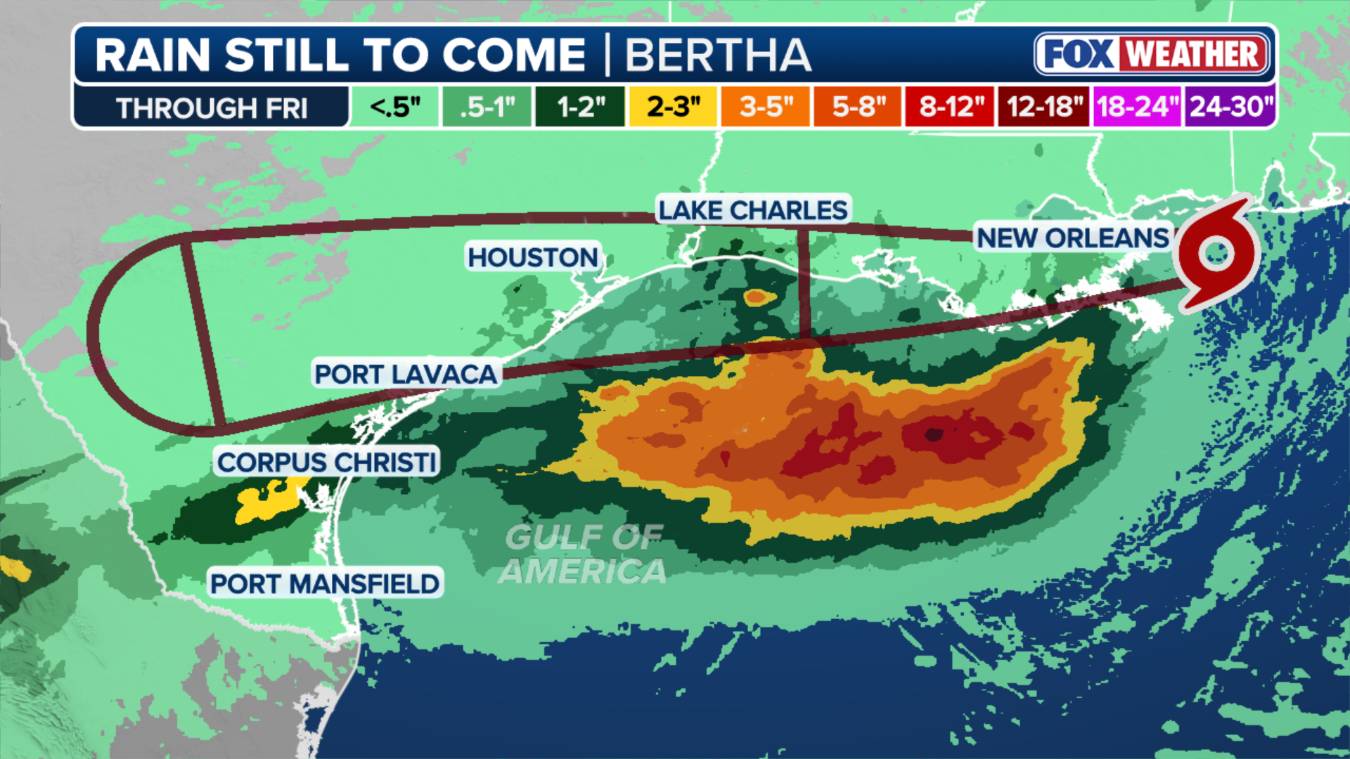 The amount rain that is expected through Friday.
(FOX Weather)
Bertha is bringing short, intense downpours over the coastal and inland areas of the Florida panhandle, Alabama, Mississippi and Louisiana. The intense rain over a short period of time could trigger low-level flash flooding.
7 FACTS YOU SHOULD KNOW ABOUT FLASH FLOODS
Rain totals of 1 to 4 inches are expected through Thursday, with isolated higher amounts possible.
This story is developing. Check back for updates.