
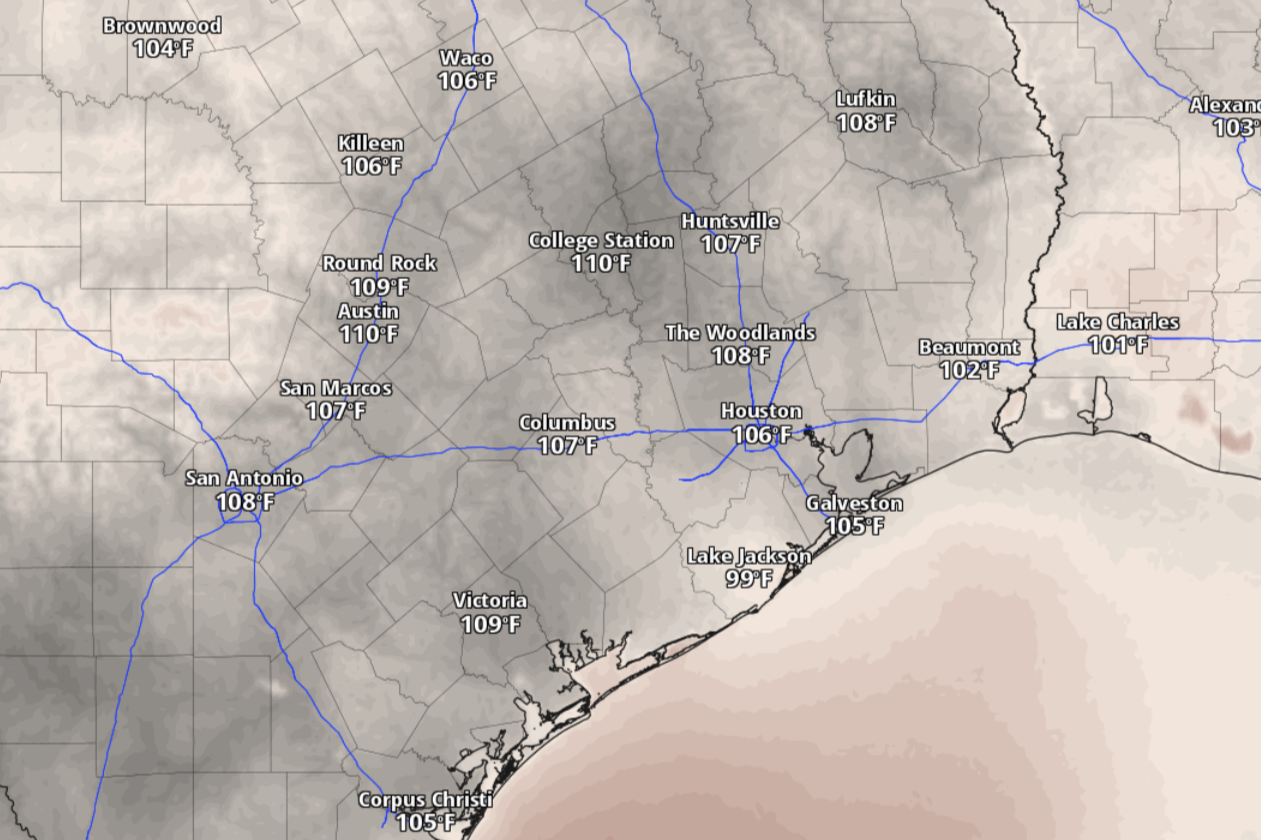
The alert was continued into Thursday as heat index values, or humidity-driven “feels like” temperatures, are expected to reach up to 112 degrees, forecasters said. The heat advisory area includes Texas counties in the Interstate 35 Corridor, Hill Country and Coastal Plains.
“Heat-related illnesses increase significantly during extreme heat and high humidity events,” the weather service said in announcing the heat advisory. “Hot temperatures and high humidity may cause heat illnesses,” such as heat exhaustion and heatstroke.
Under Austin’s sunny skies on Thursday, daytime temperatures could soar to 101 degrees, with humidity making that heat feel about 10 degrees hotter. Although skies will be partly cloudy Thursday night, don’t expect much relief from the heat because overnight temperatures will stay above 81 degrees into Friday morning.
“While most of the area will be dry on Thursday, we will start to see some precipitation chances return for the Coastal Plains by Thursday afternoon in association with Tropical Storm Bertha,” the weather service said in a forecast bulletin Wednesday, adding that they remained uncertain about “how much of a direct impact this storm will have across our area.”
Meanwhile, Austin on Friday has a slight 30% chance of rain sometime between 4 a.m. and sunrise on an otherwise mostly sunny day. Temperatures are expected to reach an afternoon high of 96, accompanied by robust southerly winds at 5 to 10 mph and gusts as strong as 20 mph.
“Things will generally dry out for the rest of the coming weekend and into the start of next week,” the weather service said.
“The actual path that Tropical Storm Bertha decides to take could impact the weather for Friday and into the weekend, which we will continue to monitor,” the weather service said. “Right now models continue to limit how much precipitation we will see across our area.”
As of Wednesday, the rotating center of Tropical Storm Bertha was about 55 miles north-northeast of the mouth of the Mississippi River. Bertha was packing maximum sustained winds of 50 mph and moving west-northwest at 6 mph, according to the National Hurricane Center.
The portion of the Texas Gulf Coast under a tropical storm watch extended from the Louisiana border to the Texas beach town of Sargent, near Matagorda Bay. A tropical storm watch means that tropical storm weather, including winds stronger than 39 mph, are possible within the watch area, in this case within the next 12 to 36 hours.
“Post Bertha, temperatures will remain hot, and slowly increase with 100-degree temperatures filtering back into the area by the middle of next week,” the weather service said.