
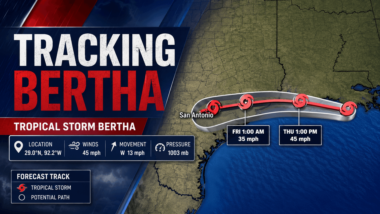
Tropical Storm Bertha is moving steadily west along the northern Gulf Coast and is expected to make landfall along the upper Texas coast later Friday while maintaining tropical storm strength.
As of 4 a.m. CST today, Bertha was centered about 95 miles southeast of Lake Charles, Louisiana, and about 145 miles west-southwest of New Orleans. The storm was moving west at 13 mph with maximum sustained winds of 45 mph. Its minimum central pressure — a measurement of a storm’s strength, with lower pressure typically indicating a stronger storm — was 1003 millibars.
Forecast track
Bertha is expected to continue on a generally westward to west-northwestward track through Friday before turning slightly west-southwest. The forecast keeps the center moving near or along the Louisiana and upper Texas coasts through the afternoon before pushing inland across Texas Friday evening. The storm is expected to weaken quickly after landfall and dissipate by late Thursday or early Friday.
Maximum sustained winds remain near 45 mph, and little change in strength is expected before landfall. Bertha is forecast to remain a tropical storm until it reaches the upper Texas coast.
Warnings
As the storm continues west, tropical storm warnings have been discontinued across additional portions of Louisiana. The warning has been dropped for the Louisiana coast east of the Terrebonne-Lafourche Parish line.
A Tropical Storm Warning remains in effect from the Terrebonne-Lafourche Parish line in Louisiana westward to Sargent, Texas. A Tropical Storm Warning means sustained winds between 39 and 73 mph are expected within the warning area within the next 24 hours.
Current conditions
Tropical-storm-force winds extend up to 160 miles from the center, mainly southeast of Bertha. A National Ocean Service station at Eugene Island, Louisiana, recently measured sustained winds of 39 mph with gusts to 47 mph. An offshore oil platform southeast of the storm reported sustained winds of 56 mph.
Storm surge
Storm surge — the abnormal rise of seawater pushed inland by persistent onshore winds — remains a concern along the northwestern Gulf Coast. Water levels of 1 to 3 feet above normally dry ground are possible from the mouth of the Mississippi River westward to Port Bolivar, Texas. The extent of flooding will depend on the timing of high tide and local geography.
Heavy rain
Heavy rain remains focused on Texas as Bertha approaches landfall. An additional 2 to 4 inches of rain is expected along the Texas Gulf Coast and South Texas through Friday night, with isolated totals reaching 6 inches. Localized flash flooding remains possible, particularly in urban areas and locations with poor drainage.
Swells generated by Bertha will continue moving west along the northern Gulf Coast through the next several days, creating dangerous surf and life-threatening rip currents well away from the center of the storm.
What to expect
While Bertha is entering its final hours as a tropical cyclone, residents along the upper Texas coast should continue preparing for gusty winds, heavy rain, minor coastal flooding and hazardous beach conditions before the storm moves inland and rapidly weakens.