
Through the first half of summer, the heat across South Texas hasn’t been quite what we’ve grown accustomed to. Since June 1, San Antonio’s average high temperature has been 92.1 degrees, which is about 1.5 degrees below average for this point in the season.
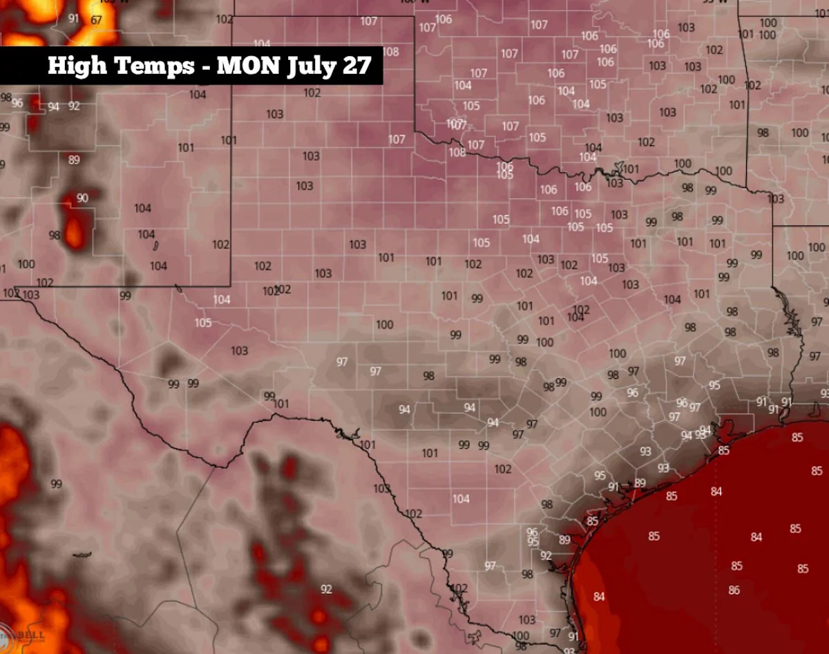
However, changes are coming, as high atmospheric pressure is expected to dominate the weather over the next seven days. Near-average summer heat is likely through the weekend, but next week is shaping up to be the hottest stretch of the year so far across South Texas.
Beyond that, weather models are beginning to hint at another shift by the first week of August, as scattered rain chances could return to the forecast. Here’s what you can expect.
Weekend forecast
Saturday: In what’s likely to be the most comfortable day of the week to be outside, Saturday morning will start with mostly cloudy skies and mild temperatures in the middle to upper 70s. Temperatures will rise steadily through the morning, likely reaching the upper 80s by noon.

Shown are the expected humidity-driven heat index values at 4 p.m. Saturday, according to the National Blend of Models (Pivotal Weather)
By the afternoon, skies will turn mostly sunny, but some scattered clouds are likely to stick around throughout the day. Temperatures will top out near 95 degrees, which is actually a degree or two below average for late July. When incorporating the humidity, heat index values are likely to reach near 100 degrees.
Sunday: A similar day to Saturday is shaping up across South-Central Texas, with morning lows once again expected in the middle to upper 70s. By the afternoon, more sunshine is expected, which may allow for temperatures to rise slightly, topping out at 96 to 97 degrees in the Alamo City.
Rising heat this week
High atmospheric pressure will strengthen across Texas this week, resulting in even hotter temperatures. In San Antonio, temps are expected to reach 98 to 99 degrees on Monday and Tuesday before potentially reaching 100 degrees from Wednesday through Friday.
Mostly sunny skies are expected each day next week, with no chance of rain throughout the entire region. Humidity levels will stay elevated, resulting in heat index values hovering between 103 and 106 degrees each afternoon.
Parts of Texas, particularly across northern sections of the state, will be even hotter. In the Dallas-Fort Worth metroplex, high temperatures are forecast to range from 104 to 106 degrees Monday through Friday, with a few isolated locations in North Texas potentially reaching 110 degrees.
Any changes coming?
Long-range forecast models suggest the pattern could begin to shift during the first week of August. According to the American GFS model, high air pressure may shift farther west by the week of Aug. 2-5. If that occurs, it could allow a low pressure system over the eastern U.S. to move closer to Texas, increasing the potential for scattered showers and thunderstorms.
However, because this is still more than a week away, a great deal of uncertainty exists, and the upper-level weather pattern could still change considerably. For now, rain chances in San Antonio are expected to be near 30% by Aug. 2-5, but that forecast could rise or fall as new weather model data becomes available. Be sure to stay updated to expressnews.com/weather for daily updates.
Subscribe
There’s more to San Antonio with the Express-News. Subscribe today for just 25¢.
This article originally published at High heat to build over South Texas, but here’s when to expect changes in the weather.