
The Brief
Foggy Mornings, Very Warm Days & Worse Drought Conditions
Strong Front Arrives Late Saturday, Delivering Big Chill
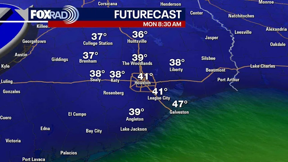
Coldest Temperatures Since February Possible Early Next Week
HOUSTON – Much warmer weather is coming to the Houston area for your Friday before a temperature roller coaster this weekend!
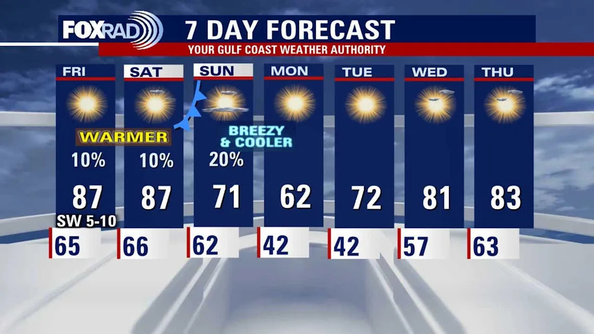
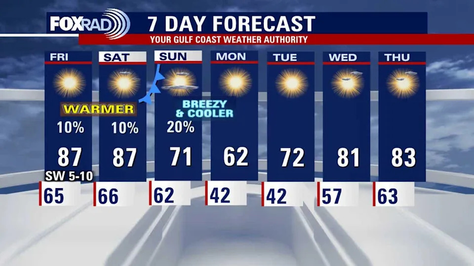
Houston weather: Warm days, overnight fog in the forecastUNSEASONABLY WARM DAYS, OVERNIGHT FOG
Get ready for a very toasty end to the week with afternoon sun and highs hitting the mid-to-upper 80s. This warm, humid air mass has been setting the stage for patchy fog to develop overnight and linger into the morning hours through early Saturday. Don’t be surprised if visibility is low for the morning commute again, but the afternoons on Friday and Saturday will be close to the record highs of 89 degrees in Houston.
 TEMPERATURE ROLLER COASTER THIS WEEKEND
The unseasonably warm weather will come to an abrupt end this weekend. Saturday remains sunny and borderline hot, likely hitting the upper 80s again. However, a strong cold front is slated to push through late Saturday into early Sunday, leading to a dramatic temperature swing. This front will be dry, meaning little to no rain is expected, but it will rapidly usher in much colder, drier air. Also a new drought monitor was released this morning and drought conditions have gotten worse with the majority of Southeast Texas in a moderate drought. Severe drought conditions have crept into parts of Austin, Colorado and Wharton counties.
COLDEST AIR IN SEVERAL MONTHS LIKELY
Sunday will be breezy and much cooler with highs in the low 70s. By Monday and Tuesday morning, low temperatures behind the front are forecast to drop into the low 40s in Houston, with readings potentially reaching the 30s north of the city. This sets up the coldest conditions the area has seen since February. The taste of winter will be brief with above normal temperatures returning by Wednesday.
The Source
Information from Your Gulf Coast Weather Authority