
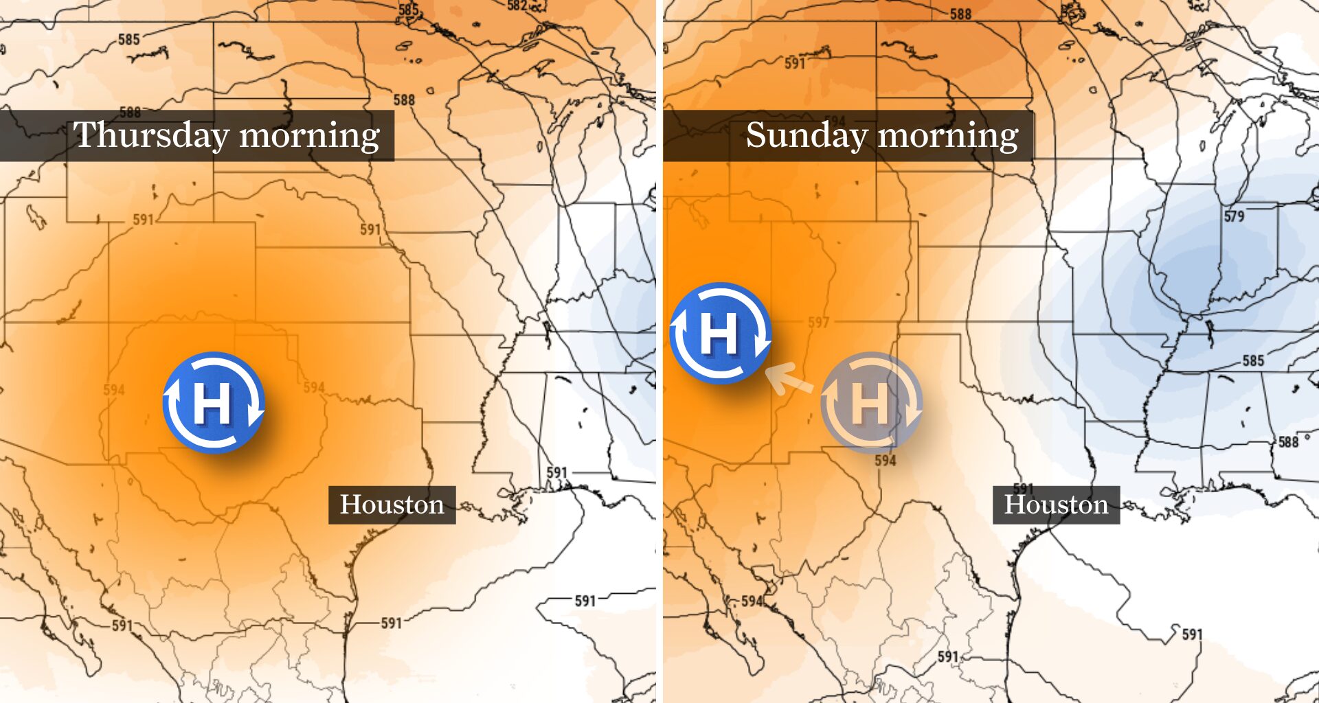
Thursday and Friday will still feel like the hottest days of the week, with afternoon highs in the upper 90s and heat index values between 105 and 108 degrees. As the ridge weakens, however, a weak front should approach Southeast Texas this weekend, bringing slightly cooler temperatures and a gradual return of rain chances.
The atmosphere may be changing overhead, but at ground level, Thursday and Friday will look and feel much the same.
Afternoon temperatures will once again reach the upper 90s to around 100 degrees both Thursday and Friday, with humidity driving heat index values to between 105 and 108 degrees. Most of Southeast Texas is expected to remain just below the trigger for a heat advisory from the National Weather Service, but the lack of an advisory doesn’t mean the heat is any less dangerous. Anyone spending extended time outdoors should stay hydrated, take frequent breaks and avoid strenuous activity during the hottest part of the afternoon.
While rain chances remain slim through the end of the work week, a weak sea breeze could spark an isolated shower east of Houston during the late afternoon or evening.
The first noticeable changes arrive this weekend as the heat dome shifts west, allowing a weak backdoor cold front — approaching from the northeast rather than the typical northwest — to slip into Southeast Texas.
Don’t expect a taste of fall. Afternoon temperatures are likely to ease only into the middle 90s, and overnight air will remain muggy. The more noticeable difference will be the return of scattered afternoon showers and thunderstorms after several mostly dry days.
Rain chances remain modest — generally 20% to 30% across much of Southeast Texas — with higher odds east of Houston toward Beaumont and Lake Charles. Confidence in more widespread rainfall remains low, however, because only a minority of forecast models bring the front far enough west to produce more frequent showers across the Houston metro area.
The change won’t end Houston’s summer heat, but it should bring the forecast back to something more typical for August: highs in the mid-90s, muggy nights and at least a daily chance of scattered afternoon thunderstorms.