
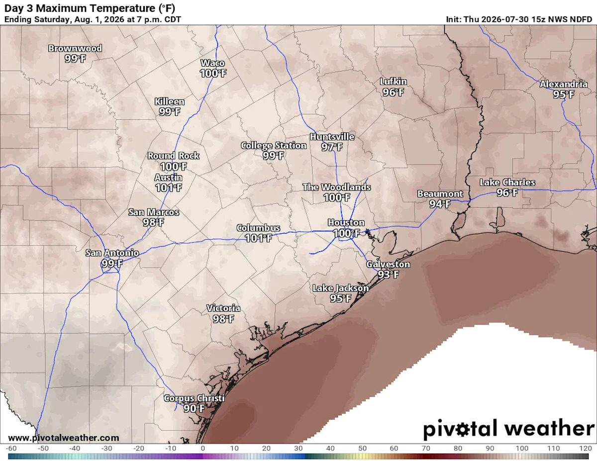
After a week of nearly 100-degree temperatures, we’re taking the next step with a forecast high of 101 degrees for Friday. However, with dew point temperatures near 70, which is an indicator of plenty of water vapor in the air and increased humidity, it will feel more like 104 to 108 degrees across the region.
We’re heading into that stretch when Central Texas typically feels its hottest – and if you can make it through the next couple of weeks, you’ll have cleared one of summer’s biggest hurdles.

Central Texas will face a moderate to major risk of heat-related illnesses on Friday with high temperatures near 100 but with humidity making the heat feel more like 104 degrees. (National Weather Service)
In Austin on Friday, morning clouds will give way to sunshine by lunchtime, followed by mostly sunny skies through the afternoon and light south-southwest winds at 5 to 10 mph.
Cloud cover has lingered a little longer than expected each day this week, keeping temperatures just below the trigger for the National Weather Service to issue a heat advisory. However, the extreme temperatures will still be a concern Friday. A moderate (level 2 of 4) to major (level 3 of 4) heat risk remains in place across the region, according to the weather service’s HeatRisk map. If you’re spending time outdoors, stay hydrated, take frequent breaks in the shade or air conditioning, and practice heat safety to reduce the risk of heat-related illness.

A rare early-August cold front will arrive on Saturday night, triggering a small rain chance and allowing some drier air to move in by Sunday. (Weather Prediction Center)
Seasonably hot and mostly rain-free weather is expected as we flip the calendar to August on Saturday. Based on Austin weather history, we’re entering Austin’s hottest two-week stretch of the year, when the average high temperature is 99 degrees from July 31 through Aug. 14.
AUSTIN CLIMATE: How microclimates give the Austin metro area different kinds of weather at the same time
The dominant ridge of high atmospheric pressure will move west, allowing a weak cold front to sneak south into Central Texas by Saturday night. Ahead of the front, our weather will remain hot and humid, with morning temperatures near 80 degrees and afternoon temps near 100 degrees, but it will feel a bit hotter than that.
As the front moves across Central Texas, we can’t rule out a small 20% to 30% rain and storm chance from Saturday night through early Sunday morning.
Behind the front, winds will shift to the north by Sunday, with a noticeably cooler and drier air filtering in. In fact, dew point temperatures will fall into the upper 50s and low 60s across Central Texas.
That is a welcome surprise, especially this time of year when dew points typically sit in the upper 60s and low 70s. Dew points reflect how much the air is saturated with moisture. They are a better indicator of how muggy it feels compared to relative humidity. Dew points above 65 degrees feel uncomfortable, while readings of 70 degrees or higher can feel downright oppressive.
We rely on the evaporation of sweat from our skin to cool down. But if humidity is too high, that process becomes less efficient because the air is already filled with water vapor. As a result, your body’s ability to cool down is compromised.
As we enter the next work week, sunshine and dry weather will continue through the first week of August and temperatures will be seasonably close to 100 degrees.
This article originally published at Triple-digit heat Friday in Austin, then a weekend weather shift for Central Texas.