
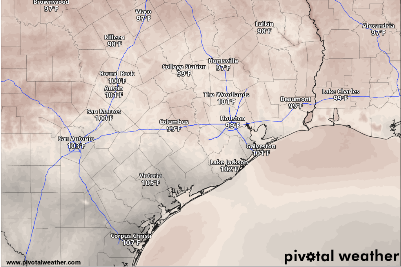
Even with the drop in humidity, Houston on Sunday will be sunny and hot, with afternoon temperatures peaking at 99. Northwest winds of 5 mph that trailed the cold front will become more northerly. At night, under clear skies, Houston’s temperatures will stay above 77 degrees well into the wee hours before dawn Monday.
The most recent National Weather Service forecast suggests the weak front will settle along the Gulf Coast by early Sunday, “where it will likely meander or even wash out over the coastal waters during the day.”
As a slightly cooler, but much drier air mass filters in from the north, dew point temperatures — which typically rise with the amount of moisture saturating the air — are forecast to drop into the lower 60s to lower 70s throughout the day on Sunday, forecasters said.
If the dew point, which is how cool the air has to get before dew forms, is 65 degrees or higher, the air is uncomfortably muggy and sticky.
So while inland areas might feel drier air, “a bit of a different story is expected along the coast, however.”
“Dew point values there will remain in the mid- to upper 70s, keeping conditions more humid with peak heat indices reaching up to 107 (degrees),” the weather service said.
Houston on Monday is shaping up to be sunny but much hotter than Sunday, with daytime temperatures soaring to 102 degrees in the afternoon, forecasters said. In the evening, again under clear skies, Houston overnight temperatures will bottom out only around a balmy 79 degrees before sunrise Tuesday.
“Upper-level ridging (of high atmospheric pressure) builds back into the region by Monday, setting up a return to southerly flow at the surface,” the weather service said in its forecast bulletin, warning that extreme heat and excessive humidity will soon return to Southeast Texas.
Expect Houston on Tuesday to once again be sunny and hot, with another 100-degree day in store.
While Wednesday looks like it will be sunny, with temperatures staying below a more seasonable 97 degrees, a slight 20% chance of rain enters the Thursday forecast.
“Beyond Tuesday, the weather pattern settles into a more typical, near-seasonal summertime regime,” the weather service said. “Expect diurnally-driven, isolated showers and storms primarily driven by the daily sea breeze, mainly in the afternoons after Thursday.”