
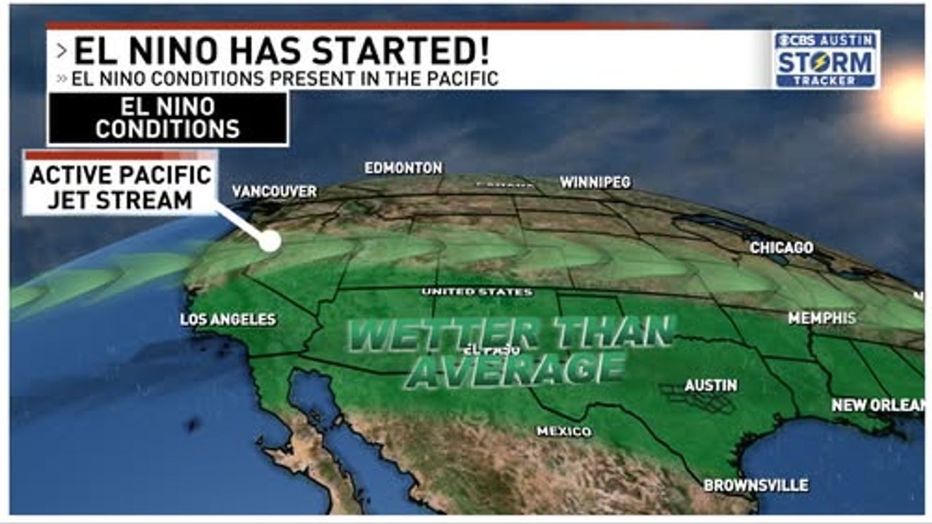
AUSTIN, Texas — New forecasts are in for the rest of this year’s El Nino forecast, and things are looking to get a bit more interesting.
The newest forecast not only shows El Nino lingering through the fall and winter, but is now expected to become one of, if not, the strongest El Nino we’ve seen in centuries.
Screenshot 2026-08-06 132723.png
That’s a scary sentence to read. The strongest El Nino in recorded history? Oh boy, does this mean I need to pack my bags and head for the hills? Well, no, but different places will be dealing with vastly different issues. But let’s first start with what this means for us in Central Texas.
A typical El Nino for Texas typically means an overactive Pacific jet stream, bringing in rain chances quite frequently for us in the fall, spring, and winter months. This year, we officially entered El Nino conditions in April, which is exactly the point where our rainfall became much much more common, near to above average rainfall each month.
Our El Nino is currently growing stronger with each passing day as the Pacific waters near the equator continue to warm. So, as our El Nino gets stronger and stronger, does this mean our weather will get crazier and crazier? Not exactly.
We’ve pulled up a few of the most recent El Ninos. A few were weak to moderate, while others were strong or Super El Ninos, but there really isn’t much correlation for yearly rainfall accumulation. Granted, some of the El Ninos peaked during the summer, which is the season least affected by the ENSO (El Nino Southern Oscillation) changes. However, over the course of El Nino vs La Nina, El Nino is significantly rainier and cooler for those in the southern area while the same areas in Texas and the south are hot and dry during a La Nina event.
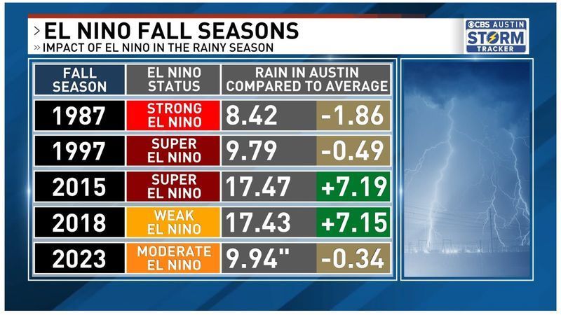
We’ve pulled up a few of the most recent El Ninos. A few were weak to moderate, while others were strong or Super El Ninos. (Photo: CBS Austin)
Two of the wettest fall seasons since 1987 were 2015 and 2018. While 2015 was one of the wettest years on record for Austin, the majority of that rain fell outside of the winter months, the time period where El Nino is supposed to bring the bulk of rainfall. Instead, May and October saw their highest rainfall totals of the year, with a benign winter of 2015 and 2016 with November through February recording below average rainfall.
And in 2018, In 1982, the world experienced one of the strongest El Ninos in history, yet gave Austin its 13th driest year on record. But then in 1991-1992, one of the rainiest years in Austin’s history was a strong El Nino. 2018 was also a rainy year, with the Llano River Flood Disaster, but it was only a weak El Nino.
The strength of the oscillation really doesn’t make a difference on our local weather. It all depends on how fast the atmosphere adapts to the shifting temperatures. Does this mean we have a rainy fall and winter ahead of us? Likely, yes it does. But not because of the strength of this El Nino.
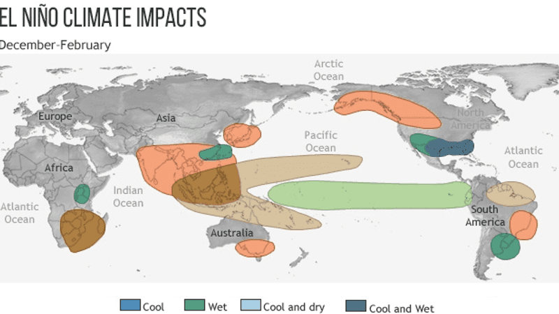
The power of a strong El Nino can be felt around the world, with catastrophic droughts felt in New Zealand, Australia, the Guineas, and Indonesia. Areas in the Caribbean also have terrible droughts due to the quieter Atlantic Hurricane Seasons. Even the weather in Chile and Brazil are affected by the warmer waters of the Pacific Ocean.
But regardless of how strong this global oscillation is, it still is no match for a heat dome or some freak event with a tropical system in the gulf. So of course there are some exceptions to El Nino causing wet years, but the general idea is a wet and rainy fall, winter, and spring months.
So, should the phrase “Strongest El Nino in History” scare you? No, but it should grab your attention. With a potentially active fall and winter ahead of us, we need to be ready for severe weather and future flooding risks. Wouldn’t be a bad idea to get those upgrades to your home now. Maybe find yourself a weather radio or maybe a back up generator. It’s never too early to prepare.