
LUBBOCK, Texas (KCBD) – The weather setup across the South Plains isn’t changing anytime soon. Which means, of course, the hot temperatures will stick around through next week with very little day-to-day variation. The only slight chance for storms arrives Friday evening, but that activity will likely stay north of the Lubbock area.
Warm Nights
There’s another dry and very warm night ahead for the South and Rolling Plains.
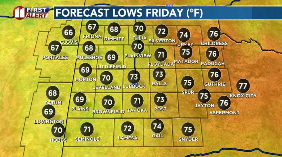 Another very warm night. Lows three to five degrees above average.(KCBD First Alert)
Actually, there’s at least a full-week’s worth of dry and warm nights ahead for most of the area. Southeasterly winds will be light, making for a fairly calm evening.
Hot Days
Friday will be another hot day with highs similar to the past few afternoons, from the mid-90s on the Caprock to just above and 100 degrees off the Caprock.
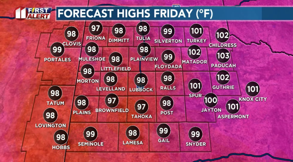 More of the same Friday! Highs again about 3 to 5 degrees above average for early August.(KCBD First Alert)
There is a slight chance thunderstorms may move into the northern KCBD/FOX34 viewing area Friday evening. At this time, we don’t expect rain to make it as far south as the Lubbock area.
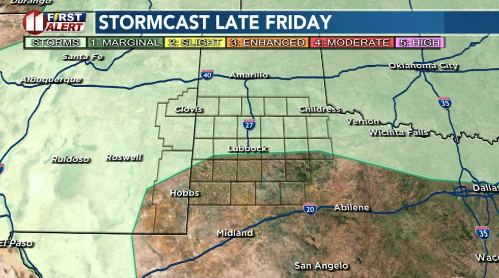 There is a slight chance that storms over the northern viewing area late Friday.(KCBD First Alert)
Repeat
The strong upper-level high pressure system (we’ve mentioned many times) is firmly planted over the Four Corners region and there is little indication that will change. This setup will keep the weather pattern locked in place through at least the middle of next week.
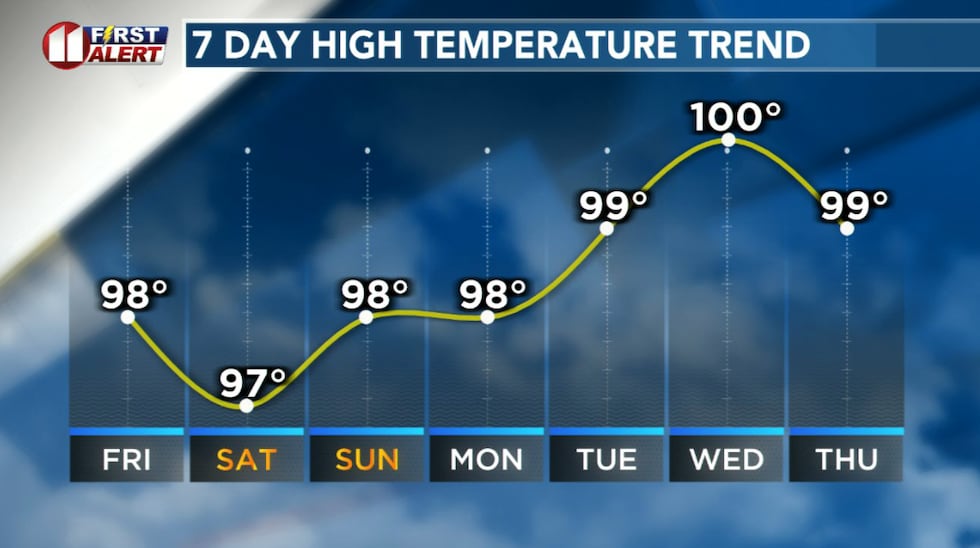 Highs upper 90s to near 100 will continue well into next week.(KCBD First Alert)
Temperatures will remain above average, with highs continuing in the mid to upper 90s on the Caprock and low 100s off the Caprock. Some afternoons may bring highs around 100 to the area on the Caprock and up to 105 off the Caprock.
There’s little chance of any meaningful rain. Even if a few storms develop, most activity will stay in the Texas Panhandle, leaving the Lubbock area dry.
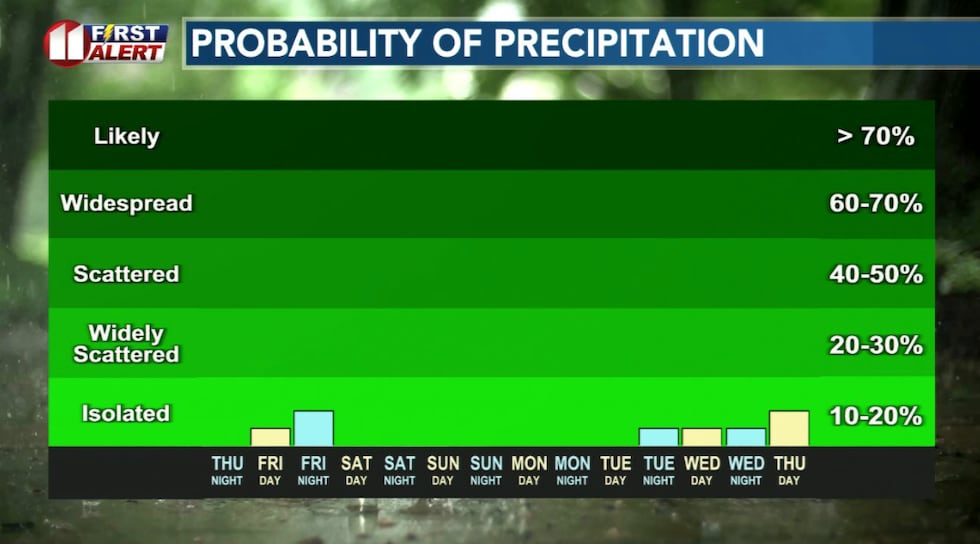 The persistent high pressure is expected to keep rain chances north of Lubbock.(KCBD First Alert)
Safety First
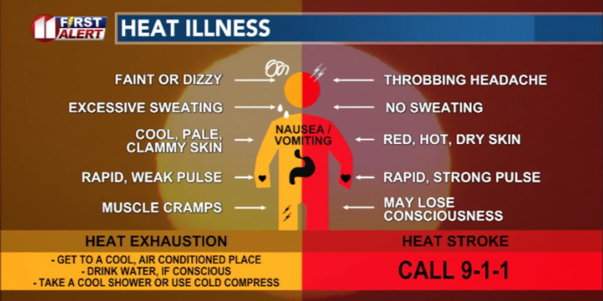
If you will be engaged in physical activity outdoors, keep yourself and those under your care hydrated, take breaks in the shade – better still, in an air-conditioned space.
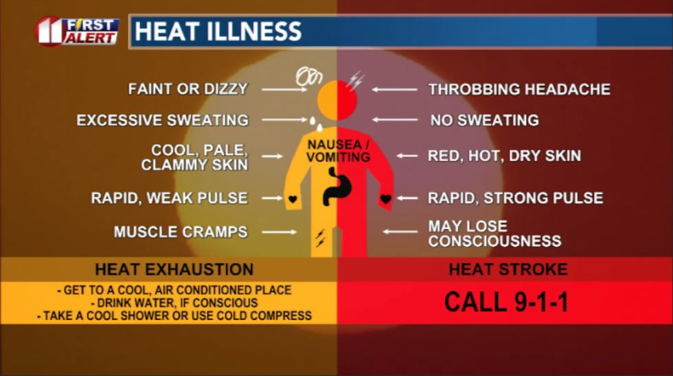 Heat Illness(kcbd)
Check on family, friends, and pets. Avoid strenuous activity during the hottest parts of the day.
On This Date
On this date in 1966, ferocious thunderstorm winds, hail, and even a tornado were reported in parts of Hale and Lamb Counties. About 7:45 PM, a tornado was observed briefly over open farmland southwest of Hale Center. Winds were measured at 90 mph at Plainview along with hail up to golf ball size. Near Edmonson the hail accumulated to depths of seven inches! Crops in a 5×10 mile strip near Edmonson were virtually wiped out.
(Source: National Weather Service, Lubbock)
Copyright 2026 KCBD. All rights reserved.