
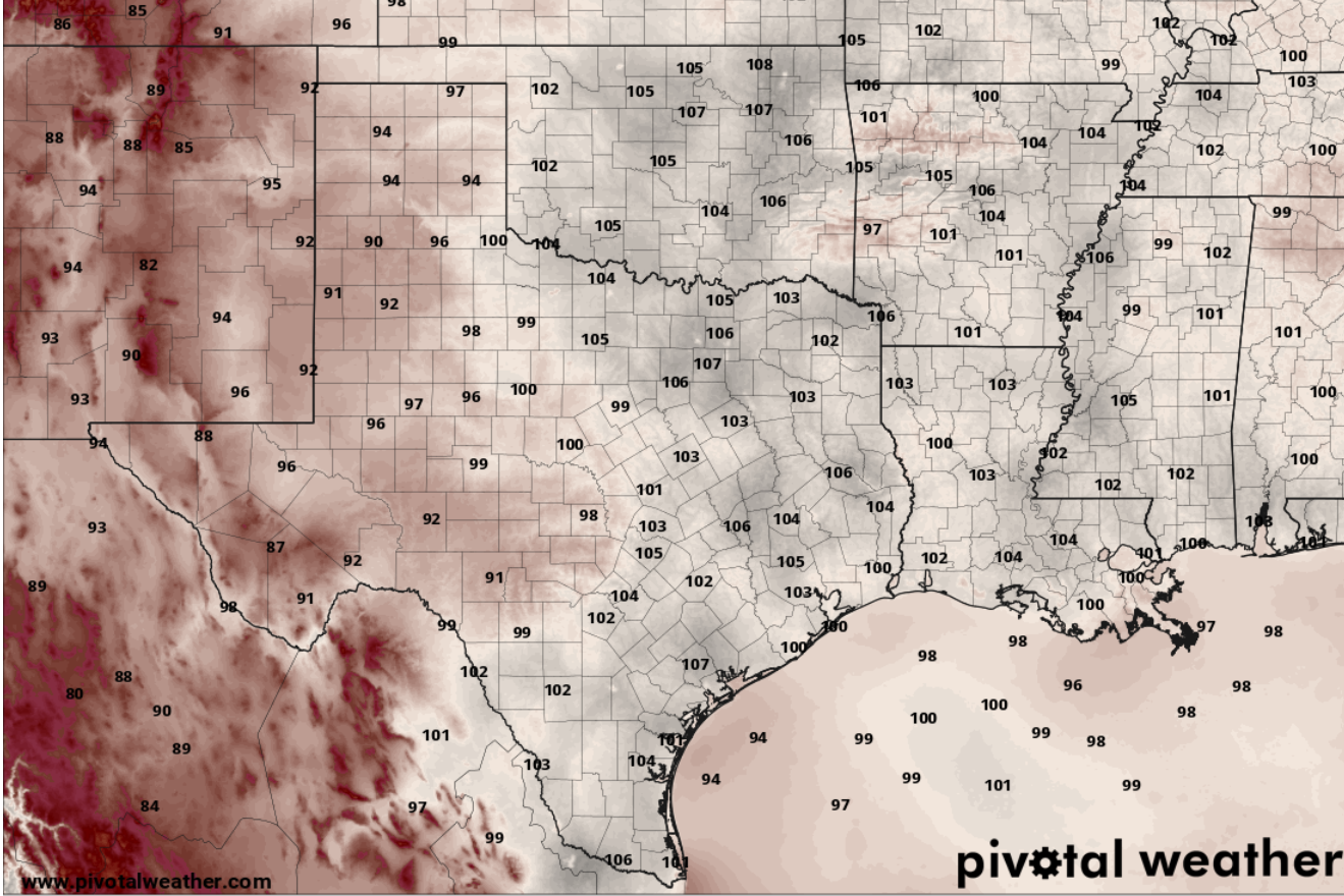
The second weekend of August brings the kind of weather we typically expect this time of year. The heat dome over the southwestern United States on Saturday will shift north slightly, allowing the triple-digit heat to loosen its grip on Texas for a few days.
Through the weekend, temperatures will be a little lower, with afternoon temps ranging from 96 to 99 degrees. However, higher humidity and the resulting dew point temperatures in the 70s will make the air feel more like 101 to 105 degrees each afternoon.
Although we have a slim 10% to 20% chance of rain and thunderstorms each afternoon, any moisture will be confined mainly to the Coastal Plains east of Interstate 35.
While it may feel like the heat has been relentless lately, temperatures have only been a few degrees above our average early-August high of 99 degrees.
If it feels like this extreme heat has been sticking around forever, that may be our minds and bodies playing tricks on us. When we look at the data, this summer has been milder compared to the past few summers.
So far this summer, our average temperature is 85 degrees. At this point last year, the average was 84.6 degrees, but the summers of 2022 through 2024 were significantly warmer.
Average summer temperatures from June 1 through Aug. 7:
So far this year, we’ve recorded 10 days of triple-digit temperatures at Camp Mabry, Austin’s main climate observation site. While we still have a few more weeks of summer ahead, our average date for the last 100-degree day of the year is Aug. 30 — just one day before the end of meteorological summer on Aug. 31. But don’t get too confident about that, as the past few years have produced triple-digit heat through September and into early October.
It has been about two weeks since the Austin rain gauges at Camp Mabry recorded measurable rainfall. Unfortunately, the forecast doesn’t offer much hope for widespread rainfall over the next couple of weeks.
The National Weather Service’s long-range forecasts from its Climate Prediction Center continues to favor better rain chances across North and West Texas, while Central Texas remains stuck in a “rain desert” for the at least the next six to 14 days.
Meanwhile, because of the recent wet weather over the past several months, the wildfire risk remains low locally. However, a significant wildfire threat persists across parts of North Texas and the Panhandle.