
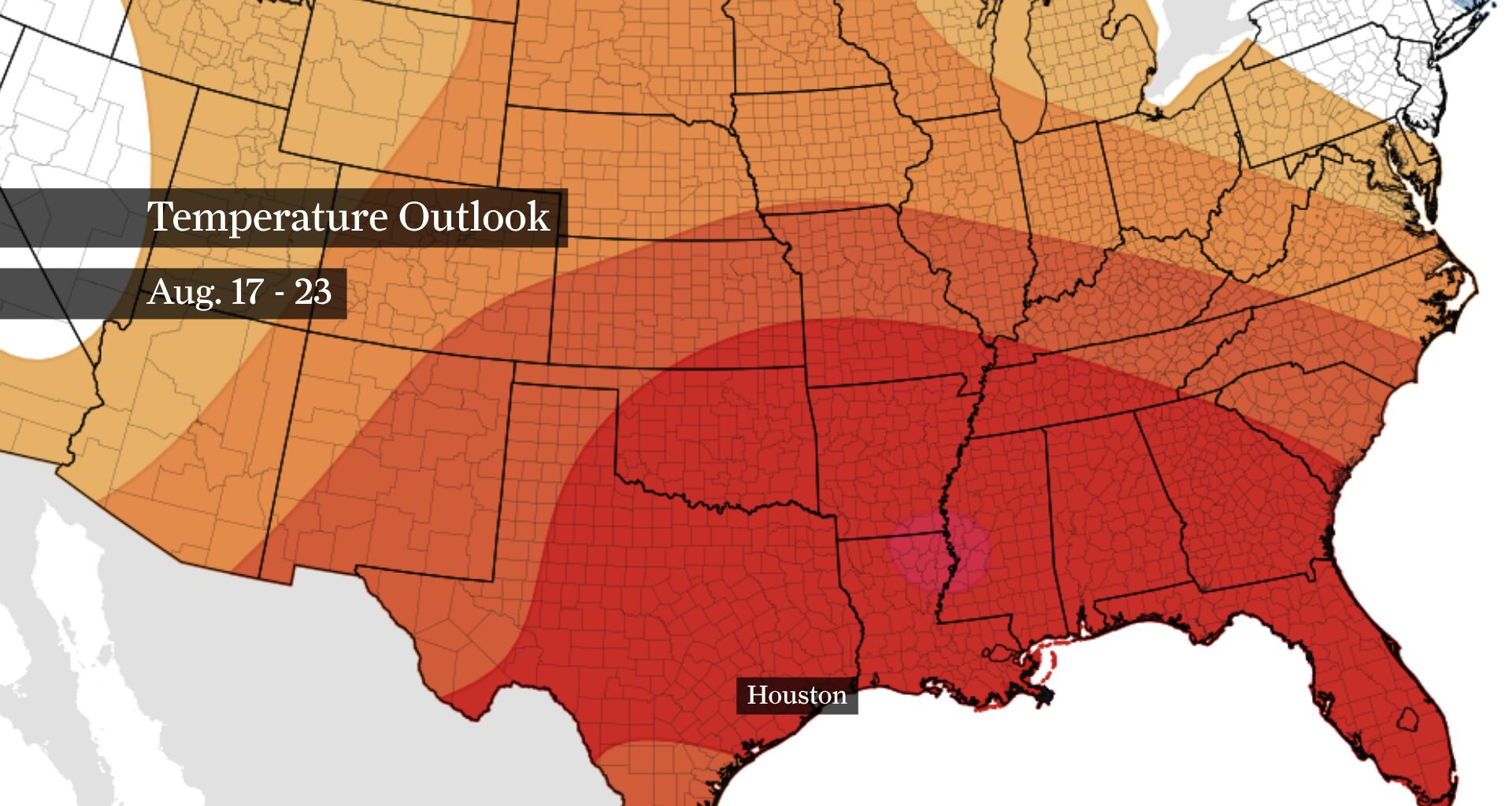
Above-average temperatures are expected through mid-August, as shown by this map from NOAA’s Climate Prediction Center. The footprint of a strong heat dome shows up in shades of orange and red, indicating where temperatures are likely to be warmer than normal.
NOAA’s Climate Prediction Center / Pivotal Weather
After a few milder afternoons in Houston, a strengthening heat dome will settle in later this week and lock in hotter, drier weather while increasing the odds of 100-degree afternoons.
Rain chances will taper off Tuesday as the heat dome begins taking control of the region. Beneath this sprawling area of high atmospheric pressure, air sinks toward the surface, where increasing pressure compresses and warms it. That process, combined with fewer clouds and thunderstorms, will send afternoon temperatures climbing as we head into the second half of the work week.
TELL US: How have you dealt with Houston’s heat waves?
Article continues below this ad
The heat could become even more intense this weekend and into early next week.
Houston rain chances fade as heat builds
Tuesday marks the transition toward hotter and drier weather. A few lucky neighborhoods may get a brief cooling downpour during the afternoon or early evening, especially near and south of Interstate 10.
As the ridge of high air pressure strengthens, Tuesday’s 20% chance of a stray storm dries up even more by Wednesday. That means the cooling effect from afternoon clouds and showers will become much harder to come by. Instead, more sunshine should allow temperatures to climb each afternoon through Friday.
Article continues below this ad
The strengthening heat dome will also make the air above Houston increasingly warm, setting the stage for hotter afternoons. How close temperatures get to 100 degrees will partly depend on how much of that hotter air gets mixed downward as the ground heats up during the day.
Heat dome could intensify over Southeast Texas
The ridge is expected to shift northward and strengthen further this weekend, placing Southeast Texas beneath an unusually powerful heat dome.
One measurement suggests this heat dome could rank among the strongest 1% ever observed over the region at this time of year. That kind of atmospheric setup can be stubborn, keeping rain chances low and allowing temperatures to climb for several days with little interruption from clouds or thunderstorms.
Article continues below this ad
EL NIÑO’S INFLUENCE: Is El Niño keeping Houston from reaching 100 degrees? History suggests it’s complicated.
Houston could be heading into a stretch of exceptionally hot and dry weather, even by August standards.
While heat-related weather alerts could become necessary as early as Wednesday, the greater concern appears to be this weekend as the heat dome intensifies.
Could Houston see more 100-degree days?
Yes. The odds of triple-digit heat are expected to increase as the heat dome strengthens.
Article continues below this ad
Multiple forecast ensembles — collections of model simulations run with slightly different starting conditions to account for uncertainty — show a greater chance of 100-degree air temperatures this weekend, with the threat potentially continuing into early next week.
When more of those simulations begin pointing toward triple-digit heat, confidence in that possibility increases. It does not guarantee Houston’s actual air temperature will reach 100 each day, but the atmospheric setup is becoming increasingly favorable for the 100-degree mark.
Exactly how widespread and persistent the triple-digit heat becomes will depend on the precise position and strength of the heat dome. After Tuesday, Houston is heading into a hotter and substantially drier stretch, with the most intense heat likely arriving this weekend.
Article continues below this ad