
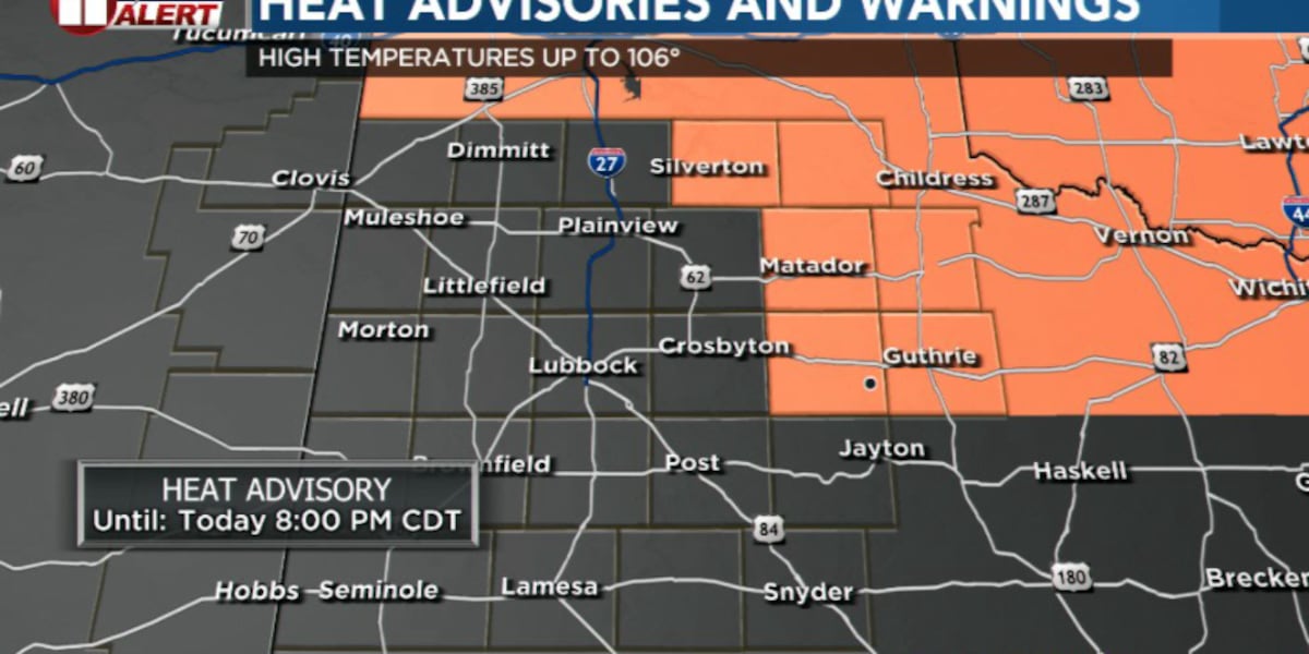
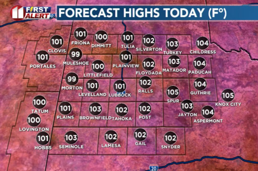
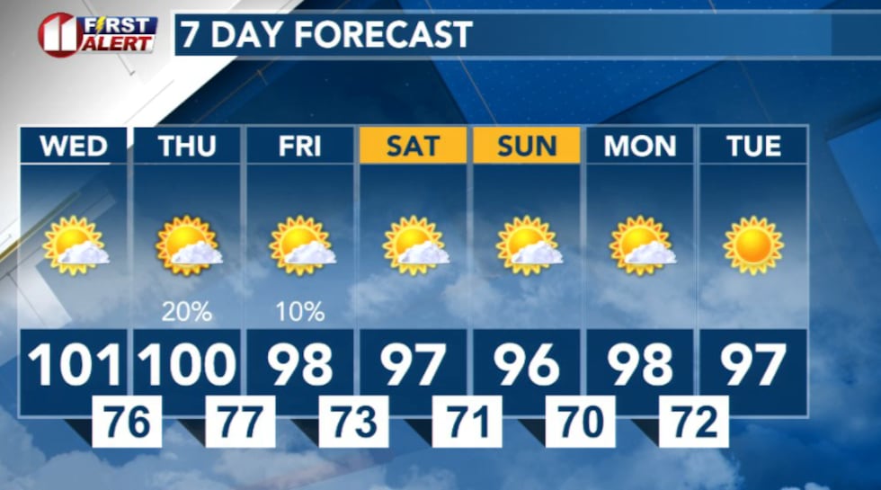
LUBBOCK, Texas (KCBD) – A Heat Advisory remains in effect as dangerously hot temperatures persist across the area. Wednesday is shaping up to be the hottest day of the week, with most areas expected to reach the low 100s. Areas off the Caprock could approach or exceed 106°.
 KCBD(KCBD)
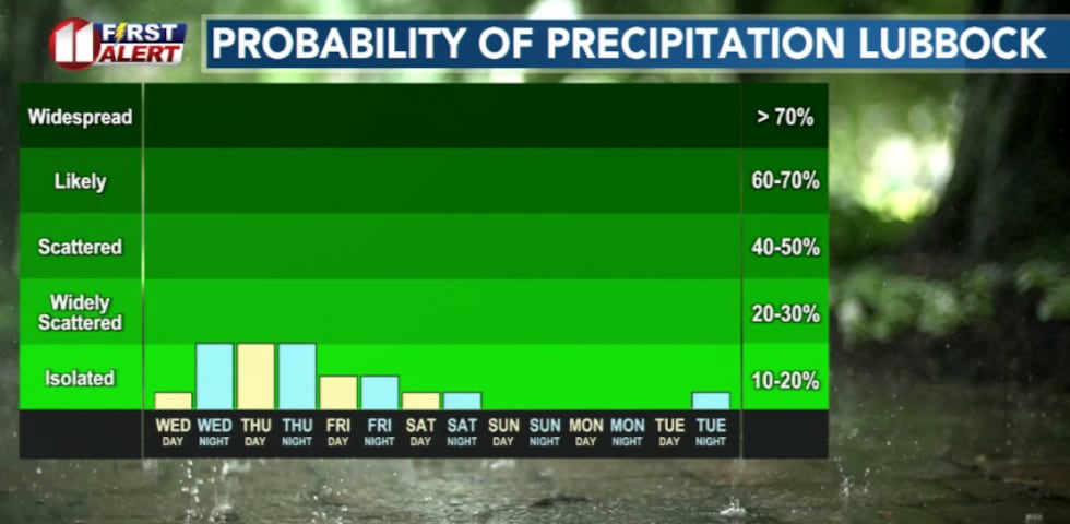
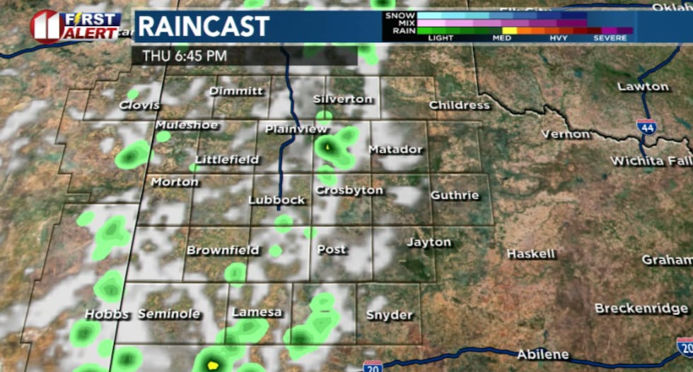
While the extreme heat dominates the forecast, there’s a small chance for isolated showers and storms on the Caprock Wednesday evening and again Thursday through Friday. Any storms that develop could produce strong wind gusts and blowing dust, so residents should stay weather aware.
 KCBD(KCBD)
The persistent heat is nothing new for the region. Over the past three weeks, some areas have experienced highs above 100 degrees on 18 out of 21 days.
What to expect
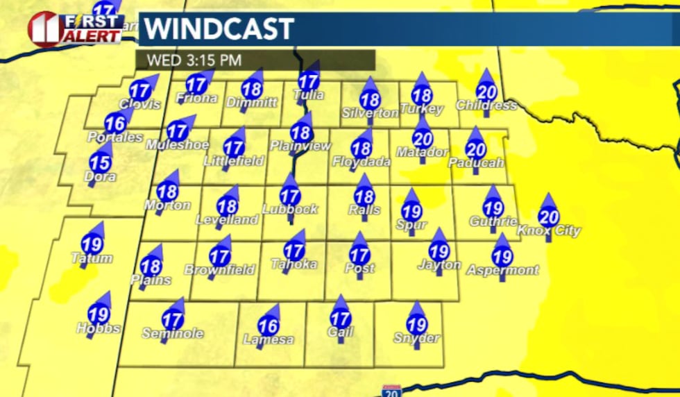
Today through Wednesday night: Expect continued hot conditions with southerly winds gusting between 25 to 30 mph. The combination of heat, dry conditions, and modest winds may create locally elevated fire conditions, particularly across the far southeastern Texas Panhandle and northern Rolling Plains.
 KCBD(KCBD)
Wednesday: This will be the hottest day of the week. Highs area-wide are expected in the triple digits, with areas off the Caprock potentially reaching 105 degrees. An isolated storm or two is possible on the Caprock during the evening hours.
 KCBD(KCBD)
Thursday and Friday: Additional storm chances exist, with any storms capable of producing strong wind gusts.
 KCBD(KCBD)What this means for you
If storms do develop, they could produce strong outflow winds and blowing dust. Secure any loose outdoor items and be prepared for sudden wind shifts.
 KCBD(KCBD)
Copyright 2026 KCBD. All rights reserved.