
AUSTIN (KXAN) — High pressure ridging keeps temperatures hot in Texas, with an active pattern steered around the Lone Star State, set to bring multiple days of severe weather to parts of the Plains, Midwest and Mid-Atlantic.
Texas Heat
Afternoon temperatures will reach the triple digits for the next several days in most of Texas. A heat advisory has been issued for northeast Texas through Monday evening.

High pressure ridging keeps temperatures hot
Severe Threat
Several disturbances will bring rounds of strong to severe weather to numerous states through mid-week. The Storm Prediction Center has highlighted multiple regions under a level 2/5 ‘Slight’ severe weather threat.
On Monday, parts of the Northern Plains could see damaging winds, large hail and an isolated tornado. The severe weather risk also is present in parts of the southern Appalachians and Carolinas.

Several areas with an elevated severe weather threat
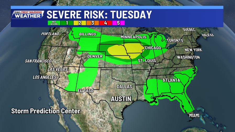
On Tuesday, the severe weather risk continues in parts of the central and northern Plains, with an increasing concern for supercells, especially in cities such as Omaha and Lincoln, Nebraska.

Severe weather risk in the Central Plains and Northern Plains on Tuesday
If you’re traveling to the affected areas for severe weather, make sure you have a way to receive severe alerts. If you’re staying in Texas, remember heat safety.
Copyright 2026 Nexstar Media, Inc. All rights reserved. This material may not be published, broadcast, rewritten, or redistributed.
For the latest news, weather, sports, and streaming video, head to KXAN Austin.