
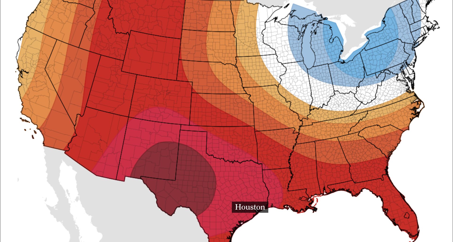
This map shows NOAA’s Climate Prediction Center temperature outlook from Aug. 23 to 27. Well-above normal temperatures are expected from Texas to Florida and Montana.
NOAA’s Climate Prediction Center / Pivotal Weather
Houston could hit 100 degrees Wednesday as a stretch of triple-digit heat threatens to become the city’s longest since August 2024.
Highs around 100 to 102 degrees are expected across much of the area, with mostly sunny skies and little chance for rain. Slightly drier air may keep heat index values from climbing quite as high, but the bigger story will be how many days Houston can string together at or above 100 degrees.
How many 100-degree days could Houston see?
Wednesday is unlikely to be the last triple-digit afternoon this week.
Article continues below this ad
Temperatures several thousand feet above the ground are expected to rank near the hottest levels typically observed this time of year from Wednesday through Friday. Combined with abundant sunshine and relatively dry air, that should make widespread highs of 100 degrees or hotter possible through at least the end of the workweek.
Depending on exactly how Houston’s official temperature shakes out each afternoon, the city could string together several consecutive 100-degree days this week — potentially its longest such run in about two years.
Overnight temperatures won’t offer much relief, either. Most of the region will only fall into the upper 70s and lower 80s before temperatures quickly begin climbing again after sunrise.
Article continues below this ad
Houston’s rain chances remain slim through the weekend
If you’re hoping for a cooling thunderstorm, chances remain disappointingly low.
The stubborn heat dome should begin shifting west later this week, which may open the door ever so slightly for a few showers or thunderstorms Friday or Saturday. Even then, rain chances are only around 10%, and most neighborhoods are likely to stay dry.
There are at least a few signs that a disturbance passing well north of Houston could help thunderstorms develop and drift southward this weekend, but whether any survive long enough to reach Southeast Texas remains uncertain.
Article continues below this ad
Wet Bulb Globe Temperature underscores Wednesday’s heat risk
Wednesday’s heat won’t just be about what the thermometer says. For anyone spending time outside, the Wet Bulb Globe Temperature, or WBGT, is another number worth watching.
WBGT factors in temperature, humidity, wind and direct sunshine to estimate how stressful the heat is on the body. That makes it especially useful Wednesday, when mostly sunny skies and temperatures near or above 100 degrees could make prolonged outdoor activity increasingly taxing.
A WBGT of 80 degrees or higher is generally a signal to start working more frequent breaks into outdoor activity. As readings approach 90 degrees, recommended time in direct sunlight drops considerably.
EL NIÑO DEVELOPS: El Niño could reach record levels by next month. How close are we to a ‘super El Niño’?
Article continues below this ad
The heat index tells you how hot it feels based on temperature and humidity, but WBGT adds the effects of sunshine and wind. So even if Wednesday’s heat index stays below advisory levels, that doesn’t necessarily mean conditions are safe for long stretches outside.
With triple-digit temperatures and plenty of August sunshine, frequent breaks, shade and hydration will still be important.