
LUBBOCK, Texas (KCBD) -Dangerous, potentially record-breaking heat will grip the region through Monday.
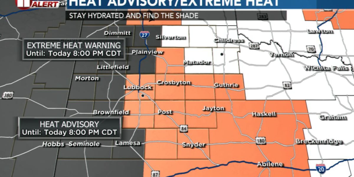
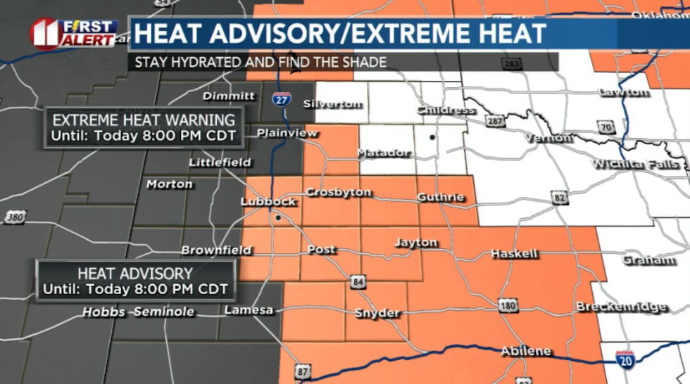 Extreme Heat Warning in effect and Heat Advisory in effect from noon till 8pm(KCBD)
Extreme Heat Warning is in effect from noon to 8 p.m. for portions of our area including Childress, Silverton, Matador, and Paducah.
Heat Advisory is in effect for the same period for areas including Lubbock, Slaton, Floydada, Crosbyton, Tahoka, Post, and Spur.
A warning is more serious of the two alerts, meaning heat is especially dangerous, and the risk of heat-related illness is significantly higher. An advisory is one step lower, but temperatures are still hot enough to make people sick.
Temperatures in Lubbock should climb to around 105 degrees today, just one degree shy of the daily record of 106. Temperatures east of the Caprock will climb even higher, topping out between 1-6 and 113 degrees.
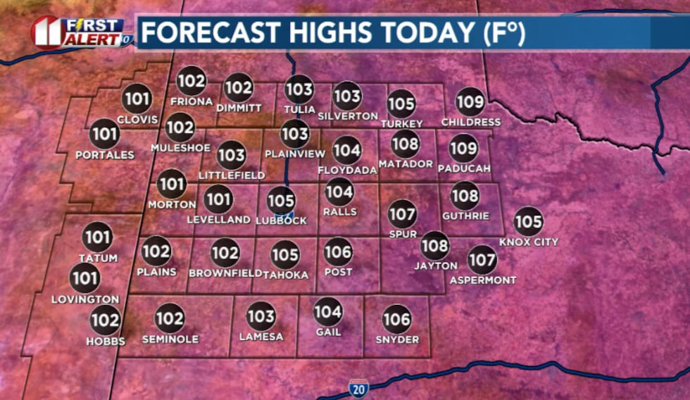 Highs today will top out in the triple digits(KCBD)
Good news, the dry air won’t make it feel quite as muggy. Bad news, our fire risk is increasing.
Humidity could fall to 15% as southwest winds increase to 15-20 mph, raising the risk of fast-spreading wildfires.
Most of us will stay dry, but we can’t rule out a stray storm or two popping up late in the day.
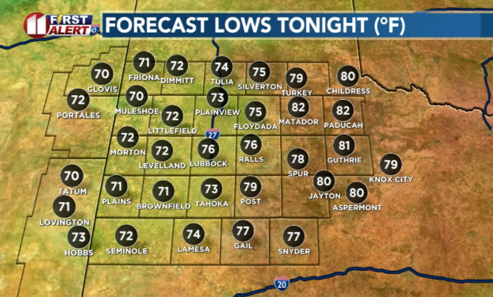 Lows tonight(KCBD)
Don’t expect much relief overnight. Lows will remain in the 70s and a few places may barely fall below 80.
Monday could be even hotter, with records potentially breaking in Lubbock and Childress.
Temperatures back off “slightly” Tuesday.
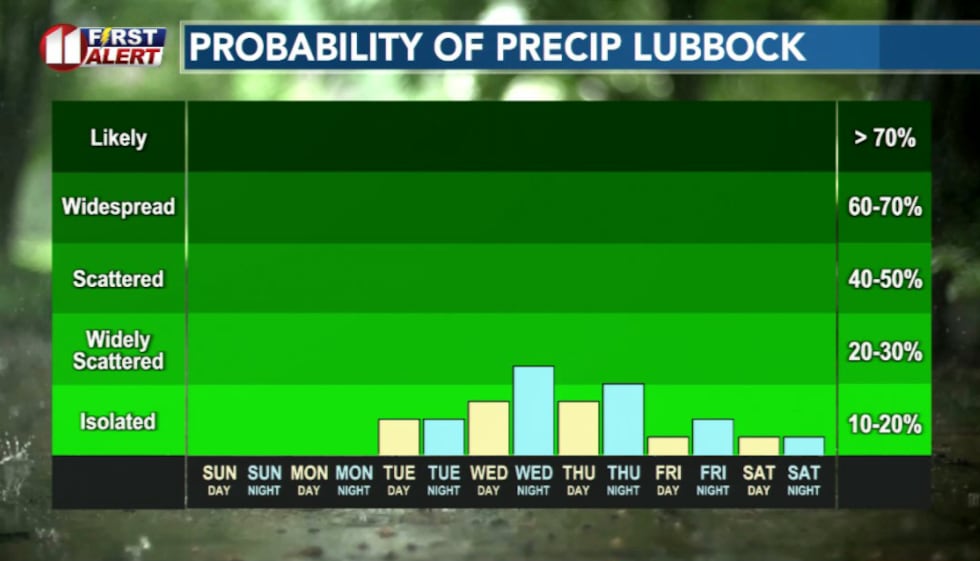 Rain chances pick back up this week(KCBD)
Scattered storms become possible each afternoon. They’ll be hit-or-miss, so relief may depend entirely on whether your neighborhood gets lucky.
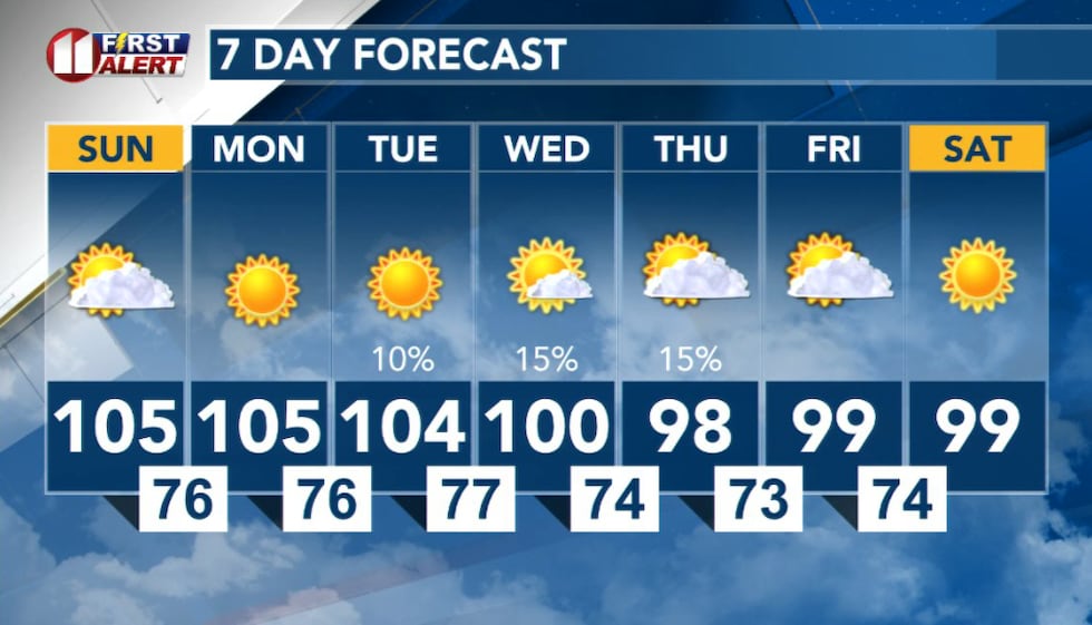 7 Day(KCBD)
Copyright 2026 KCBD. All rights reserved.