
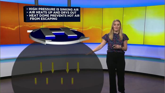
SAN ANTONIO – When temperatures soar for days or weeks, meteorologists often describe the pattern as a heat dome — a large area of high pressure that traps hot air near the surface, creating a prolonged stretch of extreme heat.
How does a heat dome form?
A heat dome forms when a strong high-pressure system settles over a region. As air sinks from the atmosphere, it compresses and warms.
The high pressure acts like a lid, preventing warm air from rising and allowing temperatures to increase day after day.
How does high pressure create extreme heat?
Normally, rising warm air helps produce clouds, storms and cooler conditions. During a heat dome, sinking air suppresses those processes by:
Warming as it compresses near the surface
Reducing cloud formation, allowing more sunlight to heat the ground
Limiting rainfall and keeping conditions dry
Allowing heat to build in the land, roads, and buildings
Why does it last so long?
High-pressure systems can become slow-moving and remain over the same area for extended periods. As heat accumulates, overnight temperatures may stay unusually warm because the ground and buildings release stored heat, providing little relief.
Heat domes can lead to:
Increased risk of heat exhaustion and heat stroke
Higher energy demand as people rely on air conditioning
Drier conditions that raise drought and wildfire risks
Stress on crops, livestock and natural environments
Daily Forecast
KSAT meteorologists keep you on top of the ever-changing South Texas weather.
QUICK WEATHER LINKS
Copyright 2026 by KSAT – All rights reserved.