
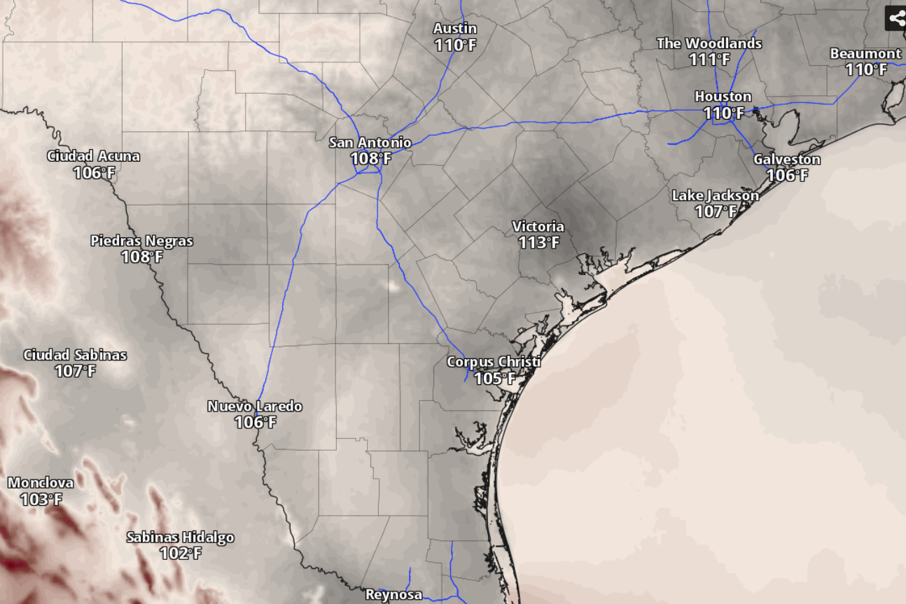
Humidity-driven heat index values will be solidly in the triple digits across South Texas on Wednesday before a slight cooling and a chance of rain on Thursday and Friday.
National Blend of Models/Pivotal Weather
A heat advisory warning the public about the dangerous combination of extreme heat and elevated humidity is in effect Wednesday for San Antonio, much of the Interstate 35 corridor and parts of the Hill Country, the National Weather Service said.

How extreme is the heat? For starters, if San Antonio temperatures on Wednesday hit 100 degrees or higher, as they are expected to do, it would happen for the 10th time in a row. That reading also would make it 14 days of triple-digit heat for the year.
Article continues below this ad
A more troubling milestone, though, is how long we’ve gone without measurable rainfall in San Antonio. The city’s official climate observation site at San Antonio International Airport hasn’t recorded measurable rainfall since July 24, when the gauges there caught only 0.13 inch of rainfall. Every day since then, we’ve seen either no rain or merely trace amounts (less than 0.01 inch).
As we enter our second month of dryness, only low to medium chances for rain could emerge Thursday and Friday, according to weather service forecasters.
Wednesday forecast
Thanks to a heat dome of high air pressure that’s been keeping temperatures higher and the air drier in South Texas, San Antonio on Wednesday will be sunny and hot. Afternoon temperatures should top out around 103 degrees, or about 8 degrees warmer than normal for Aug. 26. Humidity will make that triple-digit heat feel even hotter, closer to 107.
Article continues below this ad
On hot days, the body cools down through the evaporation of sweat from our skin. But if the air is too humid, or too saturated with water vapor, that evaporation becomes more difficult and the air “feels” hotter than the temperature would suggest. The heat index accounts for that.
Once your body’s ability to cool down is compromised, you are more vulnerable to heat-related illnesses, such as heatstroke or heat exhaustion, which can cause dizziness or nausea.
More moisture-rich air is expected in South Texas with the return of south-southeast winds from the Gulf Coast in the afternoon. At night, under mostly clear skies, temperatures will bottom out around 79 degrees before sunrise Thursday.
Article continues below this ad
Weather models indicate that the heat dome will shift farther west Thursday and Friday, allowing upper-atmospheric winds to flow out of the northwest and a trough of rain-friendly low pressure to approach our region, forecasters said.
“This has the benefit of both shifting the warmest portion of the summertime air mass away from our area, and also providing an avenue for weak areas of vorticity to round the ridge (of high pressure) and skirt South-Central Texas, bringing some potential for showers and thunderstorms,” the weather service said in a forecast bulletin Tuesday.
Thursday and Friday forecast
San Antonio on Thursday has a 30% chance of rain in the afternoon on an otherwise mostly sunny and hot day. Daytime temperatures could get to 100, but no higher than that. At night, rain chances edge higher to 40% amid northerly winds before diminishing shortly after midnight.
Article continues below this ad
On Friday, the city has only a 20% chance of afternoon rain, but temperatures are expected to stay below 100, peaking around 99 degrees under mostly sunny skies.
“Given the broader environment, any convection (storm activity) that develops will probably be high-based, with the strongest cells providing a threat for gusty winds and lightning,” the weather service said. “The likelihood for rain is expected to decrease from north to south.”