
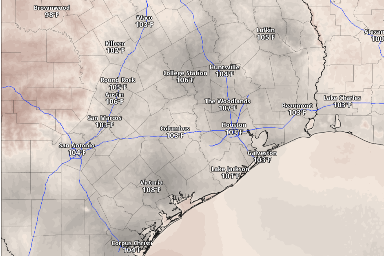
While air temperatures in San Antonio might stay below 100 degrees, the heat index values, or how temperatures “feel” to the body when you account for humidity, could easily get as high as 104 degrees by 3 p.m. Saturday.
National Blend of Models/Pivotal Weather
San Antonio will say goodbye to rain chances this week and hello, again, to above-normal temperatures and humidity-bolstered heat this weekend, according to the National Weather Service.

At least we got a brief shot at beneficial rain earlier this week, when gauges at San Antonio International Airport, the city’s main weather observation site, captured 0.06 inch of rain on Thursday. That was the first measurable amount of rainfall recorded there in more than a month. Although San Antonio has logged only 0.06 inch of rainfall since July 24, the city has accumulated 24.85 inches since Jan. 1, which is about 4.5 inches above normal for the year to date.
Article continues below this ad
The forecast for the coming days includes another welcome trend: Air temperatures should stay below 100 degrees for the next several days. Here’s what the weather service is anticipating:
What’s the forecast for Saturday?
San Antonio on Saturday is shaping up to be sunny and hot, as is typical for August, but actual temperatures are expected to max out at only 98 degrees. While that would still be a few degrees above normal, it won’t be in the triple digits, forecasters said. Instead, the moisture-rich air brought in by east-southeast winds from the Gulf Coast will keep the air muggy. Heat index values, or how the heat feels to the body when humidity is accounted for, could be as high as 105 degrees.
Article continues below this ad
At night, under mostly clear skies, overnight temperatures are expected to stay above 76 degrees before sunrise Sunday.
What’s the forecast for Sunday?
High atmospheric pressure, and its resulting heat dome, has made its way east again toward Texas. The high pressure is expected to once more trap South Texas under a static weather pattern marked by above-normal temperatures and below-normal rainfall.
Article continues below this ad
“Ridging (of high pressure) continues its movement eastward which should be centered over the southern Plains by Sunday,” the weather service said in a forecast bulletin posted online Friday.
Sunday in San Antonio is expected to be sunny, with daytime temperatures topping out at 98 degrees. Warm southeast winds of around 5 mph during the day will kick up to 10 mph in the evening and include gusts as strong as 20 mph. Overnight temperatures should bottom out around 75 degrees before dawn on Monday.
A disturbance in the Gulf
An atmospheric disturbance out of the Gulf of Mexico could give us another shot at rain later in the work week, forecasters said.
Article continues below this ad
“A disturbance in the northern Gulf will make its way westward towards the Texas coast, undercutting the ridge, which will allow it to flatten/elongate into the middle Mississippi Valley early next week,” the weather service said in its forecast bulletin.
Meanwhile, San Antonio on Monday should be sunny and hot, with afternoon temperatures peaking at 99 degrees. South-southeast winds will persist at 5 to 10 mph but could become more robust at night, with wind speeds of 15 mph and gusts as strong as 20 mph.
“It’s still a bit unclear exactly if this disturbance will impact our area and bring rain chances, but at the least it does look like the sea breeze makes a return by Tuesday,” the weather service said.
Article continues below this ad