
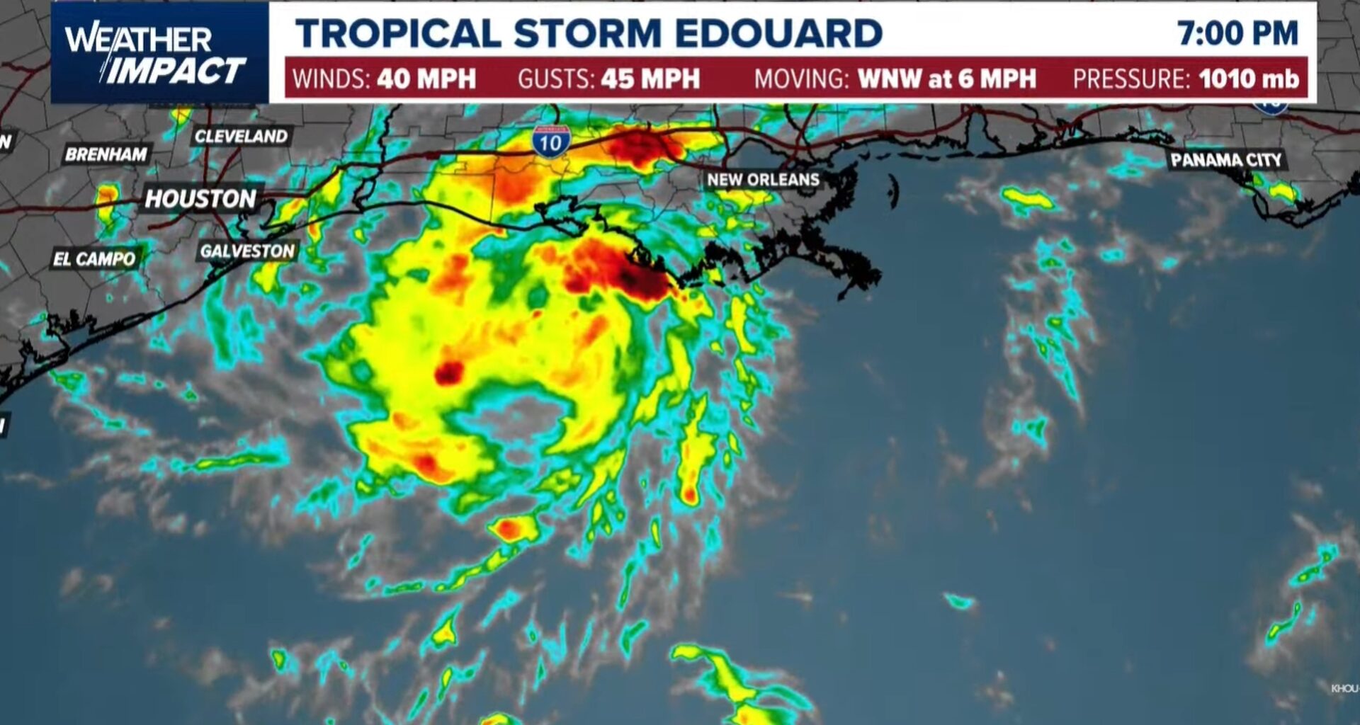
Edouard is expected to near hurricane strength before moving into Southeast Texas Tuesday, prompting a Hurricane Watch.
BEAUMONT, Texas — Tropical Storm Edouard continued to strengthen Monday night in the Gulf, prompting the National Hurricane Center to issue a Hurricane Watch and a Storm Surge Warning for parts of the upper Texas coast as the system closes in on Southeast Texas.
The Hurricane Watch covers High Island to Cameron, Louisiana, and the Storm Surge Warning stretches from High Island to the Vermilion/Cameron Parish line, according to the National Hurricane Center’s 10 p.m. advisory Monday. A Tropical Storm Warning remains in effect from Port Bolivar to the Vermilion/Iberia Parish line.

This story continues below.
The biggest concerns for our area remain heavy rain, flash flooding and gusty winds, with the greatest impacts expected Tuesday morning through Tuesday night. Edouard is expected to produce 3 to 6 inches of rain across parts of Southeast Texas, with isolated totals up to 9 inches possible farther inland through east-central Texas, raising the risk of flash flooding and possible river flooding, according to the National Hurricane Center.
As of 10 p.m. Monday, Edouard was centered about 125 miles southeast of Cameron, Louisiana, and about 155 miles southeast of Port Arthur, Texas. It had maximum sustained winds of 40 mph and was moving west-northwest at 7 mph, with a minimum central pressure of 1005 mb, according to the National Hurricane Center. Strengthening is likely, and forecasters said Edouard could approach hurricane strength before it reaches the coast Tuesday, with rapid weakening expected once the system moves inland.
12News Chief Meteorologist Patrick Vaughn said Monday evening that Edouard appeared to be getting better organized. “Right now Edouard is holding its own, but it does seem like it is getting a little better organized,” Vaughn said. “We’re seeing feeder bands starting to try to rotate around and to build around that center of circulation.”
Edouard latest forecast track
The National Hurricane Center’s official forecast track continues to bring the center of Edouard onto the coast within the warning area Tuesday, then inland over Southeast Texas Tuesday night. Vaughn said guidance shows the system making a run toward the coastline near Port Arthur by early Tuesday afternoon as a 60 mph tropical storm, then quickly weakening as it tracks toward Huntsville by Wednesday night.
Vaughn pointed to one model doing a good job showing 50 to 60 mph winds reaching Port Arthur, Sabine Pass, Winnie and Bridge City before the system heads off to the north and west, with the heaviest impacts confined mainly to those Triangle communities.
TRACK THE STORM: Edouard forecast tracks, cone and models
How strong could the system be?
Edouard’s maximum sustained winds were near 40 mph Monday night, with tropical-storm-force winds extending up to 25 miles from the center, according to the National Hurricane Center. Vaughn put local wind speeds around the storm’s center at 40 mph with gusts of 50 mph as of Monday evening.
Forecasters will be watching overnight for signs of further strengthening, Vaughn said, with storms typically building around the southern side of the circulation between about 3 and 5 a.m. “That’s when we’ll see whether or not this will try to make a run to strong tropical storm, maybe hurricane, hopefully not, and that is a possibility,” Vaughn said. “It’s not clear whether or not that will happen, but right now I wouldn’t put it past this one.”
The National Hurricane Center said storm surge, combined with the tide, could raise water levels 3 to 5 feet above ground from High Island to the Vermilion/Cameron Parish line, and 1 to 3 feet from there to Morgan City, Louisiana.
Despite the strengthening, Edouard remains a relatively small system, Vaughn said. “The good news is it’s not a terribly big storm,” he said, putting the storm’s central circulation at “only about 100 miles wide.”
Vaughn said the Triangle should expect sustained winds of 20 to 30 mph, with gusts up to 50, maybe 60 mph, and 2 to 4 inches of rainfall possible.
When will we feel it?
Locally, the worst conditions are expected to arrive “tomorrow morning late into the early afternoon hours,” Vaughn said. Edouard was moving west-northwest at 7 mph Monday evening — “a little bit faster, so that’s good news,” Vaughn said — keeping the system on track to clear the area quickly once it arrives.
Will schools be closed?
We’re keeping an updated list here.
How long will impacts be felt?
Chief Meteorologist Patrick Vaughn says this remains a one-day event. “We do not anticipate this stalling or changing directions or anything like that,” Vaughn said. “So the good news is that this is only going to be a one day event.”
The situation remains evolving. Check back often and download our streaming app for the latest updates.
Track the storm with the interactive radar below (click here if the map doesn’t load)