
The past couple of days have been quite toasty across Southeast Texas. High temps had risen 10 to 15 degrees above average for early November, topping out in the mid- to upper 80s.
Now on Sunday, a drastic weather shift is already underway, thanks to a strong cold front that swept through Houston during the late overnight hours Saturday. Strong winds and dry air will make for high fire danger this afternoon, before temps plummet to winterlike levels late tonight. Here’s a breakdown of what you can expect.
Sunday’s forecast
Temperatures won’t immediately be chilly Sunday morning, as morning lows hover in the low 60s across the Houston metro area. However, temps will be slow to rise throughout the day, likely sitting at around 68 degrees at noon. Afternoon high temps are only expected to reach the low 70s, about 15 degrees cooler than Saturday’s high temp.
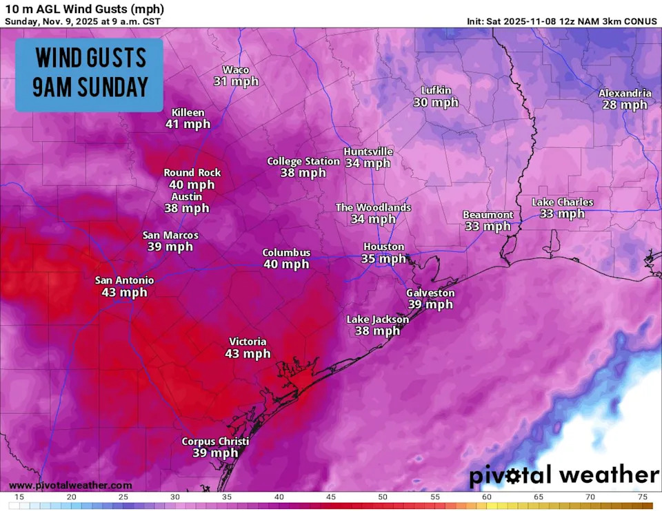
Shown are the potential wind gusts across the region at 9 a.m. Sunday morning. (Pivotal Weather)
Winds will also be quite strong. From the late morning through Sunday afternoon, Houston will experience sustained winds near 20 mph, and wind gusts could reach up to 35 mph at times. The air will also be very dry, with relative humidity values falling to around 30%.
Together, the windy conditions and dry air create an environment in which wildfires can easily start and become out of control. Be sure to avoid outdoor burning, keep vehicles off of dry ground and properly dispose of cigarettes.
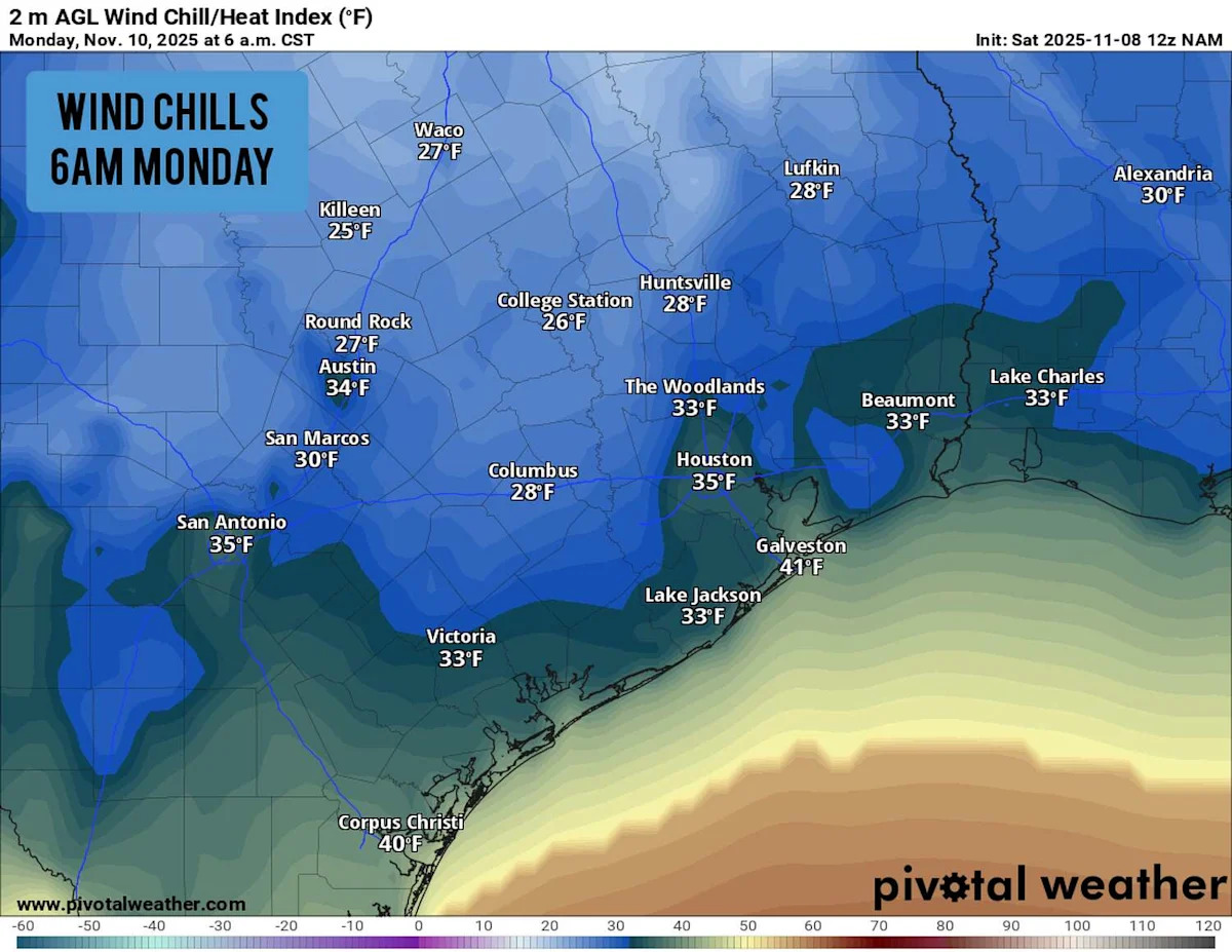
Temps plummet tonight
After sunset, temperatures will really start to plunge. Houston will fall into the 50s by 6:30 to 7 p.m., eventually falling into the 40s after midnight. By early Monday morning, low temps in the area will fall into the low 40s, while wind chill values likely bottoming out into the mid-30s.
Outside of the urban center, temperatures will fall even farther. Areas like Conroe, Katy, and The Woodlands will likely see temps in the upper 30s, while areas farther north, like Huntsville and College Station, will bottom out near 35 degrees. Wind chill values in this region may briefly drop into the upper 20s early Monday morning.
With winds still moving in from the north, temps will stay cool all day on Monday. Houston’s temperatures will hover in the 50s through much of the day, topping out near 60 degrees by mid-afternoon. Another cold night will soon follow, as lows again fall into the upper 30s to low 40s across Southeast Texas.
Quick warm-up coming
By Tuesday morning, winds will shift direction again and start to move back in from the south. That, in addition to high pressure building over northern Mexico and Southeast Texas, will result in a big warm-up this week.
High temperatures are expected to reach the low to mid-70s on Tuesday, likely continuing into the low 80s by Wednesday. High temps will stay in the low 80s Thursday and Friday, and morning lows will become much more wild as well, only falling into the mid-60s each morning.
For the most part, Houston will experience dry conditions and mostly sunny skies throughout the week. However, it should be noted that atmospheric moisture will increase by Thursday and Friday, leading to scattered clouds and a few coastal showers. The next chance of widespread rain won’t arrive until at least next weekend.
This article originally published at Houston temps are set to plummet tonight. Here’s how cold it will get..