
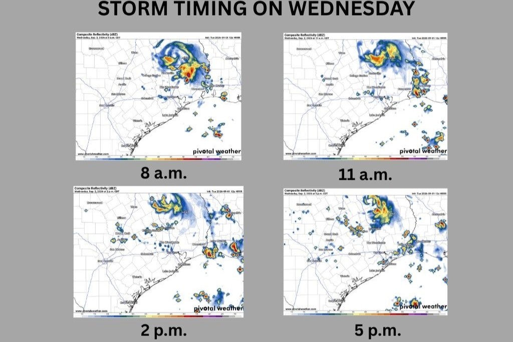
Tropical Storm Edouard made landfall along the Texas coast Tuesday afternoon, but its weather threats won’t end there. As the storm’s remnants linger across East Texas on Wednesday, a deep tropical air mass will remain in place across Central Texas, bringing scattered showers and thunderstorms to the Austin area.
Wednesday will start mostly cloudy with light south to southwest winds and temperatures in the upper 70s. Rain chances will remain low through about 10 a.m., but as moisture and instability increase, isolated to scattered storms will begin developing around lunchtime. Some of these storms could produce pockets of heavy rainfall.
The best chance for scattered tropical downpours will come during the afternoon, when temperatures and instability peak. Highs will climb into the upper 90s, but with high humidity, it will feel closer to 101 to 104 degrees.
The good news for Central Texas is that the remnants of Tropical Storm Edouard will stick around for several more days, keeping rain chances in the forecast through the weekend.
While not everyone will see rain, we will at least have opportunities for scattered showers and storms — which would be an especially welcome change after the lengthy dry spell in August, when Austin recorded measurable rainfall on just one day, Aug. 27.
“The primary concern with any storms will be downbursts and locally heavy rainfall that could lead to localized and minor flooding issues,” meteorologists at the Austin and San Antonio National Weather service wrote in their daily forecast update.
The Weather Prediction Center has placed areas just east of Austin under a level 1 to 2 risk, or at least a 5% chance, of excessive rainfall on Wednesday. We’ll need to keep an eye on the remnants of Edouard because the heavy rainfall axis could shift west over Central Texas.
After 29 days of triple-digit temperatures last month and the fifth-warmest August on record, Austin could finally get a brief break from the relentless 100-degree heat. Thanks to increased cloudiness and higher rain chances, afternoon highs should generally stay in the upper 90s to near 100 degrees this week. However, don’t expect it to feel much cooler: The high humidity will push heat index values back into the triple digits at times.
“One positive thing to note is that we may finally break free of persistent ridging by next weekend as the pattern breaks down in favor of a more active easterly mid-level flow regime,” the National Weather Service said in its forecast discussion posted Tuesday.