
AUSTIN, Texas — The Summer of 2026 was a unique one and, whether you believe it or not, it is officially over as of September 1.
We had one of Austin’s longest streaks of triple digit days in history but earlier in the summer, also a catastrophic flood in the Hill Country for the second year in a row, nearly exactly a year apart. There’s a lot to dive into so let’s get to it.
The summer unofficially started on June 1, right in the midst of some tropical moisture rolling through.
June as a whole was a rainy one, with 6.50” falling. Almost 3 inches above average, all thanks to receiving boatload of rainfall on June 14, resulting in dam operations to begin at Tom Miller Dam. Austin’s Camp Mabry picked up nearly a month’s supply of rainfall that day.
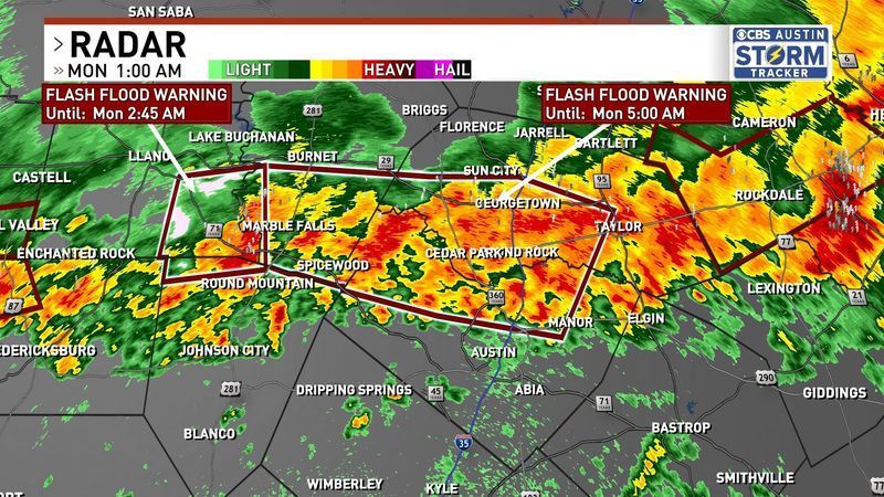
June 15 radar (CBS Austin)
Temperatures were somewhat under control. The highest temp of the month was 97 degrees, nowhere close to any record highs, which were 108 degrees or higher. Overall, less than a degree off the average temps to expect in June. Very mild start to what would be a chaotic summer in Austin, Texas.
July was a doozy.
Everyone was holding their breath as the one year anniversary of the July 4th floods approached. One of the worst disasters in Texas’ history was just one year ago, and it seemed that July wouldn’t undergo a repeat.
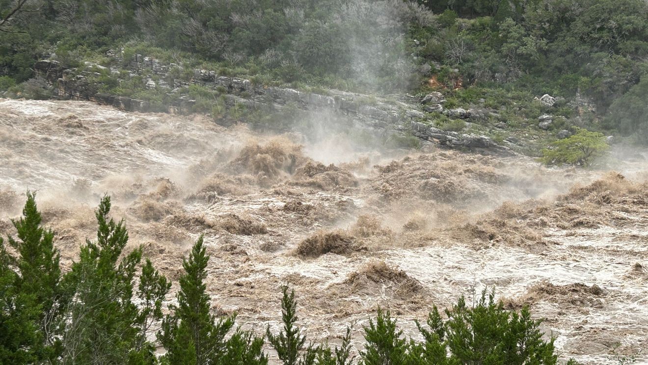
But then just over a week later, a heat dome set up to our north at the same time as an upper level low undercut from the east and stalled overhead. Overnight heavy rainfall events began on July 11, and multiple rounds of torrential rainfall for the next 4-5 days across South-Central Texas.
This was a very dangerous and historic amount of water coming down the Pedernales and the Llano.
This rain event in July, coupled with the July 4th, 2025 floods, are the entire reason our lakes are now full for the first time since 2019.
Temperatures were crazy during that week, with highs in the upper 70s and 80s throughout the rain event. We did hit 103 briefly before dipping back down into the 90s. We were having a very very mild summer with plenty of rain to go around, and then August said, “hold on. I’ve got something for ya.”
August. What a pain you’ve been for us.
Every single day in August was spent in the triple digits except for two days: 94 on August 1st and 99 on the 14th. If not for the Aug. 14 failing to reach 100, we would easily have the second longest streak of triple digits in Austin’s history at 32 days in a row. We hit one of the hottest temps Austin has seen in years with a high of 107 degrees, breaking records.
We spent nearly the entire month under a heat dome with fluctuating humidity and shower chances that came and went. Our dry streak lasted 33 days, ended by storms that arrived on August 27, where we picked up 0.3” of rain. We closed out the month over 2 inches below average, and our drought conditions have taken a step back. Despite our lakes being full, the aquifer levels are dangerously low.
The tropics have at least been kind to Austin. Texas has had 3 landfalling tropical systems and Austin has only felt the effects of one, which was Edouard. Arthur and Bertha both stayed to our south and only provided heat and some gusty winds.
The end of August and beginning of September is the beginning of football season, some people get their fall decorations ready, but it’s also the peak of hurricane season, climatologically. With an extremely strong El Nino in place that is expected to grow stronger, it’s no surprise our hurricane season has been largely quiet.
El Nino’s have a tendency to quiet down hurricane season while La Nina usually leads to hyperactive seasons. Excessive amounts of shear and Saharan Dust in the Atlantic this year has kept the storms tame and localized to the Gulf, which has limited their strength.
Even though there hasn’t been a single hurricane in the Atlantic so far this year, the tropical storms we have seen make it to Texas, besides Bertha, have caused significant issues elsewhere.
Tropical Storm Arthur was a disaster for the southeast. One location in Louisiana near Alexandria received roughly 23 inches of rain in 20 hours. Due to the slow moving water and little elevation changes, homes were flooded for weeks as the water drained into the Atchafalaya swamp to the south for days. Elsewhere in Mississippi, record-breaking and generational flooding occurred, flooding major highways near Biloxi. Just recently, areas north of Beaumont got walloped by torrential tropical rainfall as Tropical Storm Edouard stalled out for nearly 2 days, dumping 24 inches of rain in 24 hours.
From dodging the major flooding in the Hill Country and dodging three tropical systems to enduring one of the longest stretches of triple digit heat in Austin’s history, this summer had its ups and downs. With El Nino lying ahead of us, a rainy and cooler fall, winter, and spring is possible. But this is expected to be the strongest El Nino we’ve ever seen in human history, so we might have our hands full come November.