
After what had been a rainy spring and first half of summer across Southeast Texas, the region has undergone a very dry period over the past couple of months. Since July 15, Houston has recorded just 2.55 inches of total rainfall, just 30% of the average rainfall during that time frame.
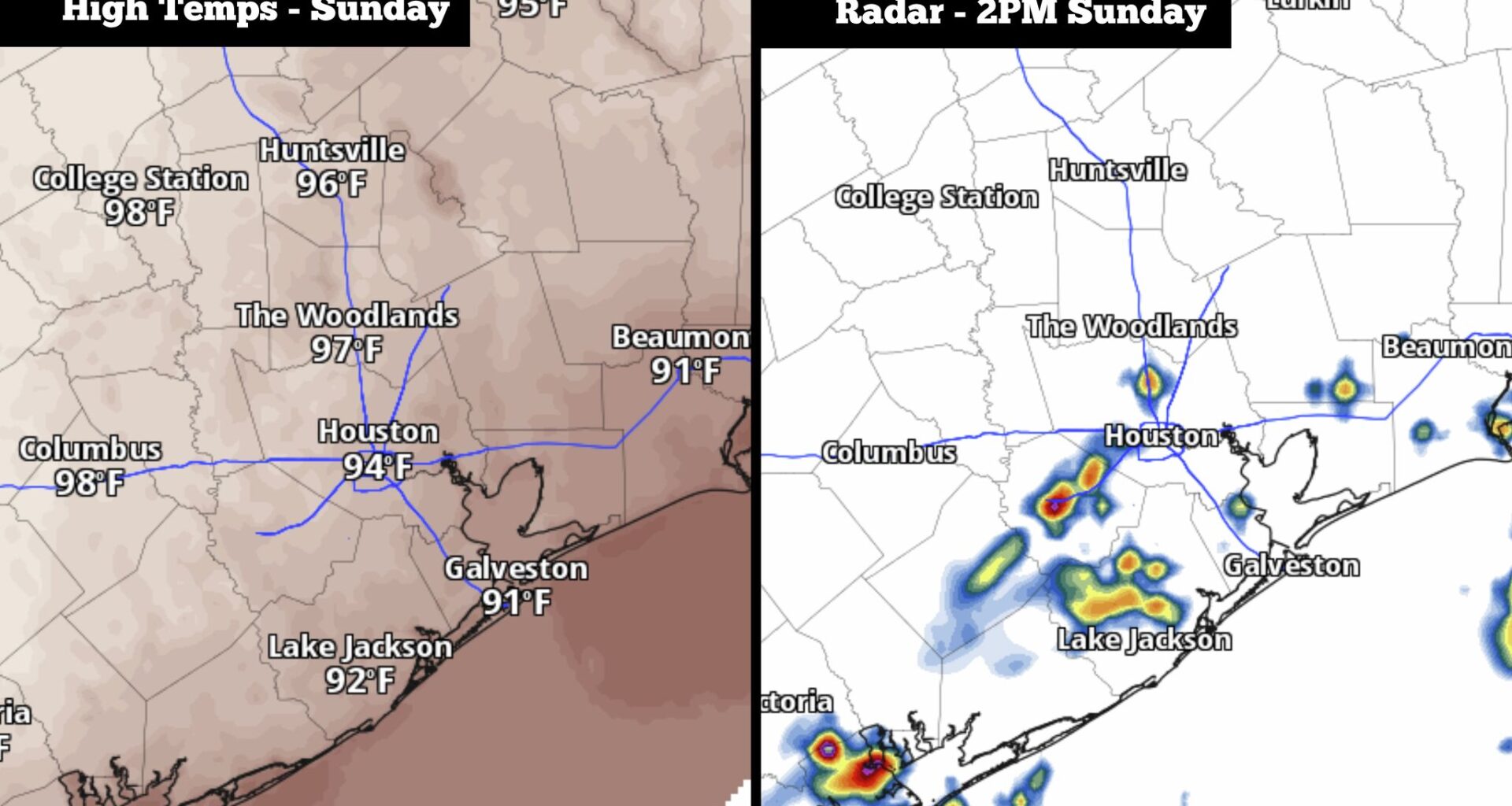
Heading into Sunday, however, some parts of the Houston metro area could encounter showers and thunderstorms as Gulf moisture moves in from the southeast. Storms will be scattered in nature, so not everyone will see rain, but a few spots could encounter isolated downpours and strong winds. Here’s how the day will play out.
A quiet and warm morning is expected across the Houston metro area as lows hover near 80 degrees. That’s significantly warmer than the average for mid-September, as lows should be closer to 72 degrees.
Temperatures will heat up quickly, likely reaching 90 degrees as early as 11 a.m. Then by the early to mid-afternoon, high temperatures near 94 degrees are expected. With high humidity continuing throughout the day, heat index values of 103 to 105 degrees are anticipated.
Besides the heat and humidity, a few scattered storms are likely to form during the middle of the day. Houston’s overall rain chances will be around 30% to 40%, with the best chances expected between noon and 4 p.m. By the early evening, rain chances will drop to under 20%.
For most areas, rainfall totals will be quite low, likely less than a quarter-inch. A few isolated locations could see higher amounts up to a half-inch or more. The flood threat is very low across all of Southeast Texas.
Consistent weather is expected across the region heading into the first half of the new work week, courtesy of a stalled high-pressure system located just to the east.
From Monday through Wednesday, Houston high temperatures are expected to reach 92 to 94 degrees. While these temperatures may not seem too extreme, abnormally high humidity for mid-September is also expected, resulting in heat index values at 105 to 107 degrees each day.
A few isolated showers and storms are also possible each afternoon, but overall rain chances in Houston will be low, at just 20% to 30% each day. Storms, if any, will be very brief.
By the end of the week, high pressure will weaken slightly, allowing temperatures to drop by a few degrees. Houston highs will likely reach 91 to 92 degrees on Thursday and Friday, with rain chances also expected to rise slightly.
By the weekend, long-range weather models are showing a potential cold front moving into Texas. However, this front is likely to stall out before moving into the Houston area and likely will not have a significant impact on area temperatures. A few storms will stay possible though, as the front moves closer.