
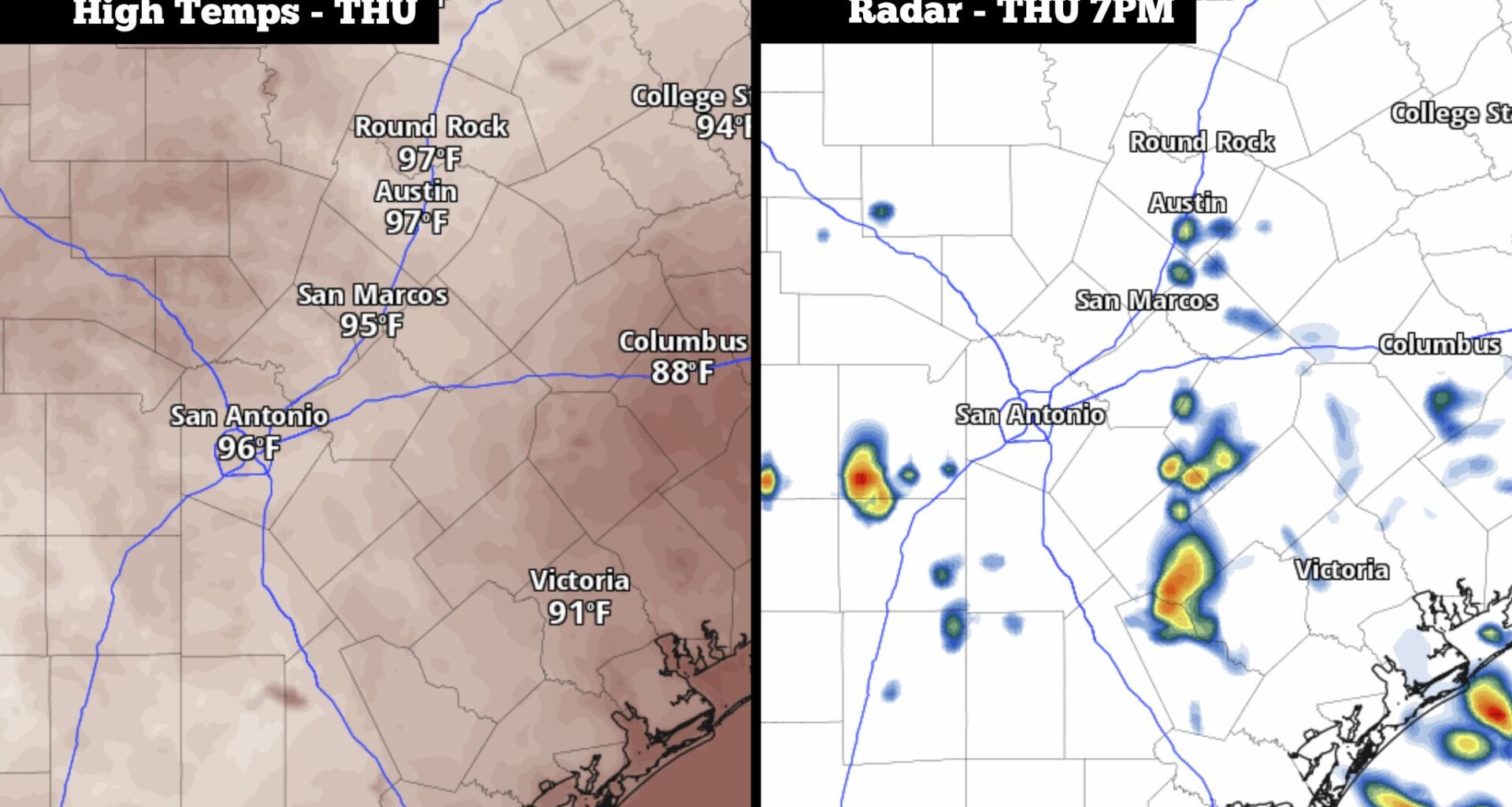
From left, the expected peak afternoon temperatures on Thursday, and weather radar modeling for 7 p.m. showing possible showers.
Pivotal Weather
So far this week, high air pressure has been the dominant feature over South-Central Texas, resulting in bright sunshine and near-record temperatures each day. However, a small shift in the pattern is expected Thursday, with the passage of a weak mid-level atmospheric disturbance.

Moving in from the Gulf, this disturbance is expected to bring higher levels of moisture-rich air into the region. While that doesn’t mean the region will see widespread heavy rainfall, it does mean we can expect higher humidity levels, more clouds and a slight chance of rain during the second half of the day. Here’s the latest.
Article continues below this ad
Thursday’s forecast
Early in the morning, the weather will be noticeably warm and muggy throughout the region as temperatures start in the upper 70s by 8 a.m. Partly to mostly cloudy skies are likely throughout the morning, and skies are expected to stay partly cloudy through much of the day.
Temperatures will steadily rise into the middle of the day, likely reaching near the 90-degree mark by noon. By the late afternoon, temperatures are expected to top out at around 97 degrees. While that is a few degrees “cooler” than temperatures were earlier in the week, it’s still significantly above average for this time of the year.
Shown are the expected humidity-driven heat index values across the region at 3 p.m. Thursday.
Pivotal Weather
Humidity levels will stay very high, resulting in maximum heat index values between 102 and 105 degrees. Scattered clouds will offer some shade, but winds will stay light, moving in at around 10 mph throughout the afternoon.
Article continues below this ad
Thunderstorms are expected to form along the Texas Gulf Coast during the early afternoon, and a few of them will move toward the San Antonio area by the late afternoon and evening. Even so, overall rain chances in San Antonio will be just 20%, with the best chances coming between 5 and 9 p.m. Thursday evening.
While most will stay dry, a few storms could be relatively strong, capable of brief downpours and strong winds.
Hot and humid weather continues
Similar weather is expected Friday, as San Antonio can expect temperatures to max out in the mid- to upper 90s under partly cloudy skies. An isolated shower can’t be ruled out, either, but rain chances will drop to around 10%.
Article continues below this ad
Over the weekend, above-average heat will continue, with high temperatures continuing to sit at 97 to 98 degrees. If it’s any consolation, humidity levels will drop a bit, allowing for morning temperatures to also drop slightly — down to near 75 degrees.
By early next week, a weak cold front could move into parts of North Texas. However, forecast models suggest that the front will most likely stall out before moving into San Antonio. Temperatures will stay rather consistent, with highs in the mid- to upper 90s.
The weak front will likely lead to scattered thunderstorms in parts of the state. The best rain chances will be in the northern half of Texas, but a 20% chance of rain is still possible for San Antonio from Monday through Wednesday.
Article continues below this ad
Moving farther out, this stretch of above-normal temperatures shows no signs of stopping. According to the Climate Prediction Center’s long-range outlook, San Antonio has a greater than 90% chance of near-average or above-average temperatures during the week of Sept. 24-30. Meanwhile, the agency calls for only a 7% chance of below-average temps during that timeframe.