
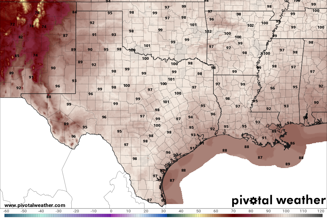
The morning will be warm and muggy, with lows around 80 degrees under mostly cloudy skies and light east-northeast winds. The clouds will break a bit around noon, helping temperatures climb into the mid-90s by that time. East winds will be between 5 and 10 mph.
Clouds will increase again as a weak atmospheric disturbance moves inland from the coast, bringing a small chance of rain later in the day, from Thursday afternoon into the early evening. Rain chances will be around 20% along the Interstate 35 corridor, increasing to 50% across the Coastal Plains.
Despite the extra clouds and the chance of rain, temperatures won’t be affected much. Highs will reach 100 degrees, with humidity driving heat index values to between 105 and 110 degrees across the region.
Friday will be a little drier and less humid as the weak atmospheric disturbance moves west toward the Rio Grande Plains and southern Edwards Plateau. Rain chances will increase in the Hill Country but decrease along and east of Interstate 35.
Temperatures will remain above the mid-September average of 92 degrees in the afternoons and 70 degrees in the mornings. Friday’s forecast calls for a peak temperature of 99 degrees, with morning temps in the middle to upper 70s.
Through Tuesday, Austin’s average temperature at Camp Mabry, the city’s main weather observation site, was 89.7 degrees — which is 7.2 degrees hotter than normal for the same period. The warmest overall average daily temperature for September in Austin was 88 degrees, set in 2019. That year, September produced 19 days of 100-degree temperatures. In 2026, Austin has already recorded 14 such days.
Unfortunately, the heat isn’t going anywhere just yet as these record highs will be challenged at Camp Mabry over the coming days:
After a slow start to the triple-digit heat this year, we’ve more than made up for it since late July. Since then, we’ve tallied 48 triple-digit days, and we’ll likely add two more, bringing the total to 50 days by the end of the weekend.
The cold front that looked possible early next week is now forecast to stall across North Texas, leaving Central Texas with above-normal temperatures. Peak daytime temps will remain well into the 90s, with some areas possibly reaching 100 degrees.
The upper-level system of high air pressure will weaken and shift early next week, allowing another upper-level disturbance to retrograde westward across the Gulf states and drift closer to Texas. This will increase rain chances across Central Texas from Monday through Wednesday.