
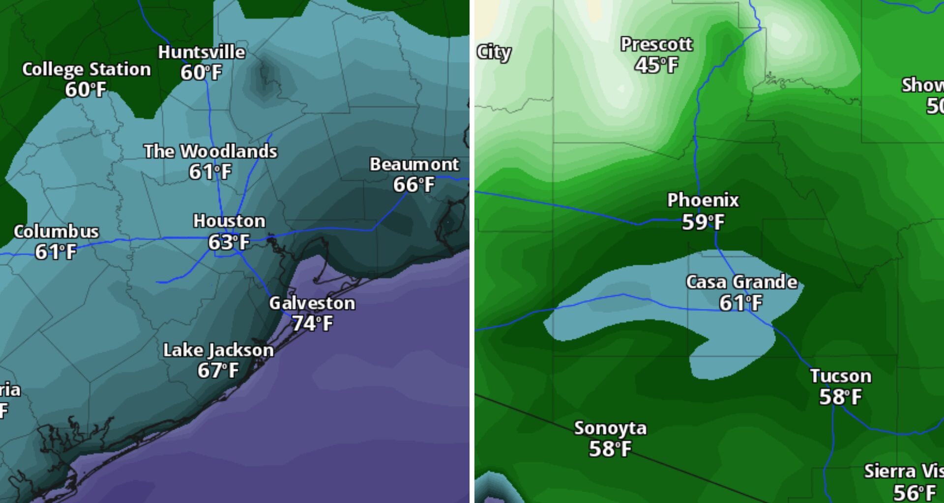
The comparison makes sense, but the two cities are drying out for different reasons. Phoenix is losing its monsoon moisture as a storm system moves away, while a northeasterly wind will push drier air into Houston. That unusual overlap will briefly narrow the moisture gap between the two cities.
Why is dew point important? Moisture levels in the air can intensify how heat feels to the body, and the dew point, or the temperature at which air is cool enough to form dew, can be a good indicator of how saturated the air is with water vapor. Typically, the closer the dew point is to the actual air temperature, the more humid the air is. You often start noticing how oppressively muggy and sticky the air is if the dew point is above 65 degrees.
Houston’s dew point is expected to fall from the mid-70s early Friday into the upper 60s by late afternoon.
That modest drop will take the edge off the steamy conditions that Southeast Texas is known for in mid-September. It should keep most heat index values below 100 degrees and make Houston heat alerts unlikely Friday.
The storm system that helped fuel flooding across the Phoenix metro earlier this week will move away Friday, allowing drier air to return to the desert Southwest. Phoenix’s dew point will start near 65 degrees Friday morning and fall to about 60 degrees by late afternoon.
A 65-degree dew point is relatively moist for Phoenix but would feel noticeably drier in Houston, where summer dew points often climb well into the 70s. The difference between the cities will narrow to just five degrees around midday before the gap widens again as both locations dry out.
The same drier air lowering Houston’s dew point Friday should also clear the skies. With less moisture overhead, clouds will be limited, and the bright blue skies may even give the day a very “fall-esque” look. It won’t feel like fall, though, with highs in the mid-90s.
That clear, slightly less muggy pattern will not last. Moisture levels will begin creeping back into Southeast Texas Saturday, bringing higher humidity even as shower and thunderstorm chances remain limited.
By Sunday, the ridge will weaken enough for isolated afternoon showers and thunderstorms to return, especially along the coast. Houston’s brief stretch of blue skies and lower dew points will give way to the familiar combination of heat, humidity and spotty rain by early next week.