

Forecast at a glace:
Hot and humid conditions will continue into the weekend and beginning of next week. Stray sea-breeze showers and pop storms will return to the forecast starting Sunday.
Our weekend forecast:
If you’re heading to the Texans tailgating on Sunday expect a warm morning and hot and humid afternoon. Kick off temperature is around 90°. Let’s hope the Texans get their first win, against the Bengals. A stray afternoon shower or storm can’t be ruled out.
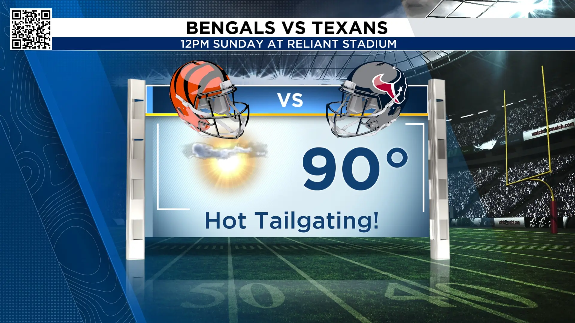 Texans kickoff forecast (Copyright 2025 by KPRC Click2Houston – All rights reserved.)
A few storms coming early week:
A weak front will fall into Texas late Sunday and the leftovers will linger into Monday and Tuesday as it slowly pushes south in the state. That means we could see afternoon storms both Monday and Tuesday for your evening commutes.
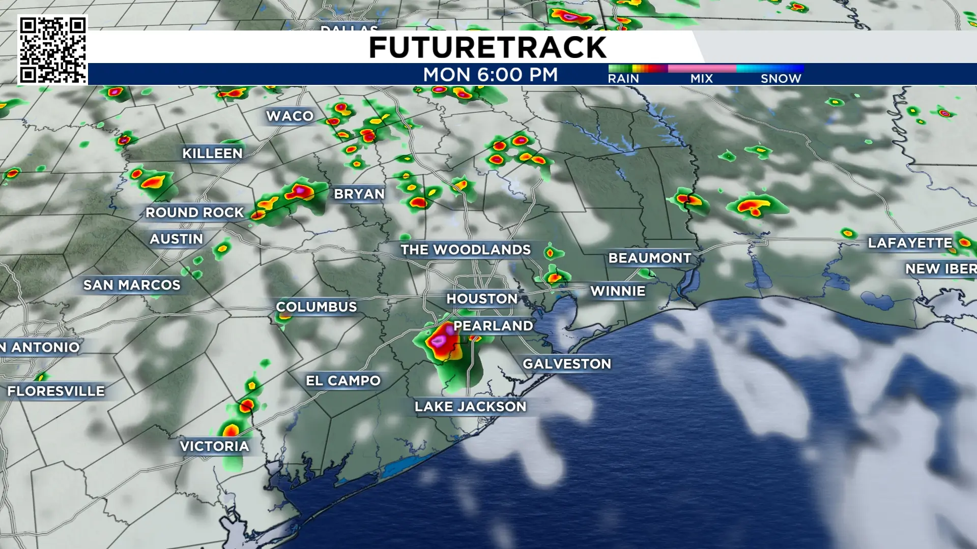 Monday afternoon storms (Copyright 2025 by KPRC Click2Houston – All rights reserved.)
Temperatures will stay very warm for this time of year, though. We’re still mainly dominated by a large ridge of hot, high pressure sitting just east of Houston. Meaning, even if we see a front or two move through, there is not enough cool air to punch the ridge out of the way, so we’ll stay hot and dry.
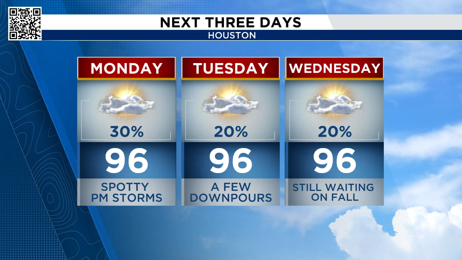 Early week forecast (Copyright 2025 by KPRC Click2Houston – All rights reserved.)
Tracking the tropics:
Storm development chances in the Gulf are still very slim, however, we now have Tropical Storm Fay, recently formed in the north-central Atlantic. Fay is a fish storm and will remain out in the open Atlantic.
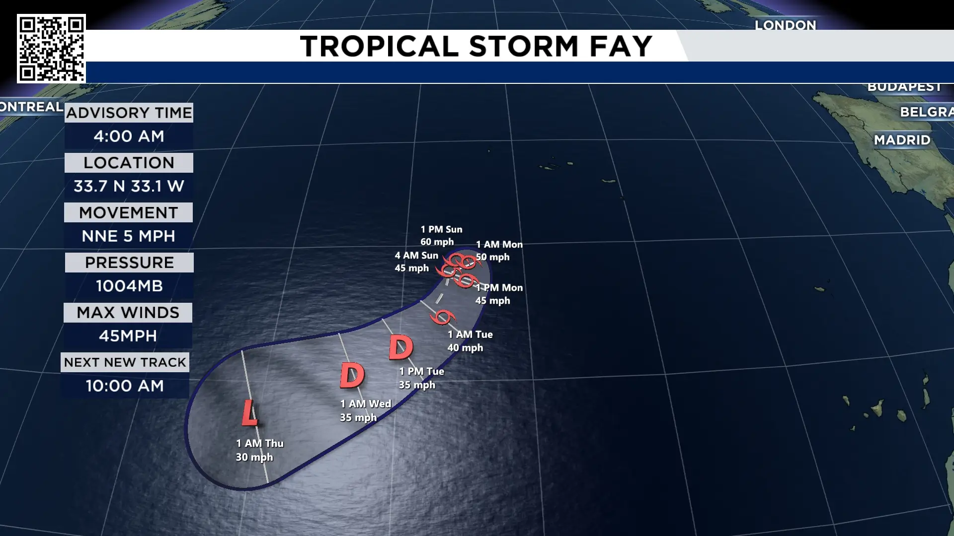 Tropical Storm Fay (Copyright 2025 by KPRC Click2Houston – All rights reserved.)
So far this hurricane season, we have not had a hurricane form in the Atlantic basin. The latest first hurricane to form was Gustav and Humberto, which formed on September 11th. This means our 2026 hurricane season set a record for the latest hurricane to form.
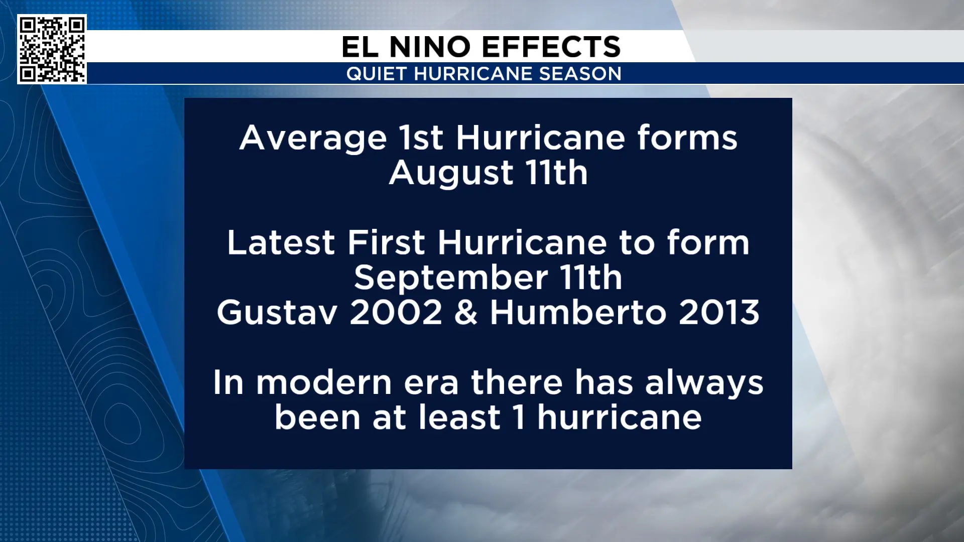 We are on pace for latest first hurricane to form (Copyright 2026 by KPRC Click2Houston – All rights reserved.)Extended forecast:
There is no big cool down in the forecast. There are periods of dry air, but highs are in the 90s for the next 10-days. More storms are possible Sunday, Monday, and for the official start of Fall Tuesday. On Monday September 21st the average high temperature falls to 89°! We however, are above that number next week.
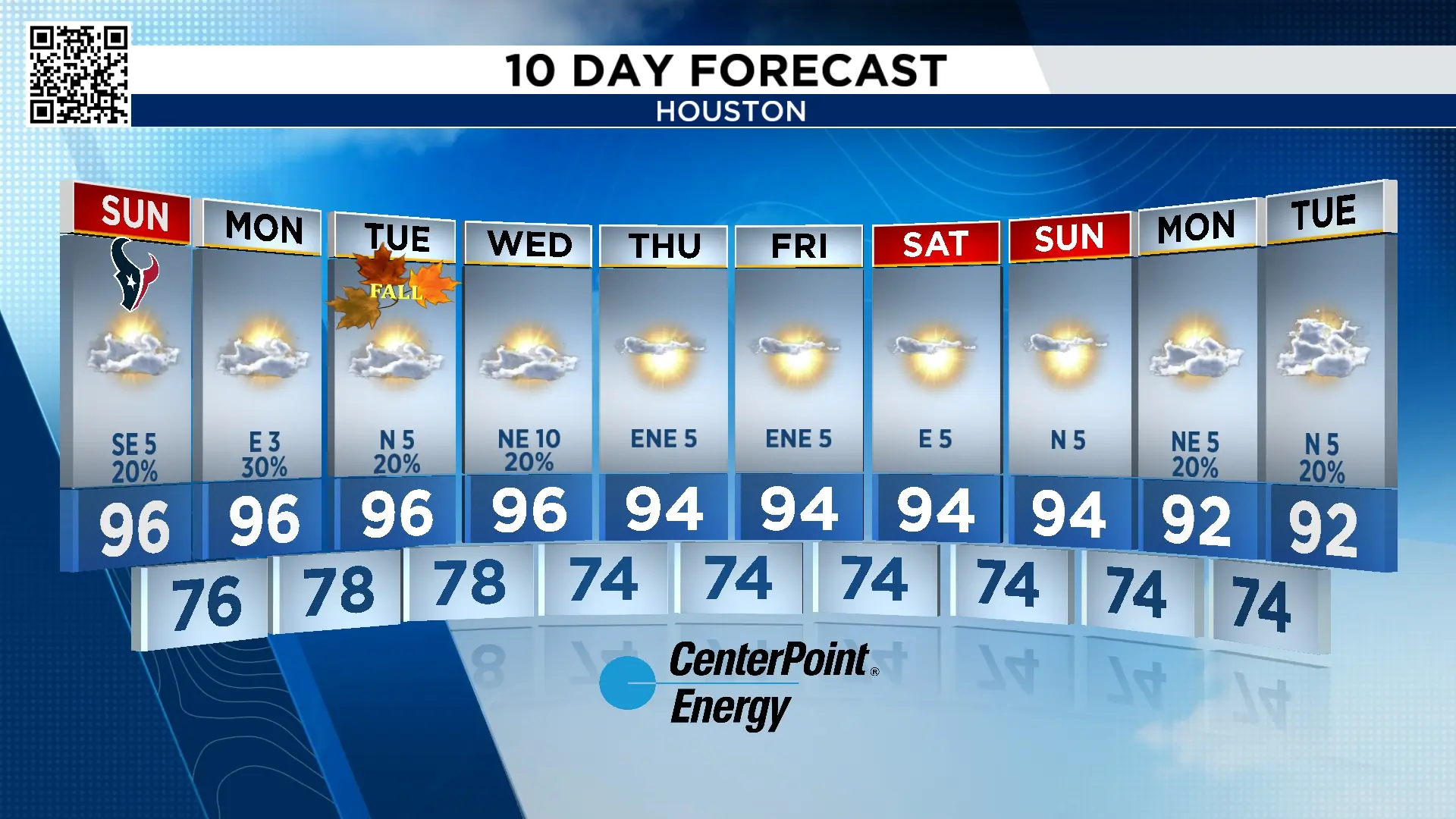 10-day forecast (Copyright 2025 by KPRC Click2Houston – All rights reserved.)Anthony’s Weather Lab

More Stories Like This In Our Email Newsletter
Copyright 2026 by KPRC Click2Houston – All rights reserved.