
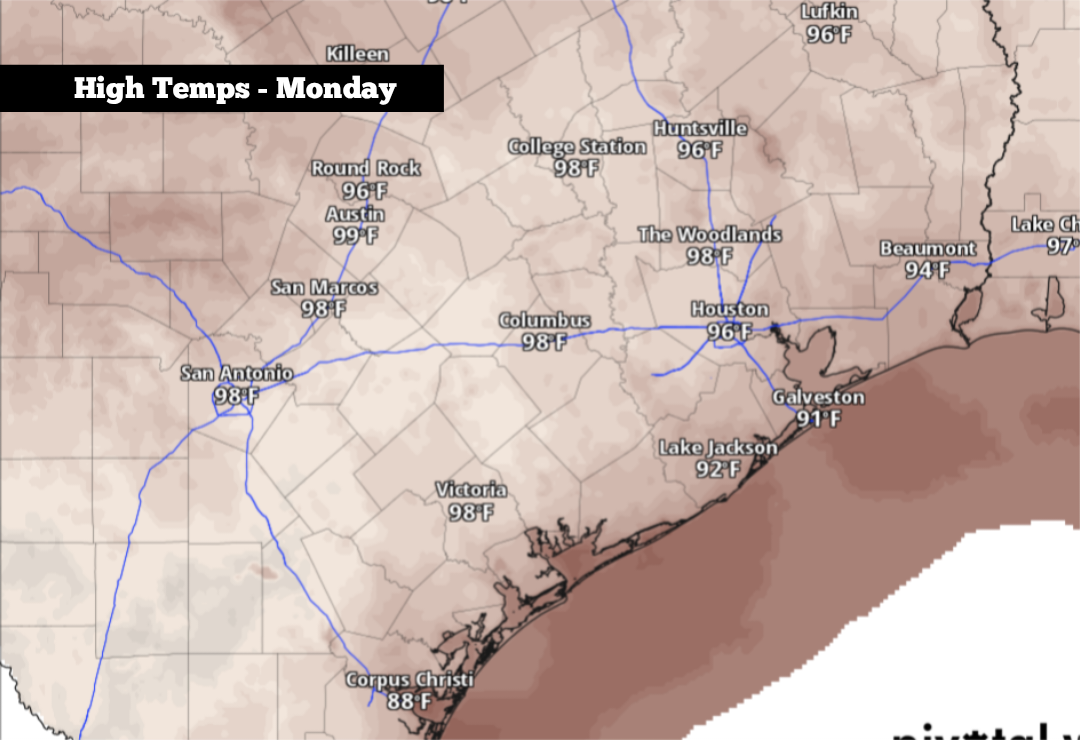
The first official day of fall arrives Tuesday, but South Texas continues to experience record heat for this time of the year. Since the start of September, San Antonio has endured an average high temperature of 97.5 degrees, along with an average low of 78 degrees. Together, that makes for the warmest start to September in the city’s history.
And according to weather models, the heat isn’t going anywhere — at least not during the upcoming week, as high pressure is expected to dominate the forecast over South-Central Texas. However, some changes could finally occur as we push into the end of the month and the start of October. Here’s what to expect.
A mild start is expected Monday with temperatures in the upper 70s through 9 a.m. Conditions will heat up steadily, though, reaching the 90-degree mark by noon as skies become mostly sunny. Afternoon highs are likely to top out at 98 degrees, with heat index values up to 103 degrees possible.
A weak cold front is also expected to move through parts of North and Central Texas during the afternoon. However, all indications are that the front will stall well before reaching San Antonio, limiting its effects locally. Scattered storms will develop along the front, with the best chances from Abilene eastward to the DFW metroplex.
An isolated storm can’t be ruled out for the San Antonio area, but overall rain chances will be only at 10% to 20% — leaving most of the region dry. About a 20% chance of a storm will continue into Tuesday, still with high temperatures in the mid- to upper 90s.
Heat continues: With high pressure still expected to hover over South Texas through the end of the week, summerlike temperatures will persist. Expect highs to range between 95 and 97 degrees from Wednesday through Friday, with lows staying steady in the mid-70s.
According to the National Blend of Models, temperatures are likely to stay about 10 degrees above average into the last weekend of September. Isolated rain will remain possible, but widespread activity is not expected.
Long-range weather models suggest a more active weather pattern developing, leading to the possibility of a cold front by the Sept. 28-30 timeframe. While likely not a strong front, it could bring scattered strong thunderstorms into South Texas by the end of the month. Because this is at least a week away, there are high levels of uncertainty.
By the first full week of October, the GEFS ensemble weather model projects that temperatures in South Texas will be near to just slightly above-average, meaning high temperatures are expected to be in the upper 80s to near 90 degrees to start the month. While still warm, it’s at least slightly cooler than what temperatures have been lately.