
LUBBOCK, Texas (KCBD) – Strong thunderstorms and heavy rain are expected to move from west to east across the KCBD/FOX34 viewing area tonight. There is a risk of localized flooding into the morning hours Wednesday.
In addition to heavy rain, there’s also a marginal risk of strong winds and even the potential for a tornado or two with the strongest storms. Wind gusts could exceed 60 mph in some areas. Be Weather Aware and if a warning is issued for your area take shelter immediately.
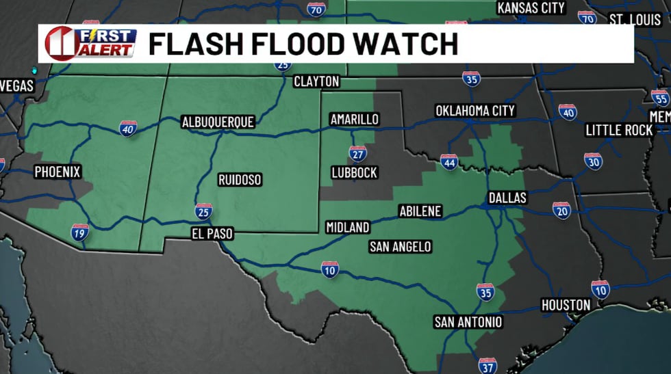 There is an elevated flood threat across a large area of Texas and New Mexico into Wednesday morning.(KCBD First Alert)
Due to the flood threat, a FLASH FLOOD WATCH is in effect across our northwestern as well as southern counties through Wednesday morning. The map here shows how widespread the flood threat is, with Flood Watches stretching from near the California-Arizona border east of I35 in Texas.
As I noted yesterday here, tonight’s setup in the past often produced widespread rainfall of 1 to 2 inches, with some spots picking up more than 3 or more inches. And a few less than an inch.
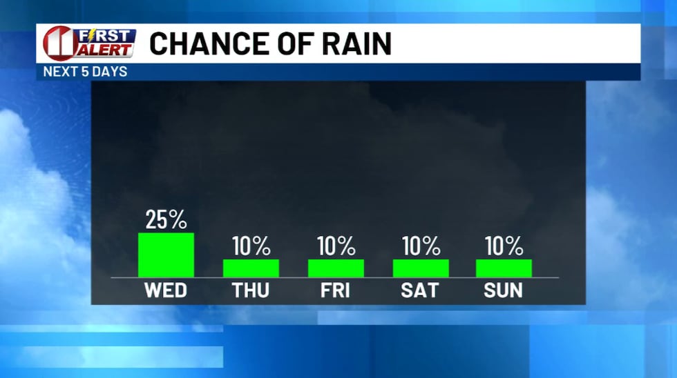 Rain, some heavy, is expected Tuesday night into early Wednesday. A drier and cooler pattern will follow.(KCBD First Alert)
The heaviest rain is expected to be over the northwestern viewing area, especially near the Clovis area. Widespread 1 to 3 inches, with locally higher amounts of 4 – 6″ possible, may fall on already saturated ground.
The heavy rain potential will increase through this evening, beginning in the west near the New Mexico state line and moving east through the night. The heaviest rain and strongest storms are most likely in the Lubbock area from around 1 to 2 AM. Even as the rain tapers off from west to east, there may still be a residual flood threat for a few hours thereafter.
Additional thunderstorms with heavy rain are possible late Wednesday, mainly over the far eastern portions of our viewing area. Again, heavy rainfall rates will be possible, so flooding will be a concern.
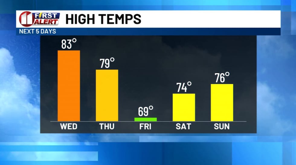 The last time Lubbock had a high below 70° was May 1st (62°).(KCBD First Alert)
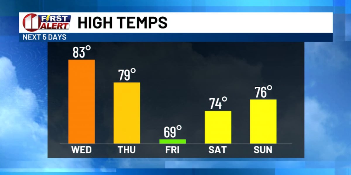
By Thursday, this system moves out and we’ll see much drier and cooler weather settle in. A cold front will swing through late Thursday night, bringing noticeably cooler air Friday and Saturday. We will see our coolest weather since May. Very fall-like weather.
Monitor our newscasts, check kcbd.com/weather, and download the free KCBD Weather app for the latest updates and alerts. Stay weather aware, stay safe, and we’ll see you back here tomorrow.
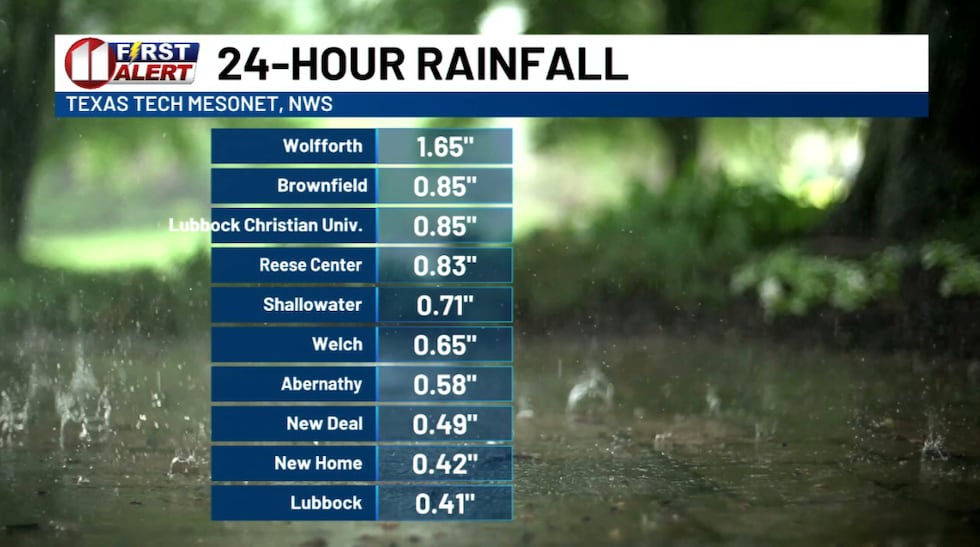 Rain totals for the 24-hours ending at 4:15 PM CDT.(KCBD First Alert)
Copyright 2026 KCBD. All rights reserved.