
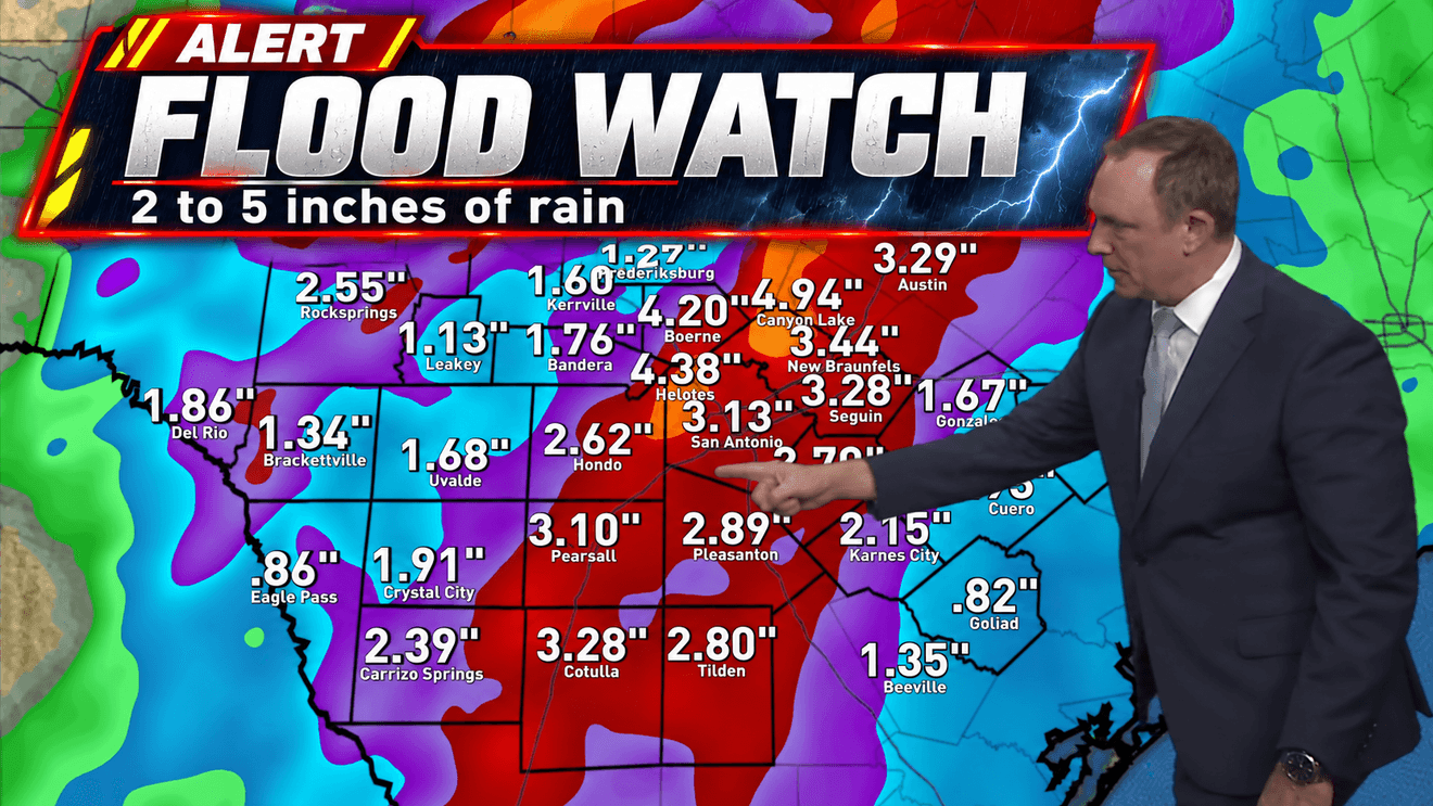
SAN ANTONIO — A Flood Watch is in effect for the San Antonio area through 7 p.m. Friday as rounds of heavy rain could bring several inches of rain and an increased threat of flash flooding.
The greatest concern develops Thursday afternoon and continues into Friday morning as showers and thunderstorms become more widespread across South Central Texas.
CLICK HERE to track the storms with our interactive radar
Storms are expected to remain focused mainly west of San Antonio overnight, with only scattered showers or an isolated thunderstorm possible closer to the Interstate 35 corridor. Rain chances increase Thursday as the system slowly pushes east.
The Thursday morning commute could feature plenty of clouds and some scattered rain, but the heavier activity is expected to hold off until later in the day.
By Thursday afternoon and evening, scattered thunderstorms could produce very heavy downpours across the San Antonio area. While there is a low risk of an isolated severe storm with damaging wind gusts, flooding is the primary concern.
The greatest flood threat could develop Thursday night as storms form along a slow-moving front. Some storms could become nearly stationary or repeatedly move across the same locations, allowing rainfall totals to quickly add up.
Parts of Bexar County and the Interstate 35 corridor could see 2 to 5 inches of rain, with isolated areas potentially receiving 6 to 8 inches or more. Under the heaviest storms, 2 to 4 inches could fall in a short period of time, creating the potential for flash flooding.
Drivers should be especially cautious Thursday afternoon through Friday morning and avoid flooded roads. Water can rise quickly at low-water crossings and other flood-prone locations.
Additional showers and thunderstorms remain possible Friday, with some heavier downpours potentially lingering into Friday evening before conditions begin to improve.
Scattered showers remain possible Saturday, with rain chances dropping Sunday. A much drier and cooler pattern is expected next week, with morning temperatures in the 60s and afternoon highs generally in the low to mid-80s.