
SAN ANTONIO — The Flash Flood Warning for Bexar County has expired.
Bexar County entered a lull, with only occasional sprinkles or isolated showers expected over the next several hours. Steadier rain continued in counties east of Bexar County, though the rain had weakened from earlier in the day.
Forecasters said the lull could last until after midnight and continued watching for a possible second round of rain between 10 p.m. and midnight.
—
The Bexar County Office of Emergency Management said the county received 1 to 4 inches of rain, while parts of South Bexar County received more than 4 inches. Forecasters expected another round of storms overnight.
Officials urged residents to avoid low-water crossings, take alternate routes and stay weather-aware as flash flooding remained possible across the area.
County Public Works Response
Eight Bexar County Public Works crews patrolled known low-water crossings. Continued rain could require the crews to work overnight, officials said.
Officials urged drivers to avoid unnecessary travel, never drive around barricades, and choose the safest available route during severe weather.
Impacts on County Parks
Flooding closed the front entrance to Rodriguez County Park, but the back entrance remained open.
Officials also closed Comanche Park No. 3. All other county parks remains open.
Check your Route
Residents traveling to work or school can check road closures and high-water locations at bexarflood.org.
—
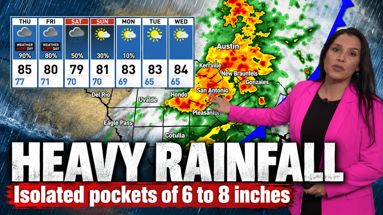
Heavy rain and thunderstorms could bring flooding to parts of Bexar County and the Hill Country late Thursday night into Friday morning.
CLICK HERE to track the storms with our interactive radar…
CLICK HERE to share your photos and video…
Some locations that will experience flooding include… San Antonio, Austin, Round Rock, New Braunfels, Cedar Park, Georgetown, San Marcos, Pflugerville, Schertz, Kyle, Taylor, Live Oak, Buda, Selma, Hondo, Dripping Springs, Castroville, Wimberley, Granger and Bertram.
Showers and some thunder are already moving through the area, but they are not expected to cause flash flooding at this time. The National Weather Service is warning that the risk for flash flooding will increase between 9 p.m. and 6 a.m. Friday. Forecasters say a zone of strong storms could form along the I-35 corridor, where slow-moving cells may drop between 3 and more than 7 inches of rain depending on the exact location.
Wet roads and travel impacts are likely this afternoon and evening as scattered showers and thunderstorms continue. The flood risk should end by late Friday morning with just scattered showers lingering into the afternoon.
The weekend is expected to stay cloudy with some scattered showers. Temperatures will be cool, with highs in the 70s Saturday and from the 70s to 80 Sunday. Flooding is not expected over the weekend.
Looking ahead to next week, forecasters are calling for cool mornings in the 60s and sunny, dry afternoons in the low to mid 80s.
Allergy levels are light across the board, with mold at 390, ragweed at 30, fall elm at 20 and pigweed at 10.
In the tropics, the Atlantic remains quiet and Hurricane Rachel is moving slowly west well off the coast of Mexico.